Pearson, Alison, Cornwallis, Pigeon and five reefs near Palawan, Philippines, Spratly Islands
That line continues east to within 67 miles of the west coast of Palawan, Philippines, and we analyze those five reefs as well.
This whole portion of the Spratlys is under-developed with only minor land reclamations and one minor island outpost. We do see a few land reclamation infrastructure elements at work, but this is a relatively calm corner of the Spratly islands.
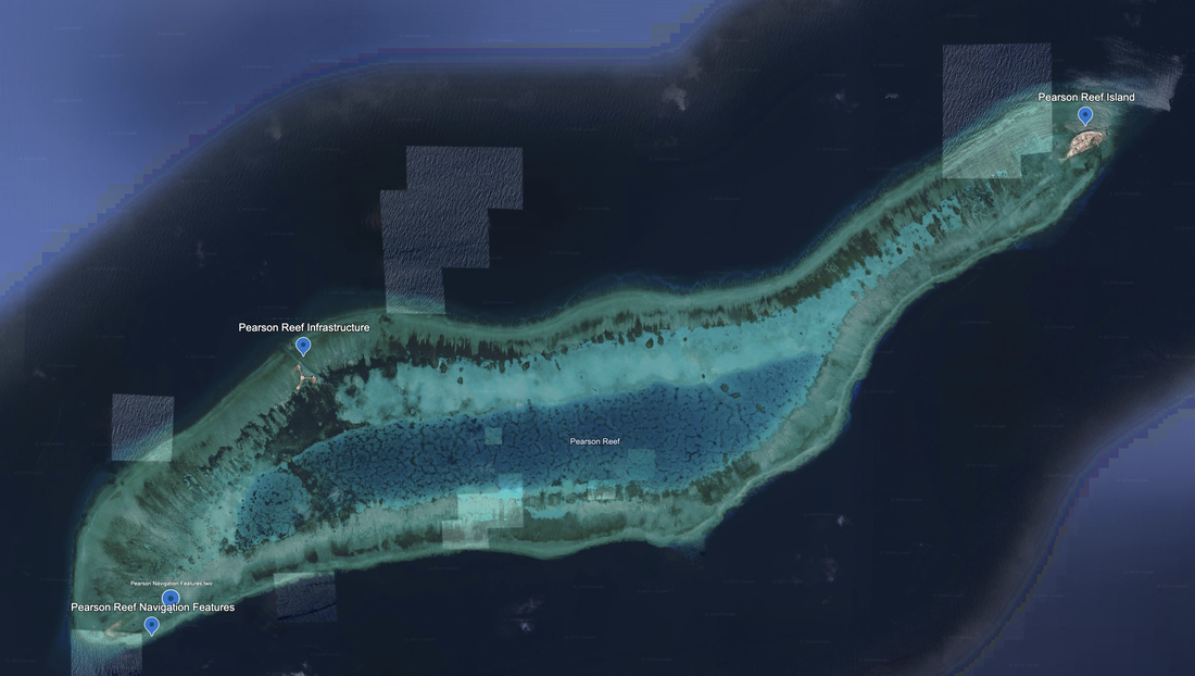
The first set of reefs are called Maralie Reef, Pearson Reef, Alison Reef, Cornwallis Reef and Pigeon reef.
The second set of reefs are called Alicia Anne, First Thomas Shoal, Northeast Investigator, Royal Captain Shoal and Half Moon Shoal.
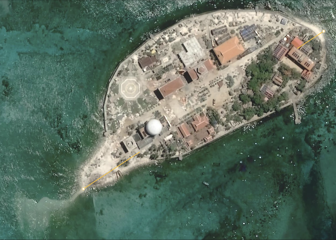
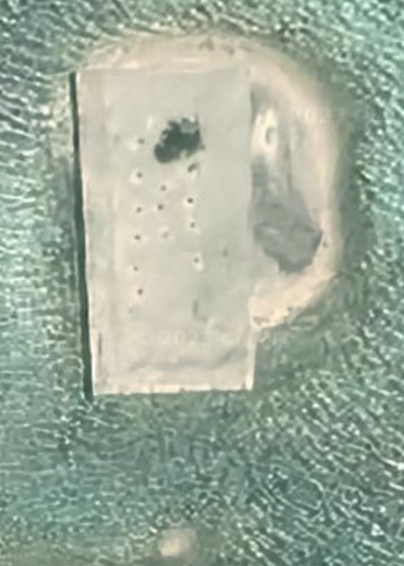
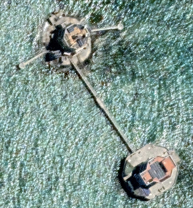
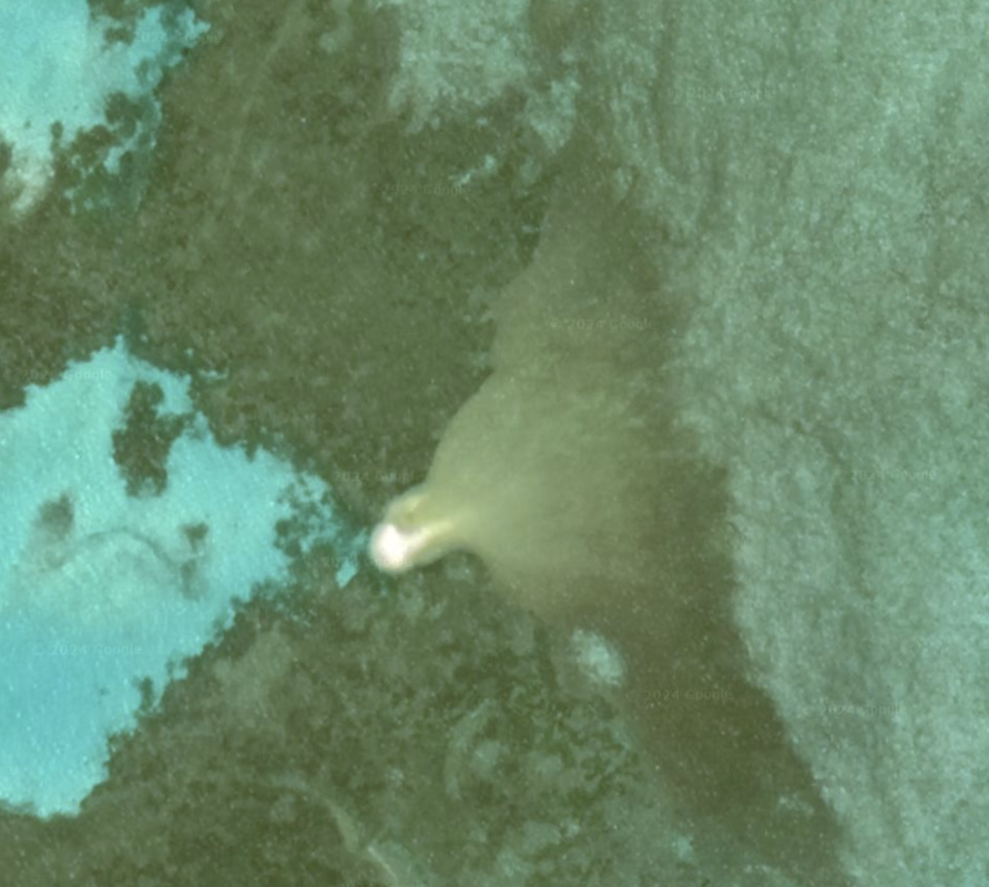
At the Northeast edge of the island we find Pearson Reef Four, at location 8°58'50"N 113°42’05"E in a satellite photo dated 5/26/2020 also displayed below that shows some additional reclamation work on the Southwestern corner of the island. Diameter is 0.19 miles.
This island is an oval has some additional reclamation occurring on the West side of the island. Pearson Reef Island Four has some typical structures we have seen. Some of the buildings have rectangular shapes on their roofs, and there is a well developed seawall around the island. We see one peer, one helipad, and a straight dirt road through the center of town, along with a few large buildings. We see one white radome, and a letter "A" printed on the roof of a building. We see a deep channel leading from the interior of the reef to the island, for western access to the island.
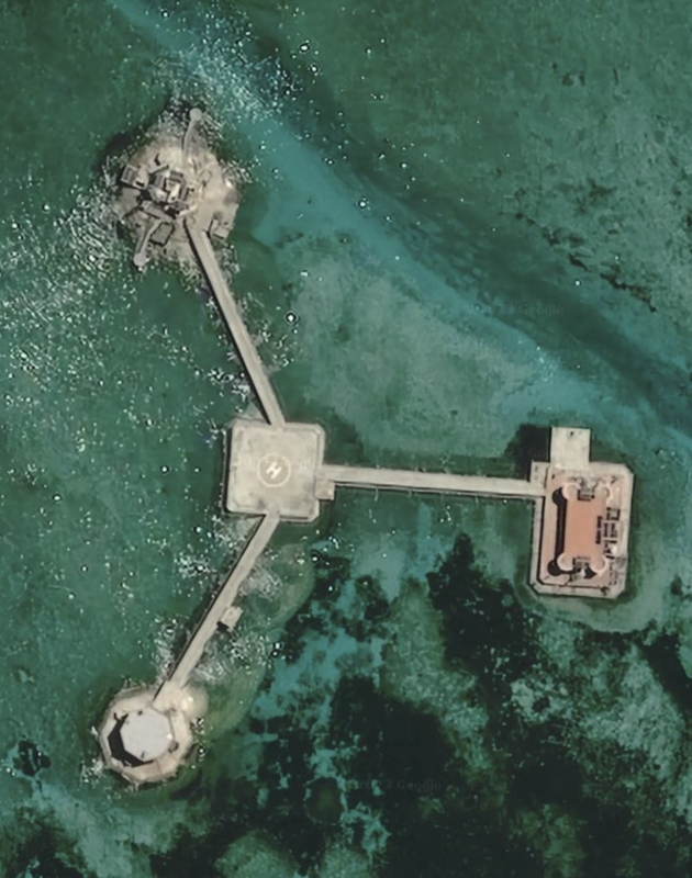
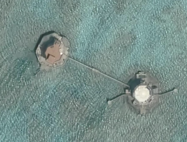
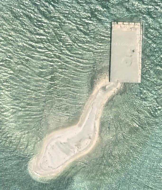
Pearson Reef has a few developments and man-made features. To the West we see navigation features at location 8°56'29"N 113°38’25”E. Satellite Imagery from 05/26/2020. Moving clockwise, we see Pearson Reef Navigation Features two, which are blurry at best. Satellite images taken 05/26/2020. At the northwest of the reef, and just north of the lagoon by a channel cut into the coral we see three infrastructure elements connected by bridges to a central helipad platform. Location: 8°57'30"N 113°39’07"E.
Fisherman from Pearson enjoy medical emergency treatment via the Vietnamese military. In the attached article, a fisherman suffered acute and severe decompression sickness from diving too deeply and ascending too quickly, and they were medically evacuated to an emergency trauma hospital on the mainland.
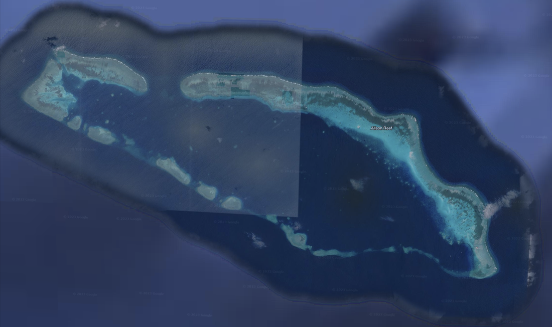
Just to the Southeast of Pearson Reef is Alison Reef, which is a submerged, coral reef atoll with three land reclamation infrastructure elements present, but no land above sea-level. At the Northwest corner, we see two infrastructure elements. Location: 8°49'57"N 113°55’25”E.
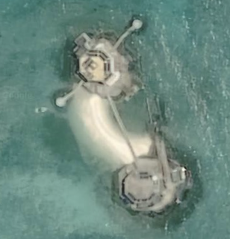
At the Southeast corner the land reclamation is a little further along, and we see ships in the lagoon nearby. Satellite Photo: 05/1/2020 and location 8°47'01"N 114°02’50”E. We can see how these two infrastructure elements work in the wild, with sand being laid out between the two infrastructure elements. We zoom in for a closer look at the reclamation efforts. Here is the location as we zoom in: 8°46'46"N 114°03'09"E m.
Alison Reef Southwest Corner
|
Alison Reef Northeast Corner
|
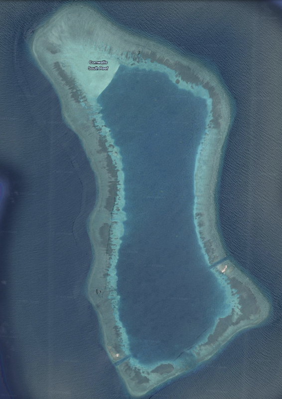
Just to the East of Alison Reef is Cornwallis South Reef. It is a coral atoll 5.8 miles in diameter with a large lagoon. We see three channels cut through the reef, one to the Southwest, one to the Southeast, and one Northcentral.
All three channels cut through the reef have infrastructure and reclamations nearby. This looks like an actively developed shoal as of 3/28/2020.
In total, there are four reclamations or infrastructure on this reef. Date: 03/28/2020. Location: 8°41'10"N 114°10’13”E.
It is interesting to note this method of reclamation as it is unique. There is a rectangle with finite sea-walls, along with additional sand expanding out.
|
|
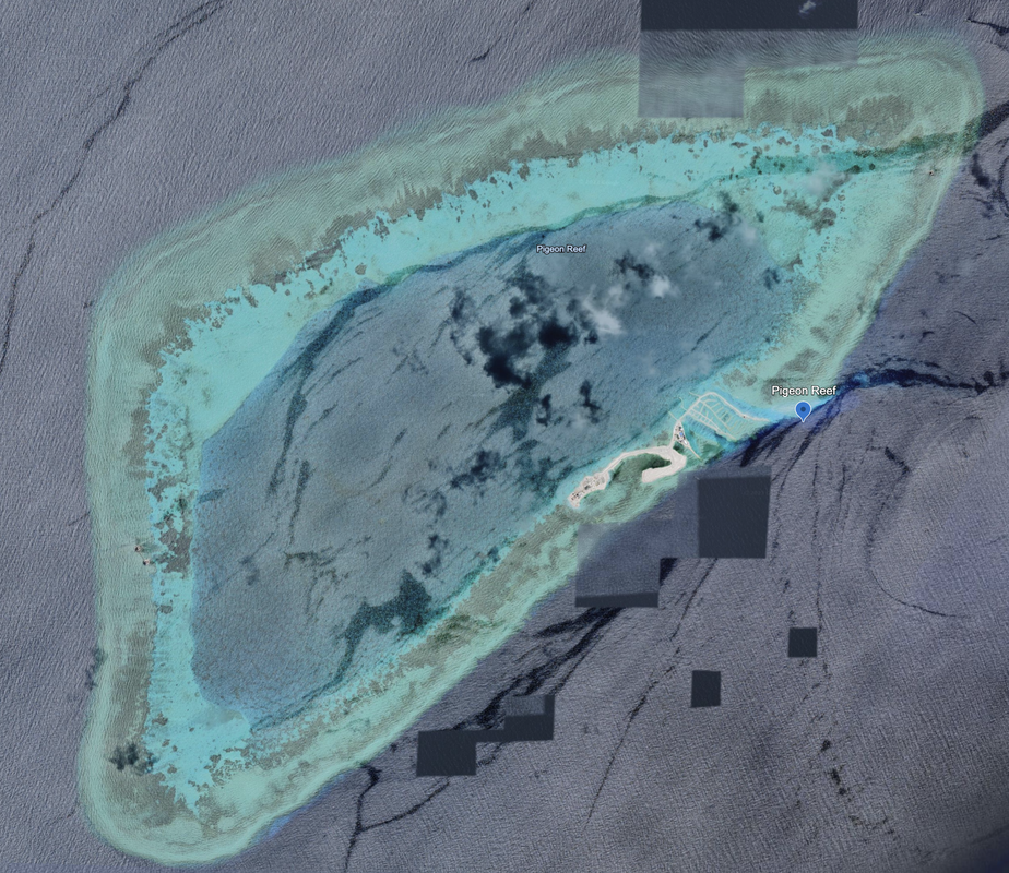
East of Cornwallis Reef is Pigeon Reef, a triangular-shaped coral atoll, triangular in shape, with the hypotenuse at 4.2 miles in diameter. We see land reclamation infrastructure to the west and east, and a significant island reclamation underway in the center of the southern coast. The land developers are busy...they probably already sold the condominium apartments to speculators.
There is the potential for a full reclamation of the reef.
East to West measures 3 miles. Location of the reclamation: 8°52'17"N 114°38’38”E. Satellite Photo: 06/04/2022. Overall length is 0.61 miles.
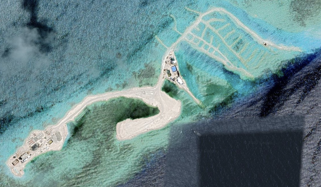
As we zoom into the construction, we see dozens of trucks, tall construction cranes, and a flurry of activity. We see foundations for a large administrative type building duplex, and a tall crane that suggests it will be a multi-story building complex.
On the West, we see a series of either roads, or peers, and we see what we now find as a common structure of the reclamation of the island. It looks similar to the lines of a parking lot or marina on the East side of the island, which we know eventually will get filled with sand and rock, creating solid ground. We cannot wait to see the new satellite imagery and track their progress.
According to Radio Free Asia, here, dated 4/19/2023, Pigeon Reef, a.k.a., Tennent Reef, has a new harbor. We await updated satellite imagery.
|

|
Alicia Annie Reef, location: 9°23'52"N 115°26’15"E is undeveloped.
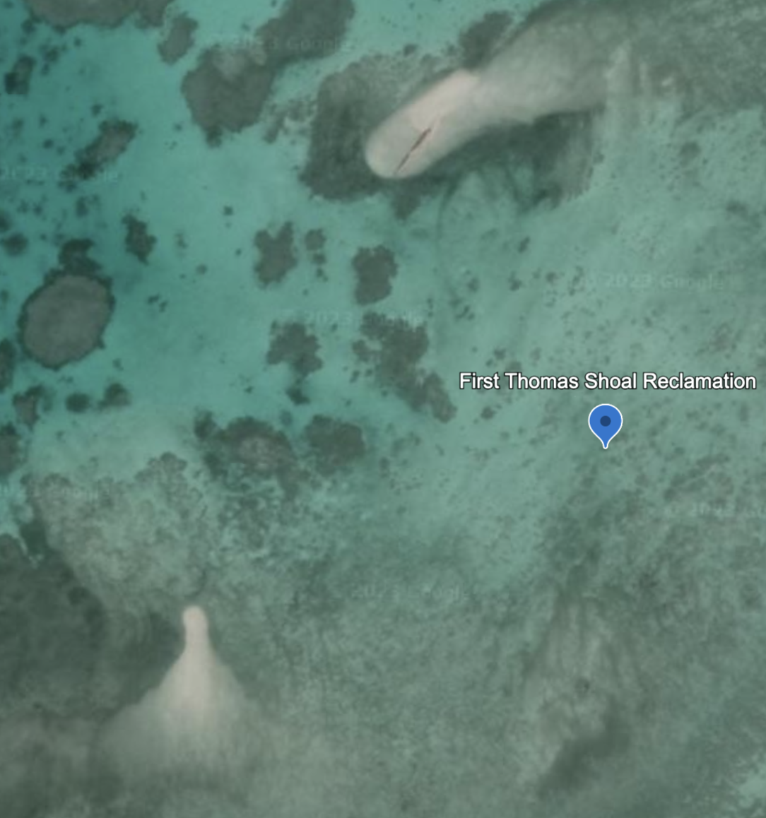
First Thomas Shoal
East of Alicia Annie Reef we see First Thomas Shoal, location 9°19'28"N 115°56’27”E. It has two early-stage reclamations underway on the East side of the shoal, at location: 9°19'33"N 115°57’30”E. We see two, small, sandy outcroppings. Satellite Photo: 10/5/2018.
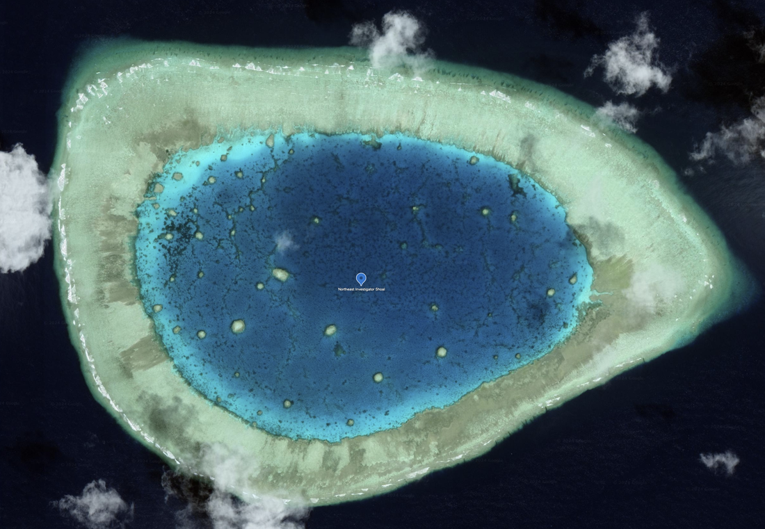
Northeast Investigator Shoal
East of First Thomas Shoal, we see Northeast Investigator Shoal which is also undeveloped. It looks like the left side of a pair of glasses as appears to be an unblemished coral atoll. Satellite Imagery 11/18/2018. Location: 9°10'16"N 116°28'10"E.
Royal Captain Shoal
Closest to Palawan, Philippines in this line of coral atolls, we see the Royal Captain Shoal 49.7 miles west by northwest of the western Palawan coast and as of satellite photo dated 03/23/2019, it appears submerged and undeveloped.
Half Moon Shoal
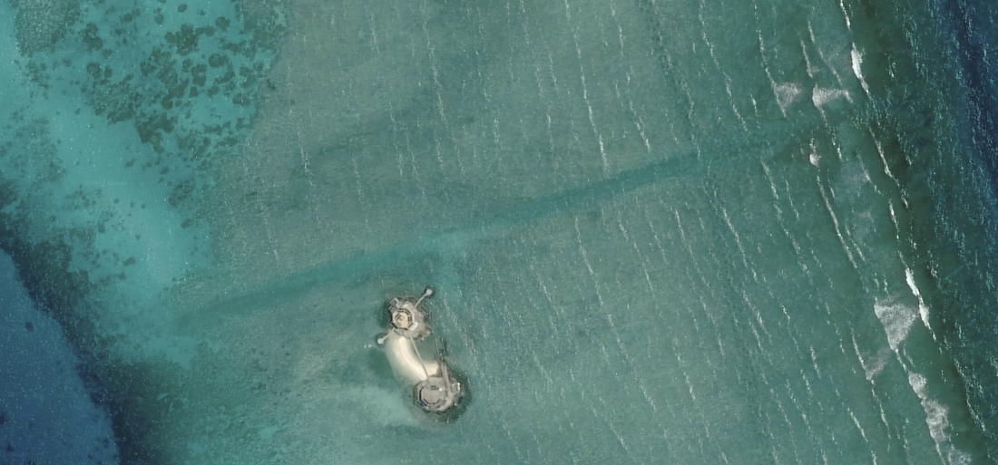
We analyze one final shoal, or coral atoll, on this webpage. It is south of First Thomas Shoal, Northeast Investigator Shoal and Royal Captain Shoal. This shoal is 67.6 miles West by northwest of Palawan. This is 3.93 miles in diameter, with a natural channel into a large lagoon. It appears undeveloped and undisturbed except for a single, tiny sand cay that could be accessed from within the lagoon and is on the Northeast corner of the lagoon at location 8°55'13"N 116°17'40"E. Satellite imagery from 6/11/2019. I expect the Philippine government is aware of this development which is within 70 miles of their coast.

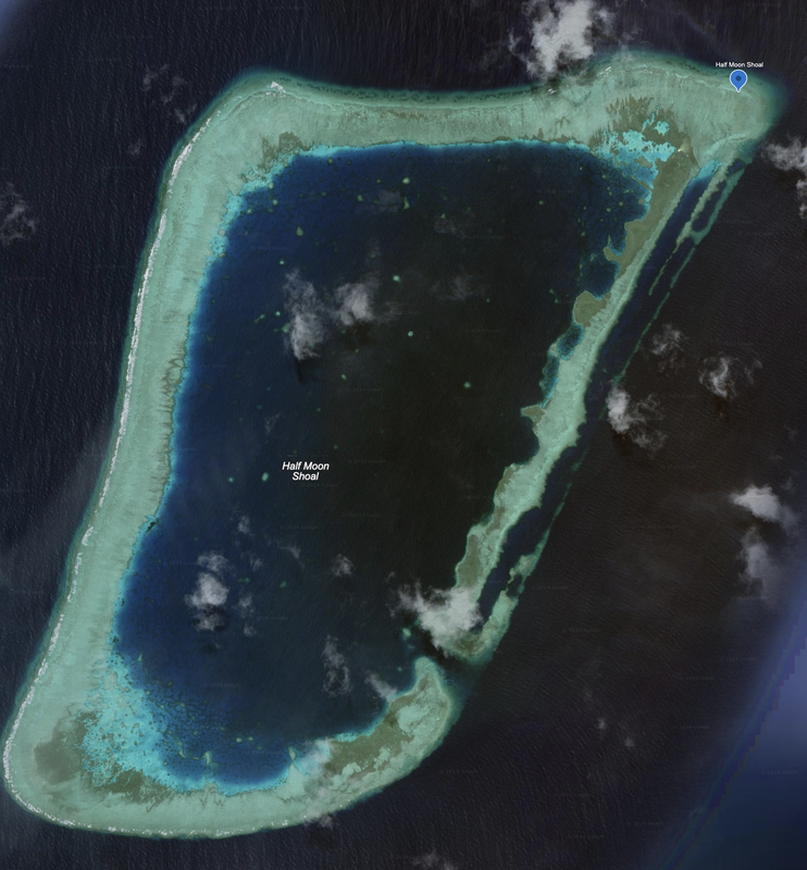
Half Moon Shoal 6/11/2019. Google Earth
|
Half Moon Shoal Land Reclamation or Natural Sand Cay, 6/11/2019, Google Earth
|
Name 1
Nearest Land
Distance from Land (miles)
Location (latitude & longitude)
Diameter (miles)
Date of Satellite Imagery
Airport Present?
Helipad Present?
Port / Dock Facility Present?
Buildings Present?
Defensive Infrastructure Present?
Athletic Facilities Present?
Hospital Present?
Sand Only Island?
Dredging Infrastructure Only?
Spratly Islands
Pearson Reef
Philippines
232
8°58'50"N 113°42’05"E
0.19
5/26/2020
No
Yes
Yes (small)
Yes
Not sure, possibly on the Western edge of the island
No
No
No
No
Consulting Session
This is a one-hour meeting, remote or in-person, with Jeffrey Cohen, President of U.S. Advanced Computing Infrastructure, Inc.
You choose the topic and deliverables.
You may buy multiple hours to fund a project.
We believe management consulting is pursuing "the art of the possible." These are areas where we believe we may be helpful:
- We will discuss our research into the South China Sea
- We offer traditional IT management consulting services.
- We offer quantum computing consulting
- We offer financial investment analysis of stock portfolios based on our Chicago Quantum Net Score (read more in our published research). Today we run a model that analyzes ~3,000 U.S. listed equities and optimizes both 'long' and 'short' stock portfolios.
- Project and program management.
- Outsourcing advisory.
- We run your business problem on our discrete mathematical models (on our own server equipment using our own solvers).
- We may configure and run your problem on quantum annealing computers from D-Wave Systems Inc.
- We ALWAYS work confidentially, diligently, free of conflict of interest, and bring our best thinking and insights.
We can operate at both the strategic and tactical level depending on client need. This includes business strategy, business problem decomposition, mathematical and data design, algorithm design, and use of quantum and classical solvers. The President has a strategic perspective from ~ 30 years of executive corporate management in IT and professional services, and also rolls up his sleeves and codes when there is a good fit with the problem and his expertise.
Absolute discretion and professionalism is assured.
In closing
If you would prefer to discuss this 1:1 and negotiate a scope of work and level of effort, please contact us at jeffrey@quantum-usaci.com or call (312) 515-7333. We will develop a quotation and will invoice for our services.