Con Dao and Vanguard Bank, Vietnam
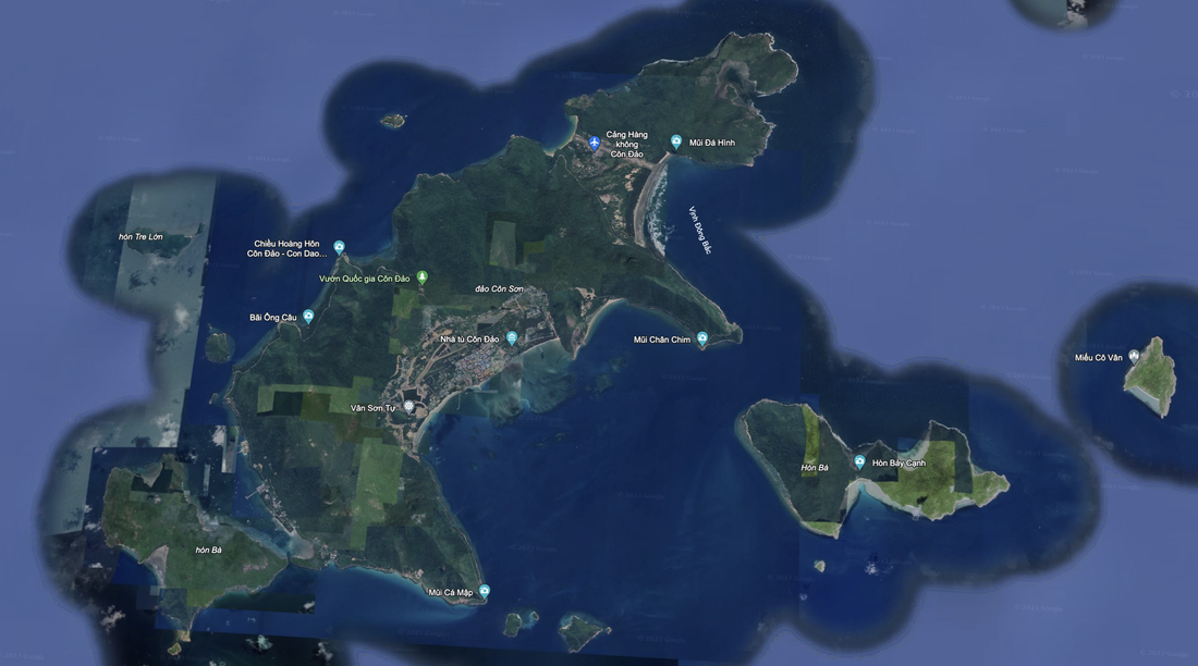
We see beautiful sport fishing location and businesses, with ample housing, winding paved roads around the main island. Con Dao has a thriving, dense residential and commercial area. Downtown is on the Southeastern coast of the island. There are islands East, West and South of the downtown. There is a sheltered cove with ample marina facilities.
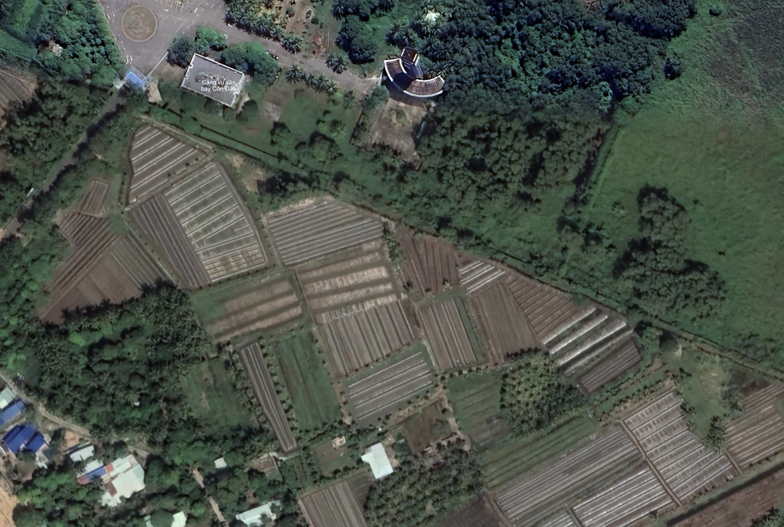
This looks like a thriving set of island with roads, schools, many places to live and work, with lush greenery around the island. We also see agriculture to help this be a self-sustaining island.
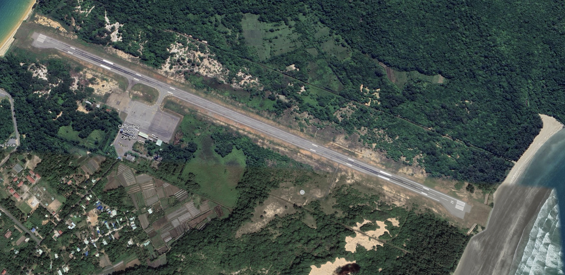
We see an airport on the Northern end of the main island. It is a long runway, stretching from sea to sea 1.15 miles in length. We see a small, open air place for aircraft and three maintenance and aircraft storage buildings at the fixed airbase. We also see a heliport and a control tower.
Photographs and Locations: To Be Confirmed, may not be accurate.
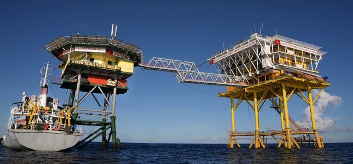
Vanguard Bank is within 50 miles of two oil exploration contracts of Vietnam with two Russian firms. It is located 253 miles Southeast of Vung Tau, Vietnam. It is due west of Rifleman Bank. There is no visual from Google Earth, but we do see a picture of an oil exploration rig on social media that may be located here. According to unconfirmed news sources, within 50 miles there are two Russian-controlled oil exploration blocks that are being worked by PetroVietnam and Zarubezhneft (06-01, 12-11) and Gazprom (05-03). We read that Harbour Energy is exploring block 12W.
Block 06-01 was developed by BP and ConocoPhillips in the early 2000s to pipe natural gas to Vietnam's mainland and meet domestic demand. That field, called Lan Do, is now operated by Rosneft, and was the site of new well drilling in 2017, 2018 and 2019 to maintain natural gas supply. PRC has been sailing in and around this area for over a decade, and this caused a significant relationship issue between Vietnam and PRC in 2019.
The Tuna gas field in Indonesia's EEZ, is being jointly developed (but currently suspended) by Harbour Energy and Zarubezhneft.
We know about Vanguard Bank due to 2023 freedom of navigation patrols by Chinese Coast Guard ships that are followed by Vietnamese naval ships.
Source: ISEAS Yusof Ishak Institute Perspective, Issue 2019, No. 69, ISSN 2335-6677 Singapore, 4 September 2019.
- 7.4750 N, 109.4517 E to 6.9300N, 108.8400E
- 7.1754 N, 108.4593 E
- 6.7498 N, 109.1638 E, 6.7400 N, 109.1517E
Yet another identifier is from the CIL.NUS.EDU.SG website.
7.31.44.93"N, 109.44.39.74"E, and is classified as a collection of submerged coral platforms in the southwestern Spratlys. It is located 220 nautical miles SE of Vietnam, 300NM NW of Borneo and over 400 NM SW of Palawan. There are no shallow geographic features. It is difficult to impossible to see these underseas formations from commercial satellites.
Name 1
Nearest Land
Distance from Land (miles)
Location (latitude & longitude)
Diameter (miles)
Date of Satellite Imagery
Airport Present?
Helipad Present?
Port / Dock Facility Present?
Buildings Present?
Defensive Infrastructure Present?
Athletic Facilities Present?
Hospital Present?
Sand Only Island?
Dredging Infrastructure Only?
South Vietnam
Con Dao
Vietnam
53
8°41'19"N 106°36'20"E
9.4
12/8/2022
Yes
Yes
Yes
Yes
No
No
Not Sure
No
No
Consulting Session for one hour
This is a one-hour meeting, remote or in-person, with Jeffrey Cohen, President of U.S. Advanced Computing Infrastructure, Inc.
- You choose the topic and deliverables.
- You may buy multiple hours to fund a project.
We believe management consulting is pursuing "the art of the possible." These are areas where we believe we may be helpful:
- We will discuss our research into the South China Sea
- We offer traditional IT management consulting services.
- We offer quantum computing consulting
- We offer financial investment analysis of stock portfolios based on our Chicago Quantum Net Score (read more in our published research). Today we run a model that analyzes ~3,000 U.S. listed equities and optimizes both 'long' and 'short' stock portfolios.
- Project and program management.
- Outsourcing advisory.
- We run your business problem on our discrete mathematical models (on our own server equipment using our own solvers).
- We may configure and run your problem on quantum annealing computers from D-Wave Systems Inc.
- We ALWAYS work confidentially, diligently, free of conflict of interest, and bring our best thinking and insights.
We can operate at both the strategic and tactical level depending on client need. This includes business strategy, business problem decomposition, mathematical and data design, algorithm design, and use of quantum and classical solvers. The President has a strategic perspective from ~ 30 years of executive corporate management in IT and professional services, and also rolls up his sleeves and codes when there is a good fit with the problem and his expertise.
Absolute discretion and professionalism is assured.
In closing
If you would prefer to discuss this 1:1 and negotiate a scope of work and level of effort, please contact us at [email protected] or call (312) 515-7333. We will develop a quotation and will invoice for our services.


