Luconia Breakers, Brunei and Malaysia Coast, Spratly Islands
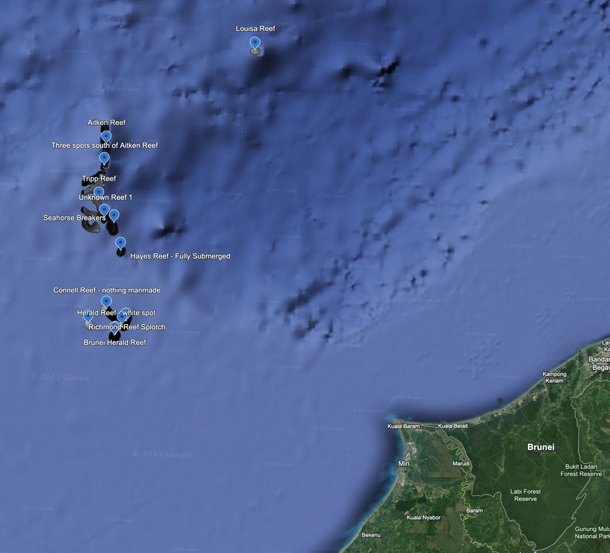
A bit Northeast of Aitken Reef we see a stand-alone reef formation named Louisa Reef. It does not appear to have any man-made developments, and is likely 100% submerged. Location: 6°19'58"N 113°14’35”E. Dated 6/7/2019.
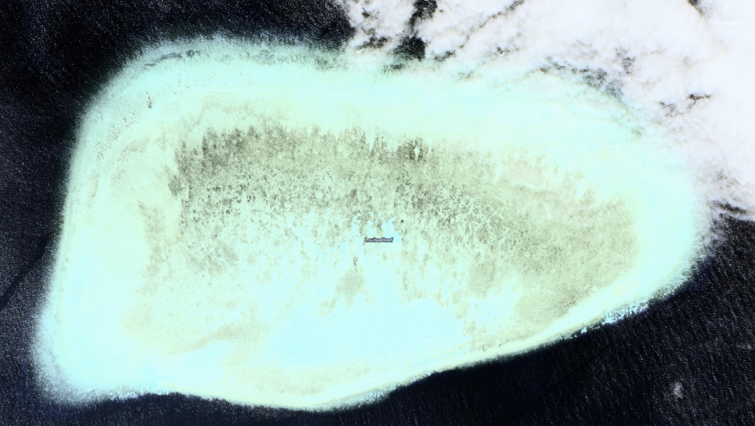
It starts with Friendship Shoal, diameter 1.96 miles, at location: 5°57'31"N 112°31'14"E. No date on the satellite imagery. This is an atoll with a lagoon. There could be a navigation channel at about 350 degrees, but the satellite imagery is unclear (too much contract).
South of Friendship is Aitken Reef. Aitken Reef is at location 5°52'21"N 112°32’35”E.
Starting from North to South, we see underground reefs and no manmade structures, until we find three spots that are too difficult to see. Location: 5°46'20"N 112°32’13”E.
As we keep going South, we discover Tripp Reef, which is fully submerged. Location: 5°36'02"N 112°30'34"E
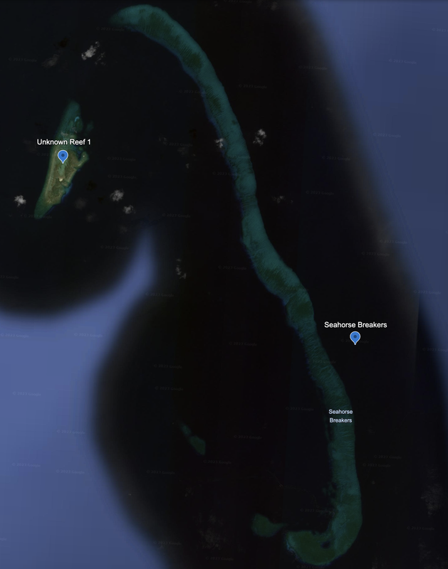
Continuing south, we see Seahorse Breakers. At the northwest of the seahorse, where the nose would be, we see a small potential reclamation of a sandy spit of land, and what looks like a ship. Satellite Imagery 10/28/2014. Location: 5°31'26"N 112°32'27"E.
As we approach Seahorse Breakers from the North, at location: 5°29'59"N 112°34’47”E, we marvel at its majestic beauty and North to South orientation.
We notice an island just West with some wave formations, possibly indicating land near the surface of the water, and a few bright spots. Let’s take a closer look at the location we called Unknown Reef 1. Location: 5°30'39"N 112°34’32"E
If I had to guess, it will be the site of future real estate development.
|
|
- Hayes Reef is to the south of Seahorse Breakers, and is fully submerged with no man-made elements.
- Connell Reef has nothing man-made.
- Richmond Reef has a small splotch of sand. This may just be a mark on the satellite imagery.
- Herald Reef has a tiny white spot of sand.
- Stigant Reef is underwater with nothing man-made.
Connell Reef. Location: 5°05'08"N 112°34’38”. No man-made structures.
Richmond Reef is long and thin, with a North to South orientation.
We do not see any man-made structures clearly, but there is one spot worth looking at later. It is unclear in the photo.
We call it the Richmond Reef splotch, location: 5°02'12"N 112°39’34"E.
The southernmost island is actually a reef that may still be underwater, Stigant Reef. It is shaped like a person’s ear.
Location (Latitude / Longitude): 5.0210560 112.47777787.
Near Stigant Reef, we see what might be as many as five reefs or islands. Let’s take a closer look.
Stigant Reef has no man-made features, and does look like a person’s ear.
To the East we see Herald Reef, which is a circular reef. Location: 4°57'58"N 112°36’22"E
At around the 2 o’clock orientation, we see a white spot on the satellite photos, but it is not clear enough to make out. Could be a large fish, or a small storm. Location: 4°58'26"N 112°36’38”E. Photos are dated back to 12/13/2014, which is nine years ago.
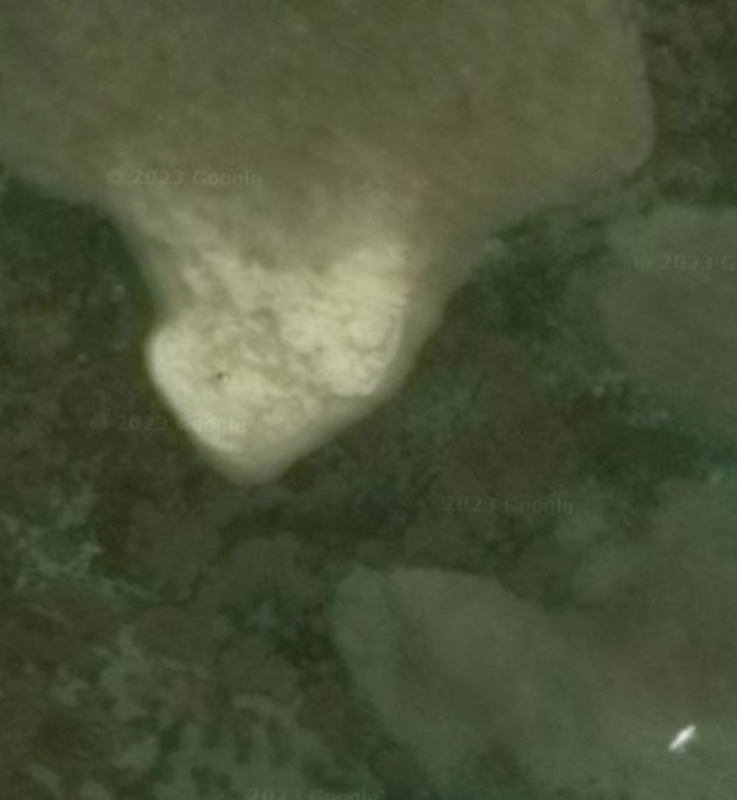
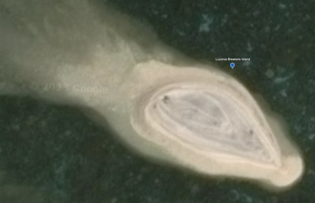
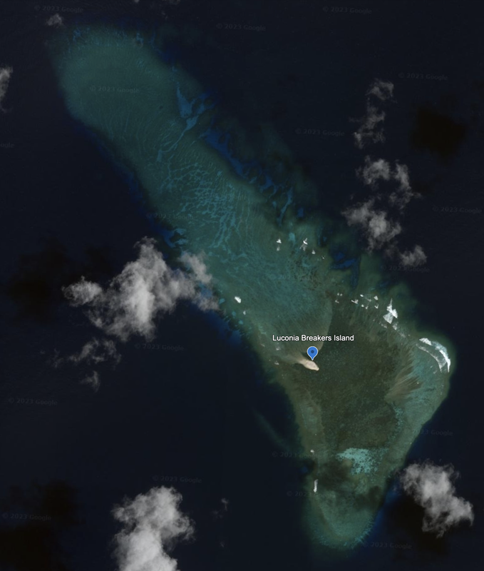
There is a small sandy island that looks new. We also see reclamation sand to the North and West of the island. This imagery is from 12/13/2014, and is nine years old. Location: 5°01'18"N 112°38'15"E. The island diameter is 0.06 miles. The full Luconia Breakers reef is 1.81 miles, and looks like a solid reef as opposed to a well defined atoll and lagoon.
Luconia Breakers, or Luconia Shoals is located 95 miles from Kuala Baram, Malaysia.
Luconia Breakers is a fairly large structure that looks like a foot. Measuring from top to heel, it measures close to 1.6 miles. Measuring from top to toe, it comes in at 1.8 miles. This reef is primarily underground but with areas close to the surface. You can see the spots where the waves are visible as white splotches.
It does have a sandy mass that looks like an oval. We remember seeing this new landmass in our previous work. The date of the satellite photo is 12/13/2014, so this is still a nine-year old photo. Location: 5°01'11"N 112°38’24”E. Given that this is just sandy land, it is probably too soon to call this a tourist attraction. We will check back.
I wonder what it looks like today?
There are a string of features to the near north. The Indonesian islands of Riau and Laut Island are 299 to 318 miles away to the West.
Name 1
Nearest Land
Distance from Land (miles)
Location (latitude & longitude)
Diameter (miles)
Date of Satellite Imagery
Airport Present?
Helipad Present?
Port / Dock Facility Present?
Buildings Present?
Defensive Infrastructure Present?
Athletic Facilities Present?
Hospital Present?
Sand Only Island?
Dredging Infrastructure Only?
Spratly Islands
Luconia Breakers
Malaysia and Brunei
94 and 103
5°01'18"N 112°38'15"E
1.81
12/13/2014
No
No
No
No
No
No
No
Yes
No
Consulting Session for one hour
This is a one-hour meeting, remote or in-person, with Jeffrey Cohen, President of U.S. Advanced Computing Infrastructure, Inc.
- You choose the topic and deliverables.
- You may buy multiple hours to fund a project.
We believe management consulting is pursuing "the art of the possible." These are areas where we believe we may be helpful:
- We will discuss our research into the South China Sea
- We offer traditional IT management consulting services.
- We offer quantum computing consulting
- We offer financial investment analysis of stock portfolios based on our Chicago Quantum Net Score (read more in our published research). Today we run a model that analyzes ~3,000 U.S. listed equities and optimizes both 'long' and 'short' stock portfolios.
- Project and program management.
- Outsourcing advisory.
- We run your business problem on our discrete mathematical models (on our own server equipment using our own solvers).
- We may configure and run your problem on quantum annealing computers from D-Wave Systems Inc.
- We ALWAYS work confidentially, diligently, free of conflict of interest, and bring our best thinking and insights.
We can operate at both the strategic and tactical level depending on client need. This includes business strategy, business problem decomposition, mathematical and data design, algorithm design, and use of quantum and classical solvers. The President has a strategic perspective from ~ 30 years of executive corporate management in IT and professional services, and also rolls up his sleeves and codes when there is a good fit with the problem and his expertise.
Absolute discretion and professionalism is assured.
In closing
If you would prefer to discuss this 1:1 and negotiate a scope of work and level of effort, please contact us at [email protected] or call (312) 515-7333. We will develop a quotation and will invoice for our services.