Erica Reef, Mariveles Reef, Investigator Island and Viper North, Spratly Islands
Updated August 26, 2024 with Sentinel-2 imagery and analysis.
We now enter the area due west of Malaysia and the Philippines. This is the center east of the Spratly Islands, and contains four significant atolls. This is also included in the Malaysian Exclusive Economic Zone, west of the Malaysian islands. Mariveles, Erica and Viper North all have man-made developments. Copernicus eESA groups these together with Swallow Reef, which is a Malaysian military base, and close to both the Philippine and Malaysian coasts.
Mariveles Reef Island Development, Malaysia
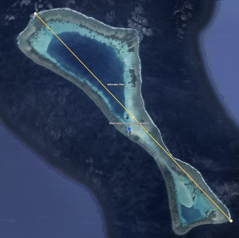
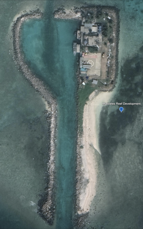
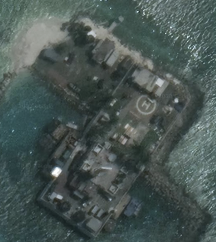
Just to the north of Ardasier Bank is Mariveles Reef. This is a 6.4 mile long, north to south atoll with a clear and well defined reef structure. We have a developed reef island (looks like a warehouse and working station) with a significant atoll reclamation that seems to be growing with a new sandy area to the South, and a channel cut into the north. Total length of the working island is 0.16 miles, and the developed area looks busy. Location: 7°57'59"N 113°54’59”E. Maxar Xpress labels this as a Royal Malaysian Navy outpost.
This 6.4 mile long double atoll reef structure with visible sand reclamation underway in the Southern half, and a small man-made island development. The existing development looks like a naval truck stop, likely for transferring cargo, crew and refueling. Given the amount of sand visible from satellite images, would expect the bottom half of the reef, or the entire atoll, to potentially be filled in over time.
This development is based around a carved out channel in the reef, and a protected bay that is open to the North and South to enter and exit the reef bay. It runs North-South, and has a helipad and two port / docking facilities in the protected bay. At the time of the satellite photo, 1/21/2022, we see a major ship and small ship docked.
Sentinel-2 L2A True Color on 7/31/2024, also confirms the length of the rectangle at 253 meters, and what looks like a deep channel into the reef through this working station.
Erica Reef, Malaysia
Northeast of Mariveles by 16.5 miles, we find Erica Reef. Erica Reef atoll is 1.9 miles in diameter with a small development in the south of the atoll at around 165 degrees. We note this is Malaysian owned and operated, based on an entry by Maxar Xpress Open Street Map.
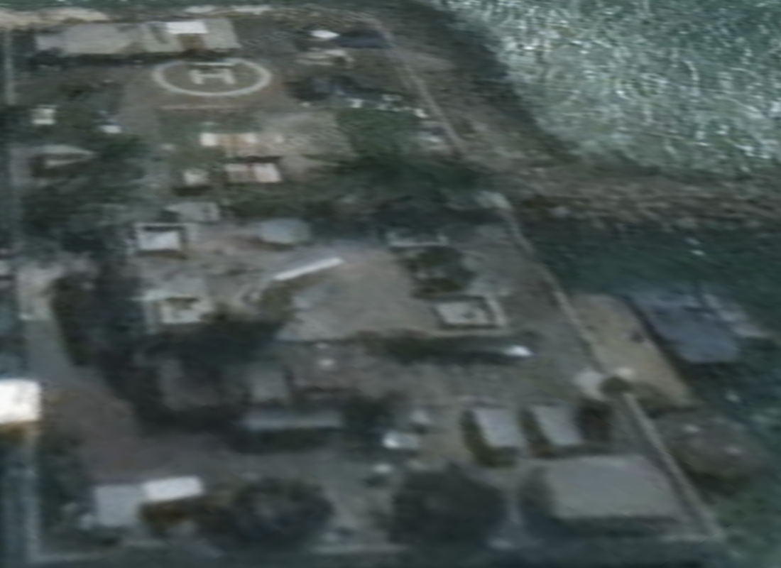
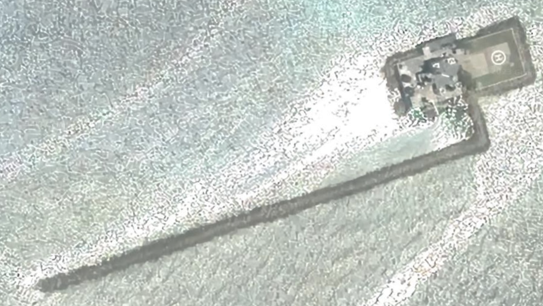
Google Earth imagery from 6/4/2022. The land development has a length of 0.05 miles, and two spits of land that create a protected bay. This development has docks on two sides, and also looks to be a naval truck stop with a helipad and the interesting tall shape that reminds us of the 2001 A Space Oddity rectangle, except this one is white in color. There are a number of buildings on this well-defined island. Location: 8°06'09"N 114°08’14”E.
Upon closer examination, it may be a rotating radar dish instead of the typical ‘three radomes’ approach.
In Copernicus Browser, Sentinel-2 L2A on 7/31/2024 shows this is now two major reclamations about 1.2 length if they are eventually joined, on the east side of the reef. This is a straight line section of the reef.
Investigator Shoal, Malaysia
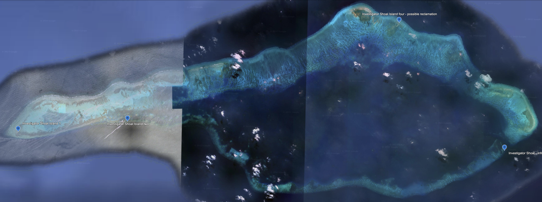
This is a 20.3 miles long atoll with a large, enclosed body of water and a navigation channel carved into the southeastern corner. It has at least two reclamation efforts underway. It contains a Royal Malaysian Navy outpost, and therefore we consider this atoll managed and operated by Malaysia (source: Maxar Xpress). This reef structure is east of Erica Reef.
Investigator Shoal, Island 1, dated 03/27/2021, at location: 8°06'42"N 114°31’02”E, is a small sandy reclamation.
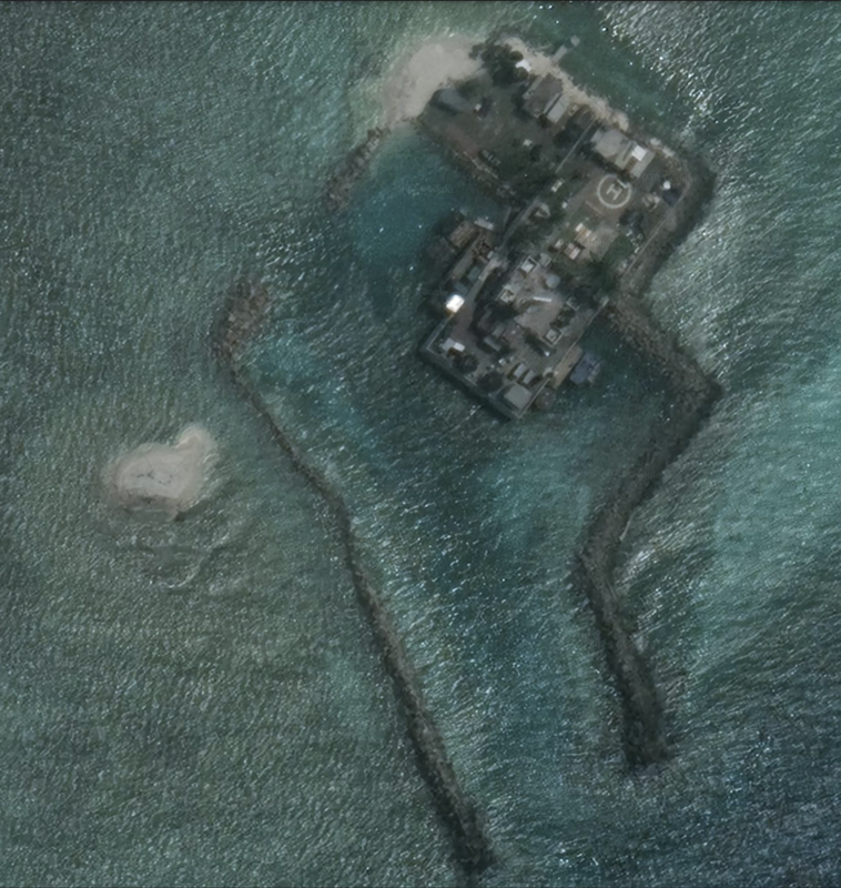
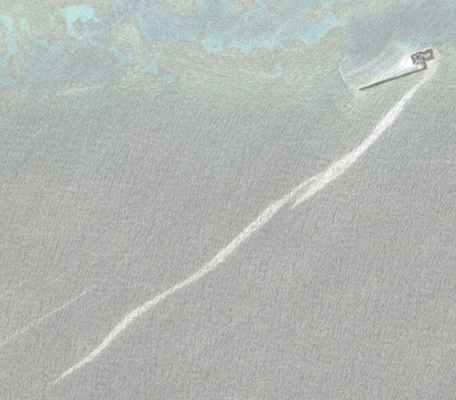
Investigator Shoal Island two is an ambitious reclamation that looks different than any other island. It has a long stream of sand reaching south for about 20x the length of the current island, likely to protect ships during rough weather. It is a very small island (about 90 meters long), with the long side of the rectangular island measuring 0.05 miles. It is at location: 8°07'07"N 114°34'36"E. It is due East of Island One. It is also a satellite image from 03/27/2021. It also has the standing rectangle we saw on Erica Reef in white and a helipad. We confirm the shape and size on Sentinel-2 L2A on 7/31/2024.
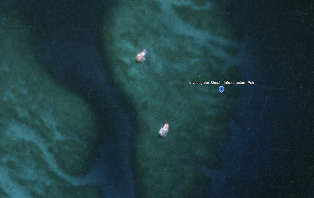
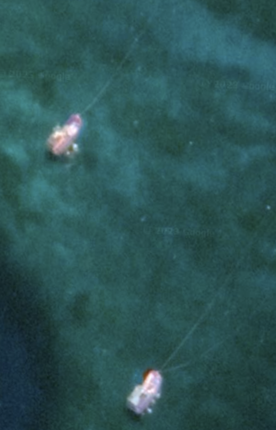
We also see a pair of infrastructure items located at the Western edge of a wide and deep channel into the reef, that each seem to have lines stretching towards the channel. There is also a natural deep channel to the east of this reef island, making it a natural defensive location. Location: 8°06'24"N 114°47’14”E. These look more like ships than they do the typical fixed-placement infrastructure we normally see. Here is the picture with a little more detail. This is Southeast of the other fortifications.
At the North center of the shoal, we see a possible reclamation that looks like a smudge of sand that we named Investigator Shoal Island Four. Location: 8°10'29"N 114°43’40”E. Via Sentinel-2 on 7/31/2024, it still looks like a smudge.
Viper North Shoal, Philippines
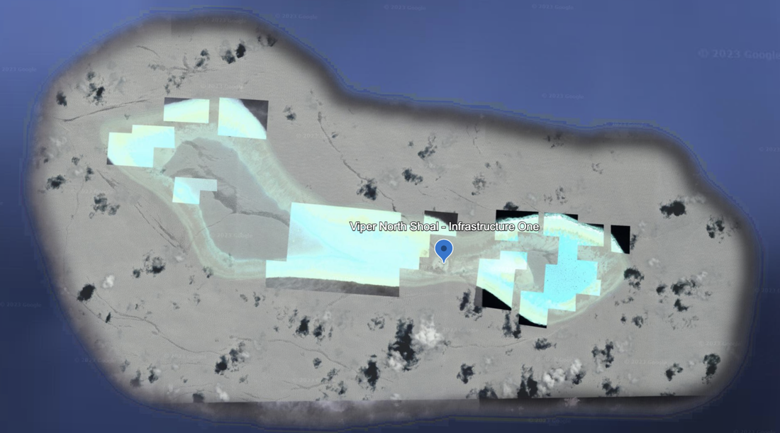
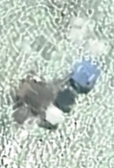
Northeast of Investigator Shoal is Viper North Shoal. It appears to be managed and operated by the Philippines. It is 7.5 miles long and runs northwest to southeast. It looks like a hightop sneaker. Google Earth satellite imagery is dated 5/26/2020. We see one permanent infrastructure element in the center of this shoal, at location: 8°21'33"N 115°14’22”E. This island is 192 km west from Balabac Island, Philippines.
Copernicus eESA Sentinel-2 L2A shows the reclamation of the central (or waist) of the island is real, and stretches as long as 2.2 km. It has the narrowest point of the reef on either side. All the reef structures in this neighborhood have islands, working islands and active reclamations. We wonder whether this is Philippine work underway. Maxar Xpress has this atoll labeled as Philippine.
Area
Name 1
Nearest Land
Distance from Land (miles)
Location (latitude & longitude)
Diameter (miles)
Date of Satellite Imagery
Airport Present?
Helipad Present?
Port / Dock Facility Present?
Buildings Present?
Defensive Infrastructure Present?
Athletic Facilities Present?
Hospital Present?
Sand Only Island?
Dredging Infrastructure Only?
Spratly Islands
Mariveles Reef
Philippines and Malaysia
204 and 208
7°57'59"N 113°54’59”E
6.5 (island is 0.16)
1/21/2022
No
Yes
Yes
Yes
No
No
No
No
No
Spratly Islands
Erica Reef
Philippines and Malaysia
189 and 198
8°06'09"N 114°08’14”E
1.9 (island is 0.05)
None given
No
Yes
Yes
Yes
No
No
No
No
No