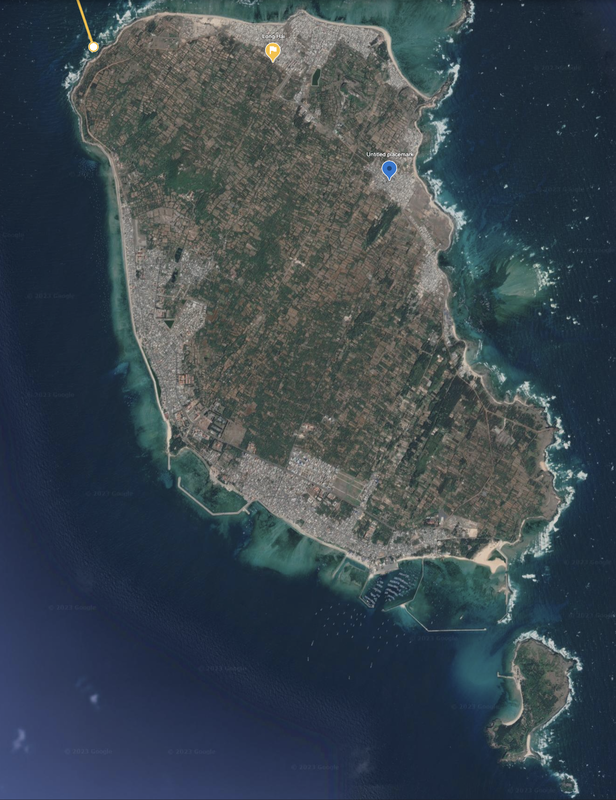
Long Hai, Vietnam
South of Vietnam is a pair of Vietnamese islands located about 65 miles east of Phan Thiet, and 45 miles SE of the closest mainland. A solid location for a fishing, beach or farming. These appear to be mature communities.
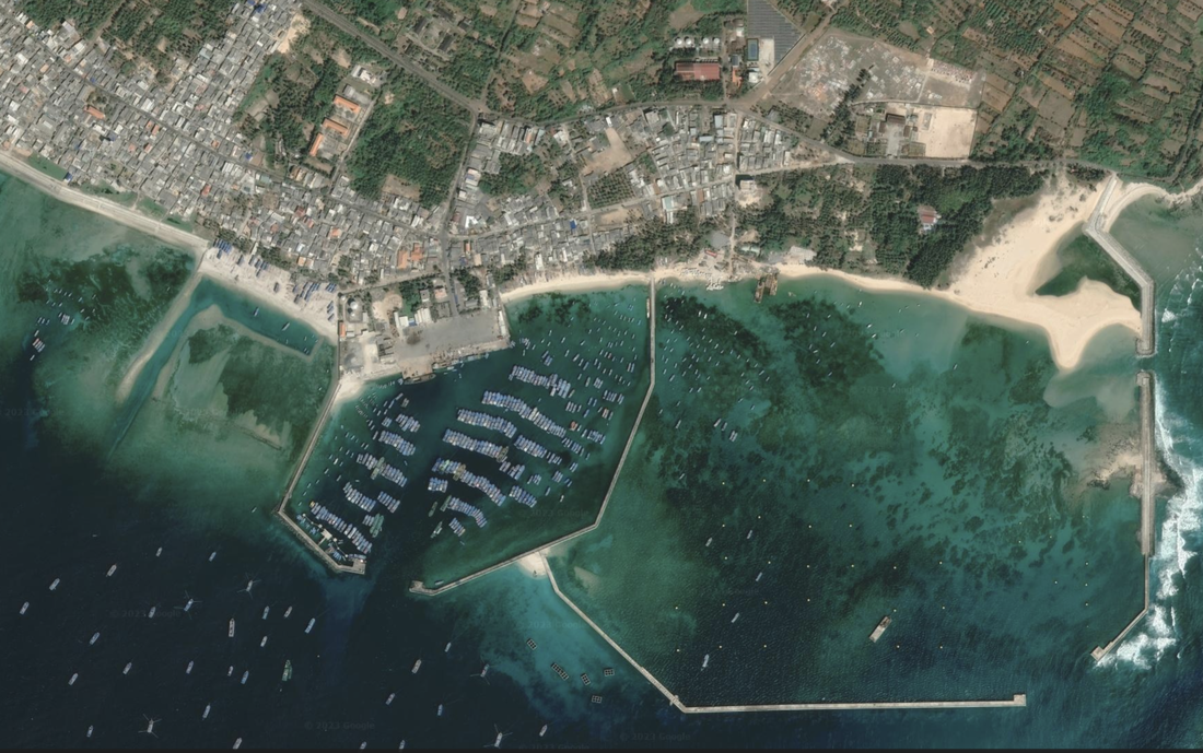
There is a main island, and a smaller one just south of the main island’s largest of two protected bays on the SE corner of the island. This island looks mature, established, looks active, well developed, with hundreds of buildings, residences closely situated, significant office space, lush green spaces and farming plots across the island.
The North, West, and a portion of the East side of the island looks to have densely packed residences and many boats in the water and two protected bays. A true ‘beach community’ while the center of the island and portions of the East have hundreds of small, individually managed farm plots.
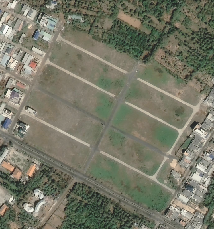
Unknown on the airport facilities. Location:10°31'20"N 108°55'00"E
Satellite imagery dated 01/26/2021, and 12/14/2015.
Name 1
Nearest Land
Distance from Land (miles)
Location (latitude & longitude)
Diameter (miles)
Date of Satellite Imagery
Airport Present?
Helipad Present?
Port / Dock Facility Present?
Buildings Present?
Defensive Infrastructure Present?
Athletic Facilities Present?
Hospital Present?
Sand Only Island?
Dredging Infrastructure Only?
South Vietnam
Long Hai
Vietnam
45
10°31'20"N 108°55'00"E
4.4 (including the protected bay)
01/26/2021, and 12/14/2015
Yes, dirt runways
No
Yes
Yes
No
N0
Not Sure
No
No
Consulting Session for one hour
This is a one-hour meeting, remote or in-person, with Jeffrey Cohen, President of U.S. Advanced Computing Infrastructure, Inc.
- You choose the topic and deliverables.
- You may buy multiple hours to fund a project.
We believe management consulting is pursuing "the art of the possible." These are areas where we believe we may be helpful:
- We will discuss our research into the South China Sea
- We offer traditional IT management consulting services.
- We offer quantum computing consulting
- We offer financial investment analysis of stock portfolios based on our Chicago Quantum Net Score (read more in our published research). Today we run a model that analyzes ~3,000 U.S. listed equities and optimizes both 'long' and 'short' stock portfolios.
- Project and program management.
- Outsourcing advisory.
- We run your business problem on our discrete mathematical models (on our own server equipment using our own solvers).
- We may configure and run your problem on quantum annealing computers from D-Wave Systems Inc.
- We ALWAYS work confidentially, diligently, free of conflict of interest, and bring our best thinking and insights.
We can operate at both the strategic and tactical level depending on client need. This includes business strategy, business problem decomposition, mathematical and data design, algorithm design, and use of quantum and classical solvers. The President has a strategic perspective from ~ 30 years of executive corporate management in IT and professional services, and also rolls up his sleeves and codes when there is a good fit with the problem and his expertise.
Absolute discretion and professionalism is assured.
In closing
If you would prefer to discuss this 1:1 and negotiate a scope of work and level of effort, please contact us at [email protected] or call (312) 515-7333. We will develop a quotation and will invoice for our services.