Duncan, Drummond, Pattle, Money and Antelope islands, Yongle Islands, Crescent Group, Paracel Islands
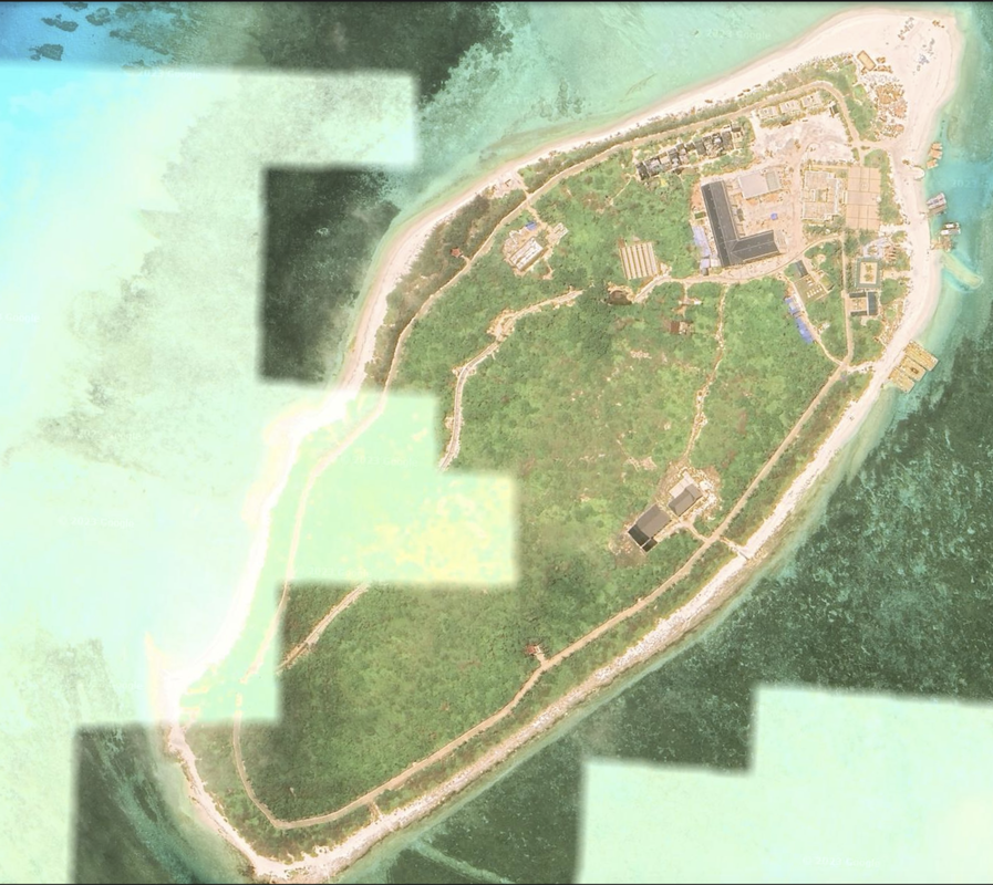
The Crescent Group in the Paracel Islands is a 20 mile in diameter oval set of coral reefs in sort of a loose atoll shape, and a few of those reefs are also in an atoll shape. What stands out is the significant amount of land reclamation and man-made development in this area by the PRC. This formation is located 161.3 miles SSE of Hainan island.
The Crescent Group contains ten primary reef structures. They are the western islands in the Paracel Islands, and the second group that traditional Chinese fisherman would visit. They are called the Lower Eight Islands or Xia Zhi / The Lower Stand-off. They are also called the Yongle Islands. Source Liu, L. The Fishermen...2021 DOI Link.
There are significant signs of naval activity and fishing, but no airports. There is significant reclamation activity underway in the satellite imagery.
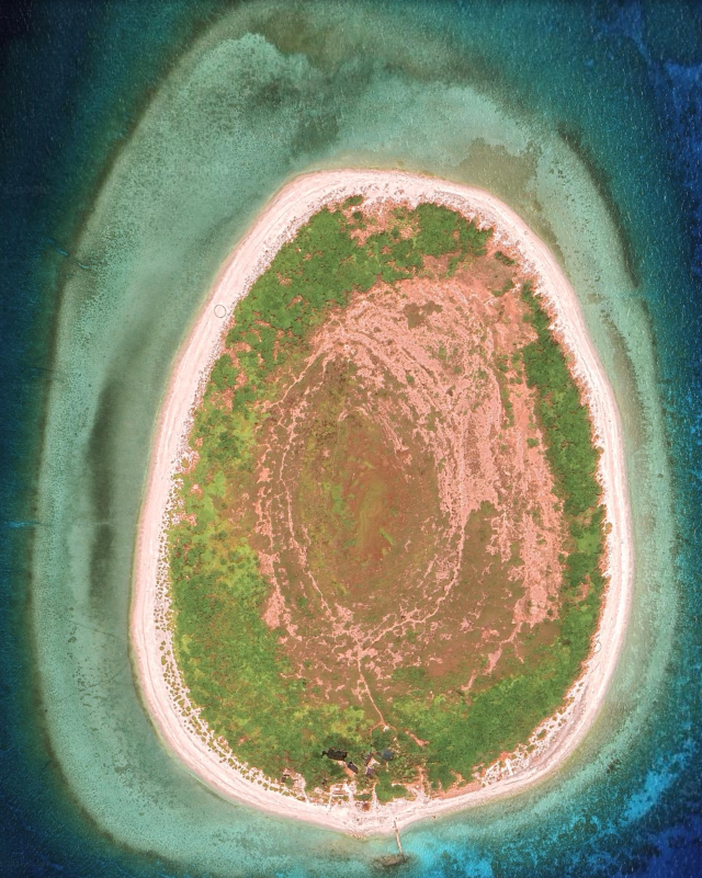
Here is an overview photo.
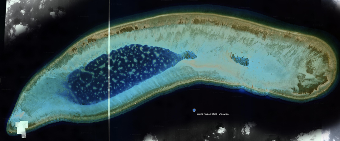
The northern 'Central West Reefs' are heavily developed. We number the islands based on 'central west, number.' The three southern 'Central West Reefs' in this photo are underwater and lack any man-made structures or reclamation. This is also true for the Southeast corner, and the far-eastern edge of the Paracel Islands.
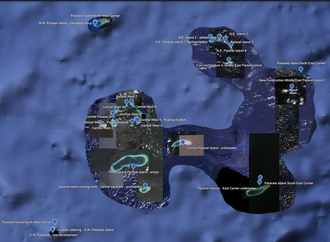
Crescent Group: Heavily Developed Central West Reefs
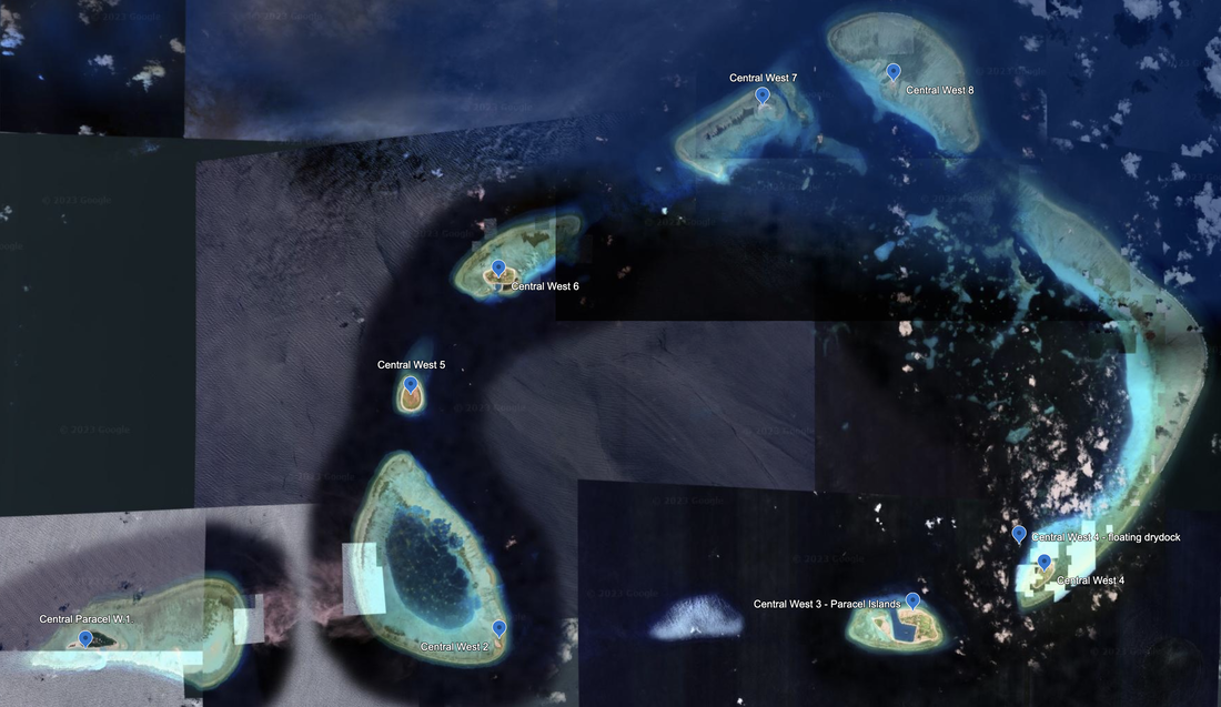
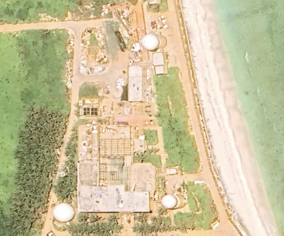
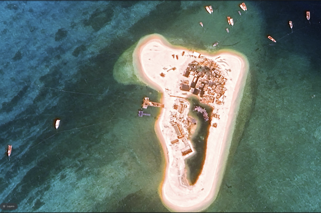
Central West 1
Location: 16°26'37"N 111°30’52"E.
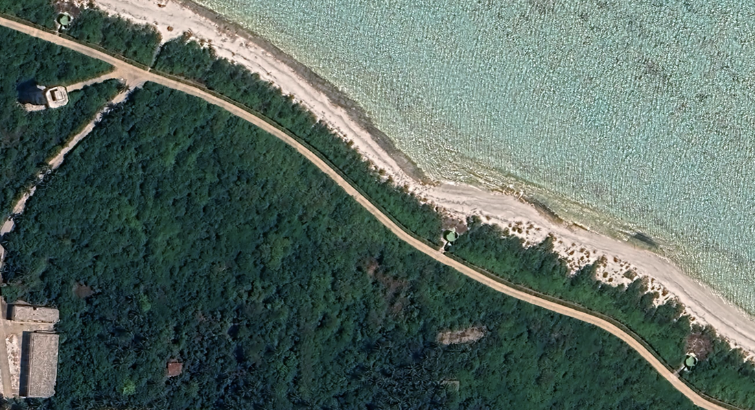
Money Island is in the western portion of the reef, is 6 meters high and brush covered. The island has a settlement of people and neatly planted groves of palm trees, and a small protected and dredged quay / basin on the south shore available for small boats (according to the NGA Publication 161).
The island looks to take up about 5% of the total coral reef surface area. We see multiple sand cays and land reclamation to the east that indicates this island will grow. The diameter of the coral atoll is 3.59 miles.
This appears to be a very busy island with many shapes that blend into the palm trees. Satellite Imagery: 4/6/2023.
This island has its share of tall, multi-story buildings, big green, camouflaged balls (radomes), and tall towers around the island. We see straight roads laid out in a grid. There are trees everywhere, and I think it makes some of the development unobservable from satellite. We do see a helipad. We see two ratio towers bracketing a radome.
We see island defenses along the outside of the island, at least on the North. There are block and round shapes around the perimeter of the island just off the paths which may be fixed, manned positions for island defense.
The extreme eastern portion of the coral atoll under Money Island has some land reclamation underway, as we see a sand cay. Satellite imagery 5/27/2023.
This island is 171.5 miles from Zhuwan, China and 218.6 miles from Da Nang, Vietnam. It is approximately one mile in diameter (0.96).
This island is notated in the 2015 H. Yong research paper, although it was not surveyed.
Central West 2
Central West 2, location: 16°26'46"N 111°36’46"E
We notice a long channel, a few sandy spots, a boat, and an inhabited island. It appears the Southern portion of the island is being expanded atop the underwater reef, and will be further built out.
As we zoom into the island, we see more details. It looks like a fishing village with a large port building, navigation body, small fishing boats, and five nearly identical buildings. It looks like this island is larger than the area in use, and the long, straight navigation channel into the bay was cleared out. This island has two survey sites in the H. Yong 2015 research paper.
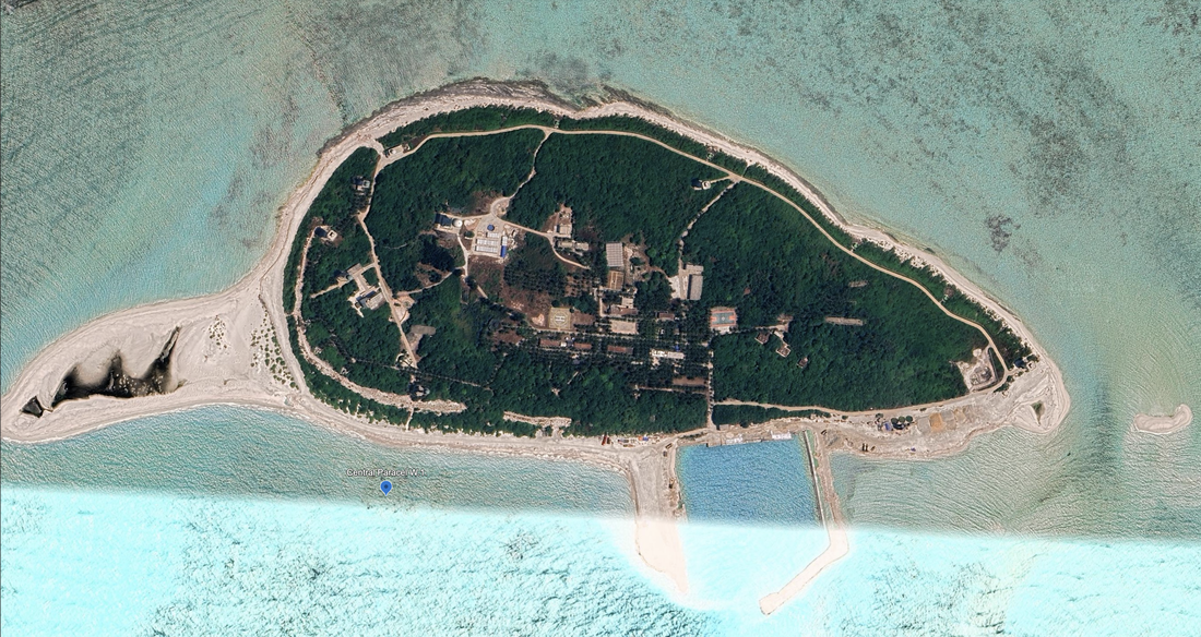
Central West 3
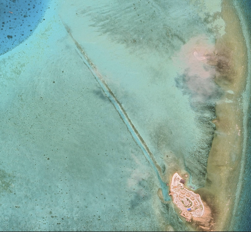
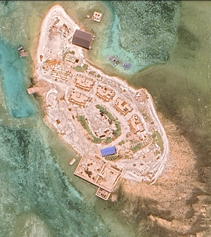
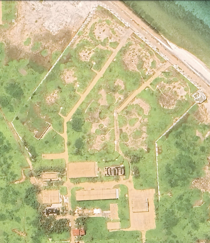
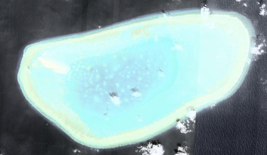
Duncan Island was two smaller coral islets connected by a long sand spit. Date: 05/19/2023. Location: 16°27'04"N 111°42’24”E. There is a significant lagoon and the harbor entrance is deep and about 1.5 miles wide. It is a very large harbor basin and a significant port or pier.
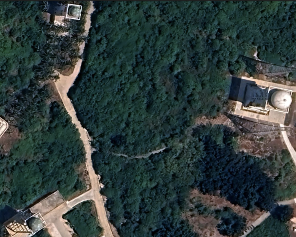
This island has facilities for people, including athletic facilities. We see six athletic fields. We see a tall radio tower and a heliport with eight helipads connected. There is no airport. It does look like some of the Western portion of the island is still under construction. We do see a set of three radomes on the East side of the island. We may see defensive infrastructure on the North and West of the island.
One unique feature is a fenced-in compound on the island, with what looks like a tower on one of the corners of the property. Fences are usually to keep people out or to keep them in. The layout of the fenced in compound does not indicate its purpose, but it is either a higher-security area or a prison facility.
Another important observation is that the western islet looks to be in the process of being fully reclaimed to the edges of the reef. That would make this a significantly larger island. With the additional reclamation, the island would be 1.40 miles in diameter.
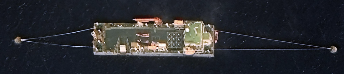
Central West 4
Location: 16°27'48"N 111°44’29”E, is east of Duncan Island. Satellite Imagery 5/19/2023. It has a trail around the island, and a couple of very large building complexes on the island. It also hosts small fishing docks and fishing boats. I notice at least two, raised observation towers along the ring trail.
There is a long, narrow channel on the Northeast corner of the island that leads through the coral reef. On the Northeast of the Island, there are some multi-story buildings showing three or four floors, and is connected to another building. We also see the helipad in front of the main building nearest the port facility. In this satellite image, we see many barges and boats, and just North of the large building are some shapes covered in tarps that could be building materials or heavy equipment.
To the Northwest of this island, we see an anchored, floating dry dock or island. This is rectangular, attached with cables to two anchors, and looks significant in size for a ship. It sports a large crane, and appears to be multiple stories in height. We measure it at 0.02 miles x 0.06 miles.
The floating dry dock is at location: 16°28'12"N 111°44’08"E. This island did not have a survey location in the H. Yong 2015 paper.
Central West 5
This island, Ganquan Island, has freshwater wells and is a place where fishermen come to obtain a supply of fresh water. It is 8 meters high, fringed with coral reef, and covered with vegetation. There are a few buildings and a place to tie up boats on the southern tip. The island has a 0.47 mile diameter. We see some irregular shapes (circles) located around the outer ring road, and the housing structures look almost jungle-like and are hard to see with their tree cover. Very little by way of roads.
Location is: 16°30'33"N 111°35’28"E. Satellite imagery 5/27/2023. This island did not have a survey location in the H. Yong research paper.
To the Northeast of Central West 2, we see additional islands that are developed with buildings and infrastructure. Pattle Island is 2 miles NE.
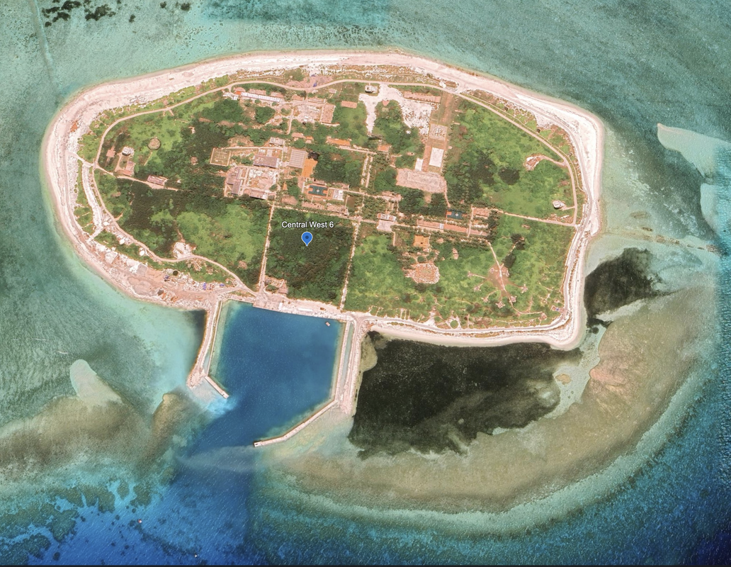
Central West 6
Location: 16°31'55"N 111°36’22”E. Satellite Imagery: 5/27/2023.
Pattle Island is a rectangular island covered with brush and mangroves, it has a fresh water well. It has additional reclamation work apparent along the south and east of the island. This island has a few straight roads, three tall towers in a triangle at the North, West and Eastern ends, and what look to be defensive installations around the outside of the island (but we do not see the cannons, only the emplacements), so they might have been empty at this time.
There are multiple athletic facilities, a tall radio tower, a significant helipad, and buildings in the center of the island.
There is an enclosed dredged basin and quay, with port facilities. Based on the buoys south of the island, and significant landmass developing to the Southeast, I would expect this island will grow in the coming years. According to Wikipedia, the French built a weather station on this island in 1932, and a lighthouse and radio station in 1937.
This island has two survey sites in the H. Yong 2015 research paper.
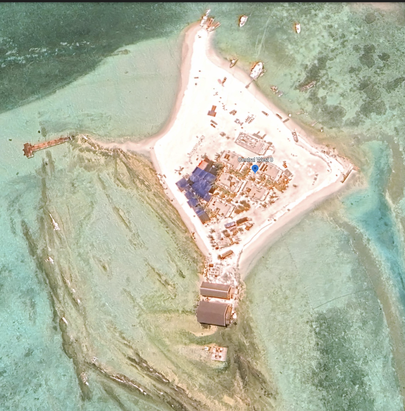
Quanfu Island, Central West 7, means All Wealth Island.
Yinyu Reef, Central West 8, also known as Silver Islet and Lesser Silver Islet.
Central West 7 & 8 are under new constructions, and still being reclaimed from the sea and reefs. We see ships between 7 & 8, and a structure that looks like a large rectangle just off island seven.
Central West 7 is a busy fishing island with additional reclamation work underway to the Northwest of the island in two locations.
Quick photos only, and the location of 7 and 8.
Central West 7 16°34'13"N 111°40'41"E. Both of these formations had survey sites in the H. Yong 2015 research paper. C.W. 7 had one and C.W. 8 had two survey sites.
Yagong Dao, He Duck
Xianshe Yu, Salty Hut
these last few, southern-most islands and look to be active fishing villages. One of them has a pool of water in the center of the island where boats are floating. I also notice there are wire cables stretching out from the island North (3) and West (2) that the boats are tethered to. In some cases, there is one boat and in other cases two. This is a new island without any greenery or growth, it is pure sand and a few buildings.
I am surprised by the number of structures on this island, and the water in the center of it. It looks like they might still be filling the area with sand, and have workers located on the island already.
It is located about 5.6 miles north of Drummond Island. The exact location of the Dragon Hole is N16°31.55’. E111°46.1’.
Discovery Reef is noted in the NGA Publication 161 as having above water rocks & overfalls. We see two, clearly defined navigation channels in the Southern coast of one reef, but no reclamation.
South of this island and still on the East edge of the Paracel Islands, we see an underwater reef without any signs of reclamation. Location: 16°02'49"N 112°30’15"E
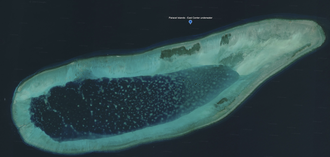
West of the island and underwater reef, we see another underwater reef with no signs of man-made development.
Location: 16°22'12"N 111°57'06"E
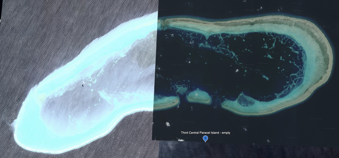
There is an empty, underwater reef that is at the far south of the Central West reef. It has no unusual or man-made features.
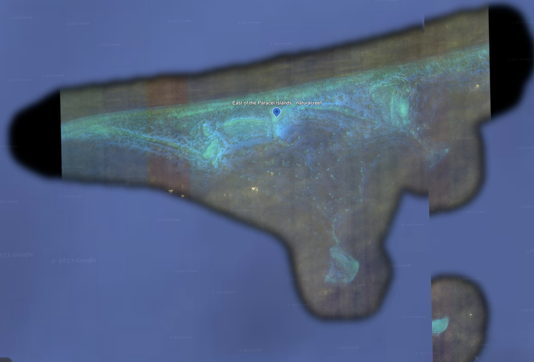
We call this East of the Paracel Islands. It is in the shape of an equilateral triangle, with the long side approximately 12 miles long, and the shorter sides approximately 8.4 miles long. Google marked this satellite image as from 03/06/2012, so this image is over 11 years old.
Name 1
Nearest Land
Distance from Land (miles)
Location (latitude & longitude)
Diameter (miles)
Date of Satellite Imagery
Airport Present?
Helipad Present?
Port / Dock Facility Present?
Buildings Present?
Defensive Infrastructure Present?
Athletic Facilities Present?
Hospital Present?
Sand Only Island?
Dredging Infrastructure Only?
Paracel Islands
Central West Reef (Island 1 of 10)
Vietnam & Zhuwan, China & Da Nang, Vietnam
China: 171.5
Vietnam: 218.6
16°26'37"N 111°30’52"E
0.96 (including 0.1 of new reclamation)
4/6/2023
No
Yes
Yes
Yes
Yes
Yes
Not Sure
No
No
Impact on the coral reefs at Yongle Atoll, Xisha Islands, South China Sea from a strong typhoon direct sweep: Wutip, September 2013 Hongqiang Yang, Kefu Yu, , Meixia Zhao b , Qi Shi, Shichen Tao, Hongqiang Yan, Tianran Chen, Guohui Liu,
Coral Reef Research Centre of China, Guangxi University, Nanning 530004, PR China,
Key Laboratory of Marginal Sea Geology, South China Sea Institute of Oceanology, Chinese Academy of Sciences, Guangzhou 510301, PR China
Consulting Session for one hour
This is a one-hour meeting, remote or in-person, with Jeffrey Cohen, President of U.S. Advanced Computing Infrastructure, Inc.
- You choose the topic and deliverables.
- You may buy multiple hours to fund a project.
We believe management consulting is pursuing "the art of the possible." These are areas where we believe we may be helpful:
- We will discuss our research into the South China Sea
- We offer traditional IT management consulting services.
- We offer quantum computing consulting
- We offer financial investment analysis of stock portfolios based on our Chicago Quantum Net Score (read more in our published research). Today we run a model that analyzes ~3,000 U.S. listed equities and optimizes both 'long' and 'short' stock portfolios.
- Project and program management.
- Outsourcing advisory.
- We run your business problem on our discrete mathematical models (on our own server equipment using our own solvers).
- We may configure and run your problem on quantum annealing computers from D-Wave Systems Inc.
- We ALWAYS work confidentially, diligently, free of conflict of interest, and bring our best thinking and insights.
We can operate at both the strategic and tactical level depending on client need. This includes business strategy, business problem decomposition, mathematical and data design, algorithm design, and use of quantum and classical solvers. The President has a strategic perspective from ~ 30 years of executive corporate management in IT and professional services, and also rolls up his sleeves and codes when there is a good fit with the problem and his expertise.
Absolute discretion and professionalism is assured.
In closing
If you would prefer to discuss this 1:1 and negotiate a scope of work and level of effort, please contact us at [email protected] or call (312) 515-7333. We will develop a quotation and will invoice for our services.