Sand Cay, Namyit Island, and Gaven Reef, Tizard Bank, and Great Discovery Reef, Spratly Islands
We will start with Great Discovery Reef, then Flora Temple, then Tizard Bank (excluding ROC islands of Taiping and Zhengzhou Reef).
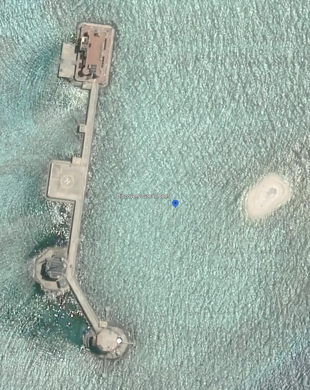
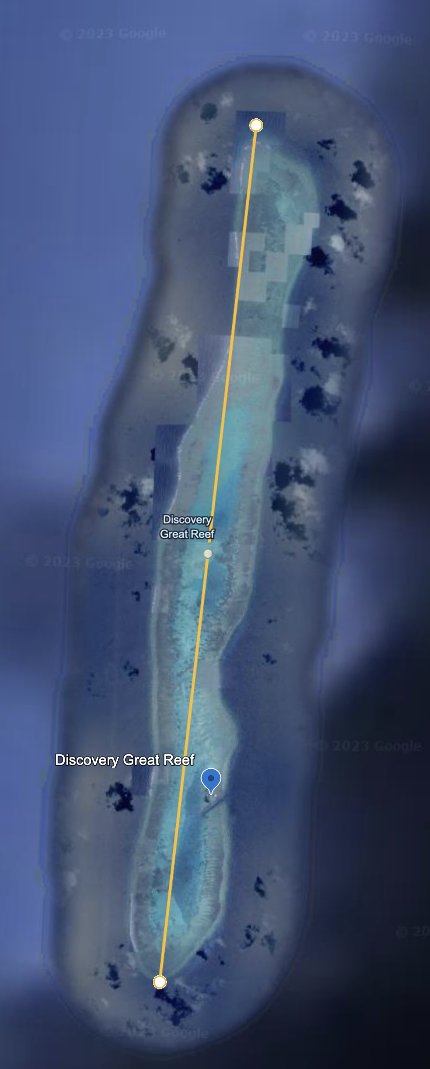
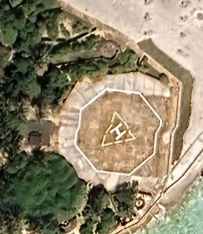
Discovery Great Reef is 9.3 miles long, and travels in a straight line from North to South. We find a reclamation infrastructure station, complete with helipad, at location: 10°01'24"N 113°51'16"E. Satellite imagery date: 5/13/2020.
Discovery Great Reef is much larger, stretching from North to South. We see a man-made development near and just North of the sole channel carved through the reef near the Southeast corner. It is two pieces of infrastructure, a helipad, and a building, along with a small sandy outcropping. The four structures are connected by a wide bridge.
Location: 10°01'24"N 113°51’17”E.
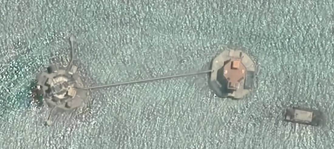
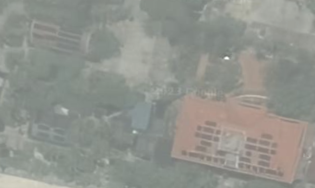
On the West side of the reef, we see two structures connected by a bridge. I wonder if these are dredging structures, or if they serve some other purpose. The two images below are from the South, then the North of the atoll.
The Flora Temple reef is smaller and completely submerged.
|
|
These two underwater, coral formations are adjacent and we consider them as a single formation. They stretch 37.2 miles long, and the Tizard Bank section is approximately 13 miles wide. We identified six formations within the atoll. We start at the North Gaven Reef (in the Southwest) and move clockwise to end at South Gaven Reef (underwater).
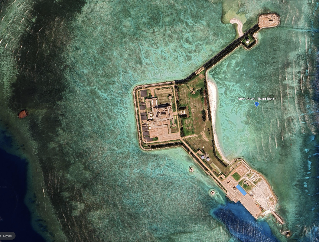
Tizard Bank 1
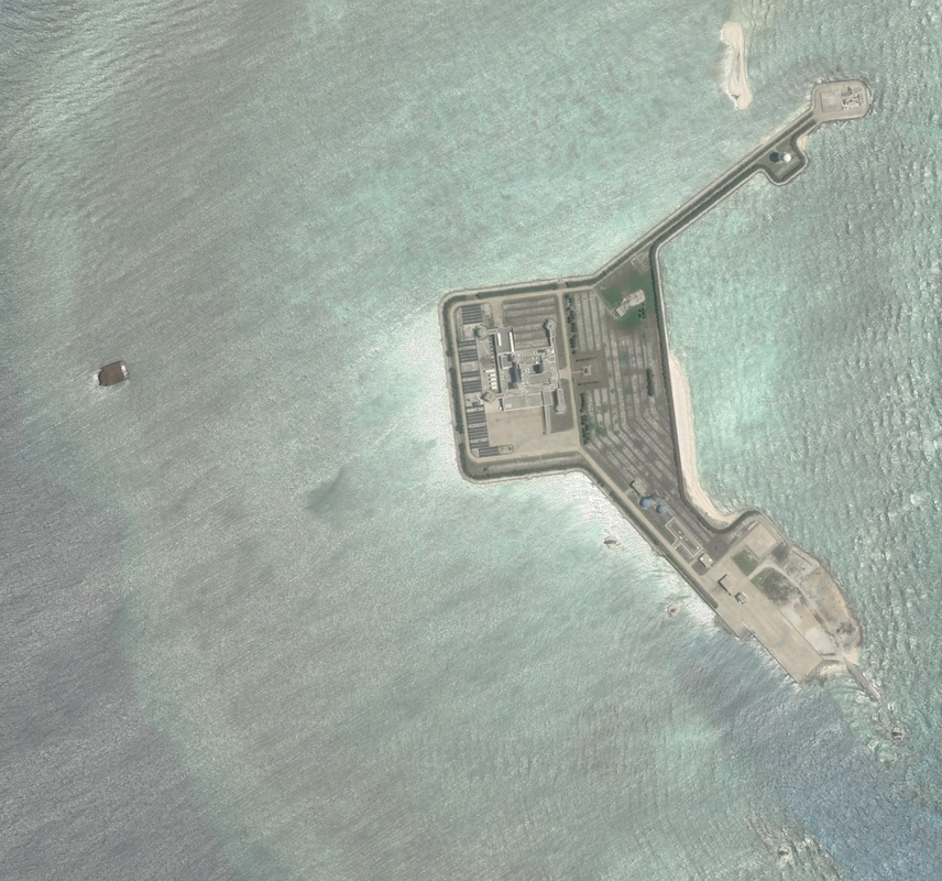
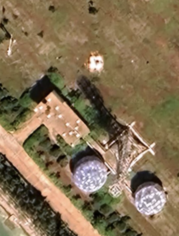
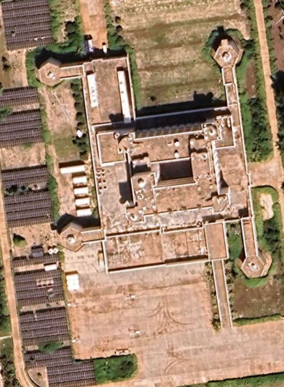
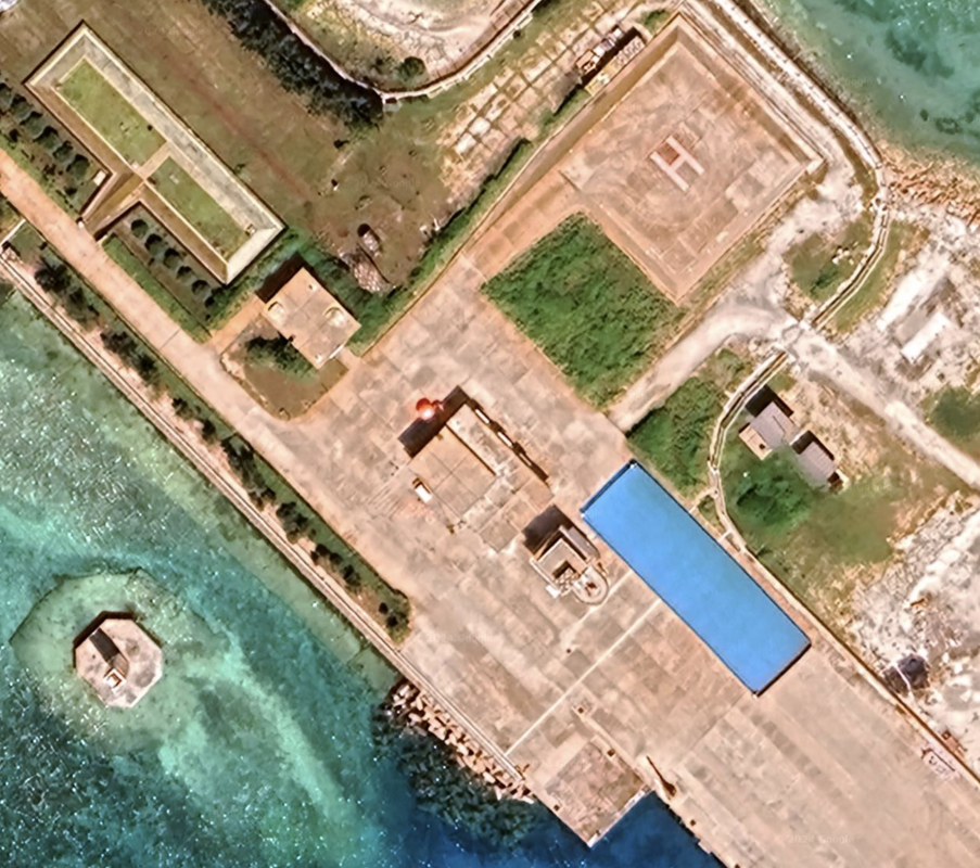
Location: 10°12'05"N 114°14’13, is a small man-made island, rectangular, with two wide arms forming a wide protected bay. It has two blue radomes, and what appear to be 32 storage sheds or corrugated metal buildings. There is one large building with four raised turrets at the corners (might be anti-aircraft cannons on two or three of them. This is the same architecture I saw on other islands, where there is a ramp leading into the building, but there are no cars on the island. We also see the blue rectangular shape by the pier that we have seen on other PRC militarized islands.
According to Wikipedia, the island is occupied and controlled by the PRC and administered as part of Sansha. It is also claimed by ROC, the Philippines and Vietnam. The island is called Nanxun Jiao in Chinese, Burgos Reefs in Filipino, and Da Ga Ven in Vietnamese.
We have new satellite imagery of the island from 10/27/2023. The previous imagery is on the left and the new imagery is on the right. Finally, there is a reddish-brown man-made structure just to the west of the island, but still within the coral reef, and to the northwest of that is a navigation aid.
|
|
The Northern and Southern 'arms' also appear to have a buildings on them. We also notice a blue 'tarp' or roof in a perfectly rectangular shape, and it is not very tall compared to the buildings adjacent to it.
We see a significant number of boats in both sets of satellite imagery.
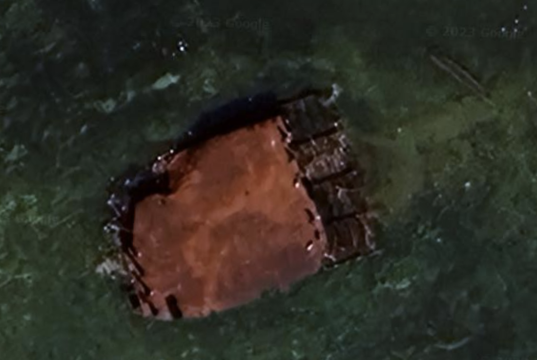
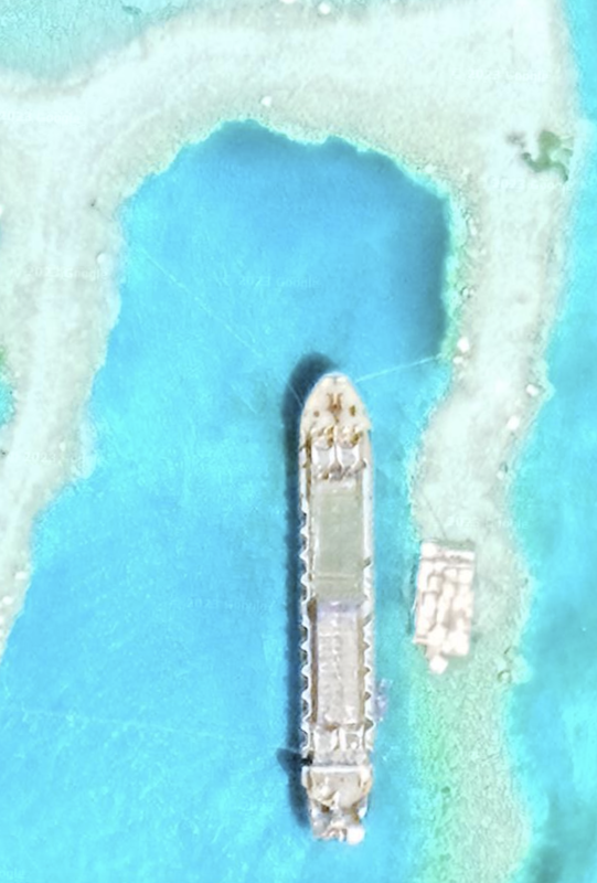
Structure west of North Gaven Reef
|
|
Tizard Bank 4
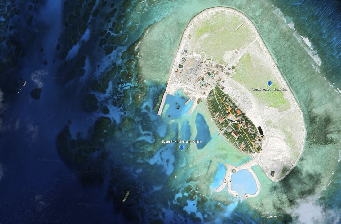
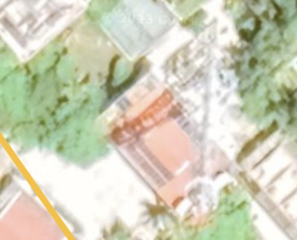
Sand Cay a.k.a., Bailan Island (Philippines), Son Ca Island (Vietnamese) and Dunqian Shazhou (Chinese).
This is an inhabited island with signs of significant, recent land reclamation effort underway. Our most recent image is dated 10/19/2023, and shows ships in the area, and reclamation shapes to the west of the island. This island has grown at least 2x from where we see greenery.
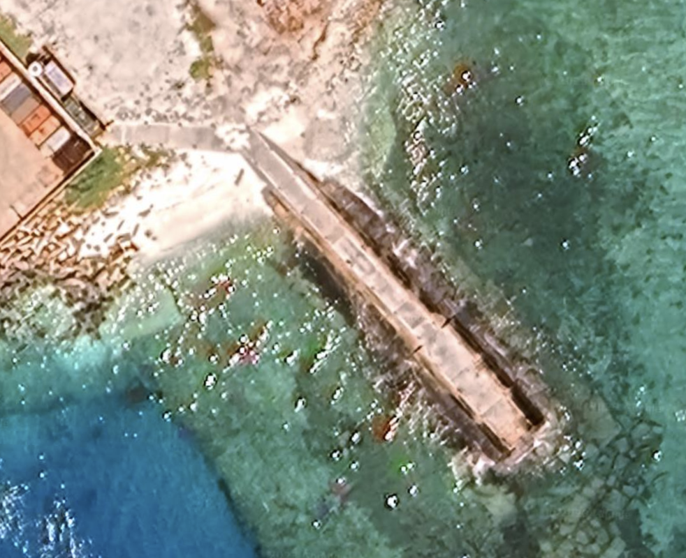
This is a developed teardrop island, that has been doubled in size, and has a set of sea lanes carved in the reef and built into paths into the water. This is a new feature, vehicle-ready paths build on the reef. This reef appears to have room to grow. We see a helipad, a lighthouse, and a very tall communication tower. Also, we see some solar panels.
This looks like a spot for significant fishing boat management over time. We see boats in the vicinity in this satellite photo.
Location: 10°22'34"N 114°28’24”E. The original island is 0.26 miles long, and the incremental area is 0.2 miles, so overall this is still a small island in the South China Sea.
Something just occurred to us. Could these islands be a way of building a self-sustaining fishing enterprise in the South China Sea to provide a safe harbor in a storm? The piers, airports and helipads allow for resupply and personnel transport for those who wish to remain on the islands?
The image on the top is newer than the image on the bottom, and this is the same location. We can see the significant development north and east with the additional land reclaimed on the coral reef.
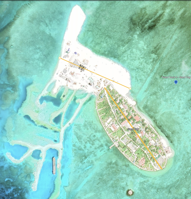
From the older satellite imagery we see a ship and a vehicle, a tall radio tower and a helipad. The focus this time around is the number and type of construction vehicles and equipment (e.g., cranes) on the island and working.
We see significant reclamation activity on the island. In this last photo, we see a boat docked at one of the reef ‘footpaths’ tethered to the shore in three points, along with a vehicle that also seems tethered to the ship.
The land mass has more than doubled (our estimate) and the diameter of the island is now 0.65 miles. Notice the new land on the north, east and south of the island, although the south appears to be under continued development.
|
|
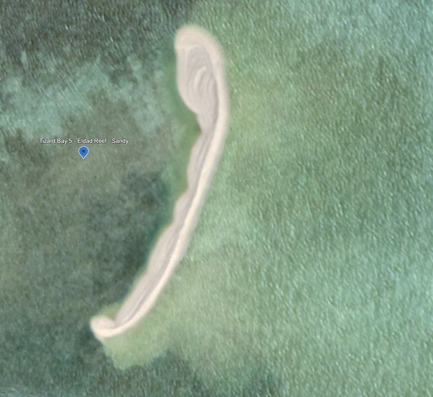
We pass East past Petley Reef (underwater), three unnamed reefs, and Eldad Reef which has a tiny sand outcropping at its NorthEast corner. In fact, this location is the Northeast anchor for this set of reefs. Location: 10°21'58"N 114°42’58”E. The satellite is dated 03/12/2019, so it is 3.5 years old.
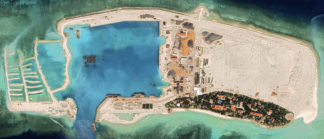
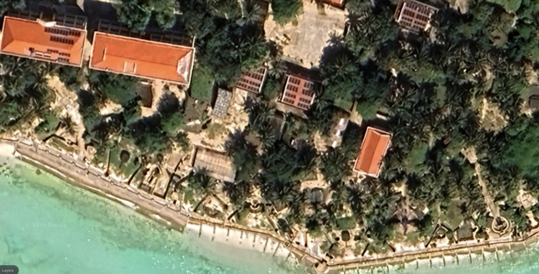
Namyit Island (occupied by Vietnam) has undergone significant land reclamation between 6/10/2020 and 10/27/2023.
It was formerly a long, thin island that measured 0.43 miles in diameter, and now has a diameter of 1.05 miles, including the yet to be completed work on the western side of the island. There is still continued construction underway.
We see numerous reclamation shapes, ships, cranes, and two different colors of construction sand (orange/red and grey/black). There is a small sand spit extending from the north of the island, so there may be continued work being performed there. The west of the bay is a full-on land reclamation project, and we see numerous reclamation shapes in stages of use, and empty to be filled with sand/rock.
We see a large protected cove or bay with what looks to be significant pier access, measurements 0.25 miles x 0.29 miles. This will be a major shipping stop.
Namyit Island is a fully developed island with two large, elevated radomes, a navigational light, a helipad, and continued reclamation efforts on the west of the island. This satellite photo is dated 06/10/2020. We see a significant number of buildings, and some of which look very old. There is a navigation light. The diameter of the island measured 0.53 miles in 2020, although it measures smaller today at 0.43 miles.
We also notice a set of defensive installations on the island on the southwestern edge of the old town by the radomes that look like anti-aircraft cannons. Moving east we see additional anti-aircraft cannons, and what look to be round, fortified, gun emplacements. Finally, the satellite imagery appears to be a little bent or distorted.
This has a very small dock on the Southern middle section. The buildings have an interesting shape on their roofs, which is either solar panels, or open air roofs. Also, we do not see clear roads on the island, which leads us to believe the roads are covered with trees, or the residents travel by foot or bicycle. Normally we can see the roads.
2020 Location: 10°10'46"N 114°21’55"E.
2023 Location: 10°11'00"N 114°21'37"E
|
|
We finish the survey by viewing South Gaven Reef at the Southwest corner of this set of reefs, but it is submerged with no man-made structures.
One of the things we notice is that some of the roofs are either broken or open air on purpose. We have seen this in Puerto Rico after a storm, where buildings are damaged, water and mold set in, and it is expensive and slow to repair buildings. We saw significant number of buildings abandoned in Puerto Rico once water damage sets in after a storm, and wonder if this island shows the same type of effects from a storm.
Name 1
Nearest Land
Distance from Land (miles)
Location (latitude & longitude)
Diameter (miles)
Date of Satellite Imagery
Airport Present?
Helipad Present?
Port / Dock Facility Present?
Buildings Present?
Defensive Infrastructure Present?
Athletic Facilities Present?
Hospital Present?
Sand Only Island?
Dredging Infrastructure Only?
Spratly Islands
Great Discovery Reef
Philippines and Vietnam
275 and 318
10°01'24"N 113°51'16"E
9.3
5/13/2020
No
Yes
No
No
No
No
No
Yes
Yes
Spratly Islands
Tizard Bank (6 islands)
Philippines and Vietnam
228 and 363
10°12'05"N 114°14’13
37.2
10/27/2023
No
Yes
Yes
Yes
Yes
No
No
Yes (on some)
No
Consulting Session for one hour
This is a one-hour meeting, remote or in-person, with Jeffrey Cohen, President of U.S. Advanced Computing Infrastructure, Inc.
- You choose the topic and deliverables.
- You may buy multiple hours to fund a project.
We believe management consulting is pursuing "the art of the possible." These are areas where we believe we may be helpful:
- We will discuss our research into the South China Sea
- We offer traditional IT management consulting services.
- We offer quantum computing consulting
- We offer financial investment analysis of stock portfolios based on our Chicago Quantum Net Score (read more in our published research). Today we run a model that analyzes ~3,000 U.S. listed equities and optimizes both 'long' and 'short' stock portfolios.
- Project and program management.
- Outsourcing advisory.
- We run your business problem on our discrete mathematical models (on our own server equipment using our own solvers).
- We may configure and run your problem on quantum annealing computers from D-Wave Systems Inc.
- We ALWAYS work confidentially, diligently, free of conflict of interest, and bring our best thinking and insights.
We can operate at both the strategic and tactical level depending on client need. This includes business strategy, business problem decomposition, mathematical and data design, algorithm design, and use of quantum and classical solvers. The President has a strategic perspective from ~ 30 years of executive corporate management in IT and professional services, and also rolls up his sleeves and codes when there is a good fit with the problem and his expertise.
Absolute discretion and professionalism is assured.
In closing
If you would prefer to discuss this 1:1 and negotiate a scope of work and level of effort, please contact us at [email protected] or call (312) 515-7333. We will develop a quotation and will invoice for our services.