Chicago Quantum
  • Home
    • About Us & What We Do
    • Our Capabilities
    • Brochure
    • Positions
  • Projects
    • Quantum Computing >
      • Quantum Computing - What is it?
      • Investing in Quantum Computing Stocks
      • Early Use Cases for Quantum Computing (2019 & 2020)
      • Early Use Case - Detail
      • 2020 Quantum Computing Ecosystem
      • Platforms Detail
      • 2024 Quantum Computing - What we are seeing
      • PQC Post Quantum Cryptography
    • South China Sea >
      • Nearshore Islands >
        • Swallow Reef and multiple reefs near Malaysia
        • Louisa Reef, Brunei
        • Basco and Mavudis Islands, Batanes, Philippines
        • Scarborough Shoal and Second Thomas Shoal, Philippines
        • Laut Island, Indonesia
        • Natuna Island, Indonesia
        • Dao Bach Long, Vietnam, Gulf of Tonkin
        • Koh Paulo Wai, and related islands in Kien Giang Province, Vietnam, Gulf of Thailand
        • Con Dao and Vanguard Bank, Vietnam
        • Long Hai, Vietnam
        • Qizhou Liedao & Nanshi, Hainan, China
        • Dongsha, Pratas Islands, Republic of China
        • Penghu County, Republic of China
        • Kinmen County Islands, Republic of China
        • Southern South China Sea
        • Mengalum, Pulau Tiga and Kampong Mantanani , Malaysia
        • Strategic underwater reef of the coast of mainland China
      • Spratly Islands >
        • Subi Reef, China, Spratly Islands
        • Mischief Reef, Spratly Islands
        • Fiery Cross Reef, Yongshu Jiao, China, Spratly Islands
        • Thitu Island, Pag-asa, Kalayaan, Spratly Islands
        • Taiping Island, Spratly Islands
        • Spratly Island and Ladd Reef Vietnam, Spratly Islands
        • North Danger Reef & Trident Shoal, Spratly Islands
        • Irving Reef, West York and Loaita Bank, Spratly Islands
        • Sand Cay, Namyit Island, and Gaven Reef, Tizard Bank, and Great Discovery Reef, Spratly Islands
        • Union Bank, Johnson South Reef, Sin Cowe, Hughes Reef, Whitsun Reef, Spratly Islands
        • Nanshan Island, Flat Island, Iroquois Reef, Jackson Atoll, Spratly Islands
        • Sabina Shoal, Second Thomas Shoal to Half Moon Shoal, West of Palawan, Spratly Islands
        • Amboyna Cay, Rifleman Bank, Barque Canada Reef, Vietnam
        • Erica Reef, Mariveles Reef, Investigator Island and Viper North, Spratly Islands
        • Pearson, Alison, Cornwallis, and Pigeon Reef, Vietnam Occupied
        • Luconia Breakers, Brunei and Malaysia Coast, Spratly Islands
        • London Reefs, Vietnam and Cuarteron Reef a.k.a. Huayang Island, China, Spratly Islands
      • Paracel Islands, China, PRC Overview, South China Sea >
        • Woody Island and Rocky Island, China, Paracel Islands
        • Triton Island, Zhongjian Dao, China, Paracel Islands
        • North Reef, NW Paracel Islands
        • Tree Island, West Sand, North, Middle, South Islands, and the Three Sisters, Xuande Islands, Amphitrite Group, Paracel Islands
        • Lincoln Island, Bombay Reef and Vuladore Reef, Paracel Islands
        • Duncan, Drummond, Pattle, Money and Antelope islands, Crescent Group, Paracel Islands
      • Participant List
      • Active Conflict Areas
      • Energy Transportation, Resources & Production
      • ROC - Taiwan Environment
    • Yellow Sea Construction
    • Iran Overview >
      • Iranian Energy Export Capabilities
      • Iranian Energy Production Capabilities
      • Iranian Energy Refining Capabilities
      • Iranian Importation of Afghan Opium in 2024
  • Advisory
    • Separately Managed Accounts
    • Pharmacy Retail Trends 2024
    • US Residential Real Estate Economic Analysis
  • Insights

Swallow Reef and Atolls near Malaysia

Updated: August 29, 2024
​Malaysia has developed and occupied two islands. Swallow Reef is inhabited with a resort, the Layang Island Resort, and Station Lima, run by the Royal Malaysian Navy (RMN). There is also the Swallow Reef Airport. Names sourced from Maxar Xpress.

We believe they are Malaysian islands due to the word "Malaysia" printed in English on an airport runway. The rest of the reefs in this area are underwater and undeveloped, and are described below.

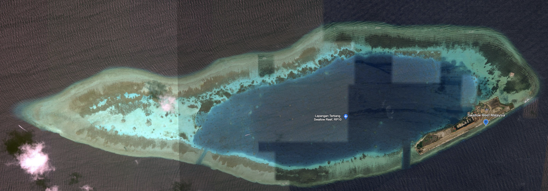
Swallow Reef is a mature island built on about 10% of an atoll, with an airport, a port, civilian sports, and two navigation channels into a large lagoon. We see additional land developments, with one on this atoll to the NE and another on a nearby atoll which we call Spratly Malaysia 2. These man-made developments are located 183 miles from Malaysia.

Newer Google Earth imagery:
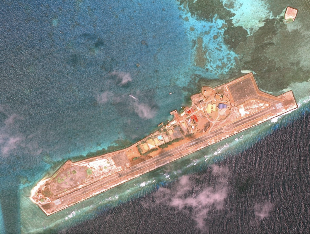
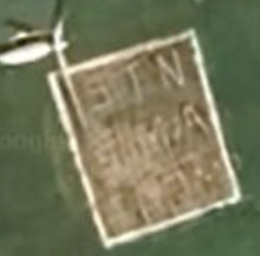
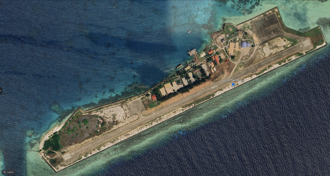
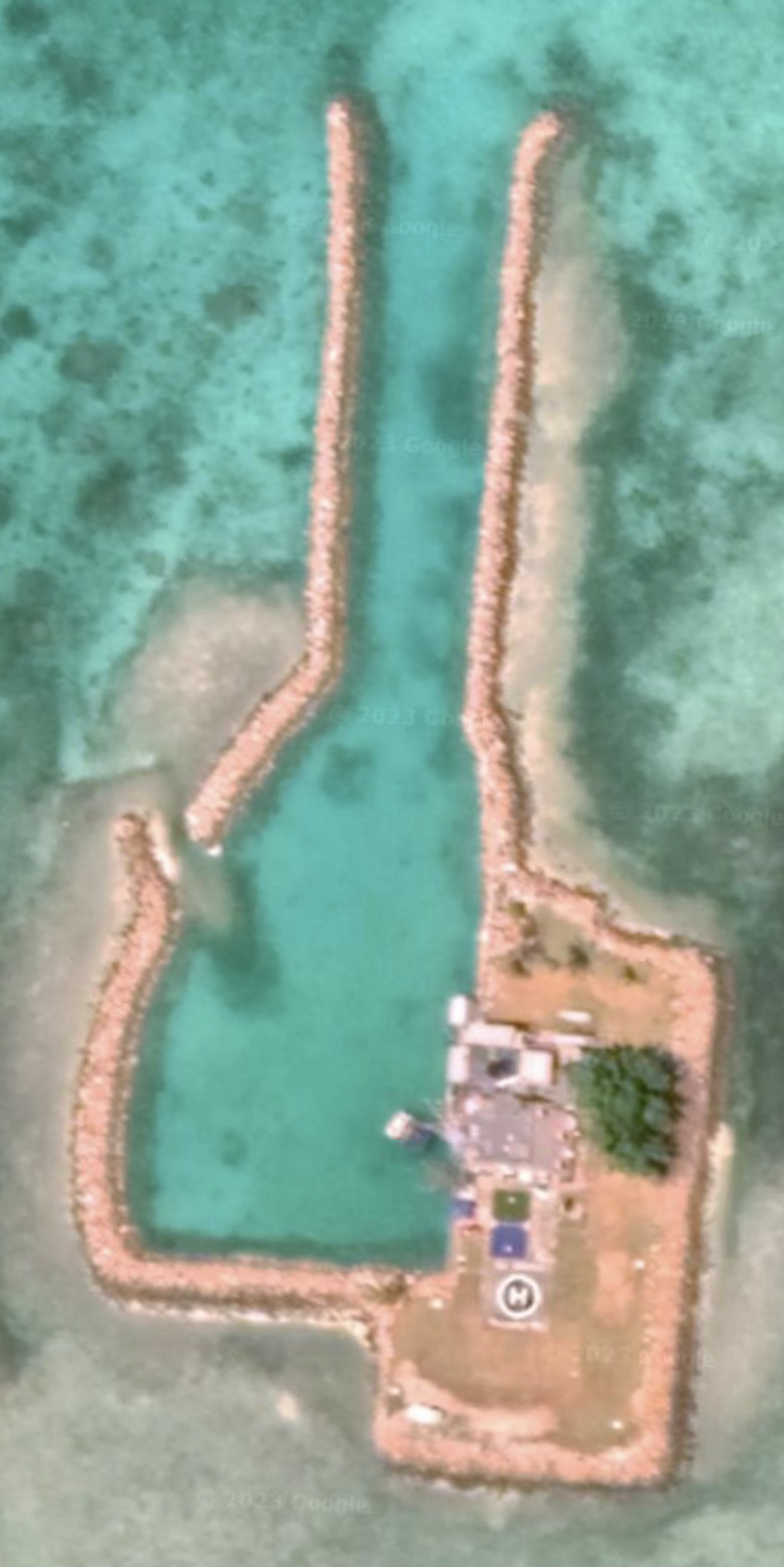
​This atoll is 4.5 miles in diameter, located at 7°23'15"N 113°48'36"E, and we have satellite imagery from 10/17/2023. In the photos below, we see the older island image and the more current one. The runway length, from tip to tail, is 0.73 miles. The island diameter is 0.83 miles. The island also has a helipad, a windmill, and two new aircraft hangers (or at least large buildings) near the runway. We see a diving school on the Northwest of the island, one basketball court, and an interesting inscription on a dirt patch.
​
There are two large atoll structures to the north of Swallow Reef, also supported by Malaysia.

The western atoll is Dallas Reef, and is submerged, but also under the management of Malaysia.

The eastern atoll, Ardasier Bank, is very large. At its extreme western edge there is a 
tiny, man-made workzone that looks like a naval supply station. It seems unnamed in the public domain. We call it Spratly Malaysia 2.
​
From Copernicus Browser, eESA, we see the island has additional reclamation underway on the east side as of 7/31/2024 on Sentinel-2 L2A, True Color, and seen even more clearly with other layers (e.g., False Color). New island length, 1.98 km, once reclamation is complete. The channel on the west is deep and clear.
Picture
Swallow Reef (older imagery) does have a developed island with airport. There is a note on Google calling it Lapangan Terbang Swallow Reef, RP10 with an airport sign. The photo is dated 04/6/2016, or seven years ago.

Swallow reef is primarily an airport with a parking area for aircraft, potentially a few hangars, with a few buildings, port facilities inside the reef (facing the bay), and the island is set just east of a channel cut through the reef to enter the protected bay. We see a mix of purple, yellow and red buildings. We see a helipad. The two purple buildings appear to be hangars for aircraft, and face a helipad. Finally, we see a dive school on the North-central part of the island.

We see the word “Malaysia” painted on the runway, and we see evidence of a dive school  inside the bay. Location: 7°22'20"N 113°50’43”E. There still appeared to be open areas not yet developed.
Picture
Picture
Picture
Picture
Picture
Swallow Reef, Google Earth, 10/17/2023, Camera 1,392m 100m /unit scale.
Spratly Malaysia 2, Royal Malaysia Navy station, at the western edge of Ardasier Bank
Moving North by Northeast 16 miles, we find another man-made development we call Spratly Malaysia 2. Satellite imagery 11/12/2018. The rectangular land portion (not the spits of land forming the protected bay, is 0.07 miles long, by 0.03 miles wide. This island is west of the Ardasier Bank by around 6 miles. This island is east of Dallas Reef by 7.5 miles. 

The second nearby development looks like it was drawn or printed onto the satellite imagery. Not sure why it looks like that, but we document it here. It looks like it is still under development, and is a naval or fishing focused island built around a navigation channel in the reef.

From Copernicus eESA Sentinel-2 L2A on 7/31/2024, we see the same working island. False color and NDWI layers show the working part of the island is active and different than the artificial channel. We can also view the island from Sentinel-2 L1C and it looks the same.
Picture
The island we call Spratly Malaysia 2, Google Earth 11/12/2018. Camera 234m, 20m / unit scale. 10cm. The scale is off, as the helicopter pad would be ~ 5m square.
Picture
Copernicus Sentinel-2 L2C True Color 7-31-2024, Island north of Swallow Reef, working station
Further North

​There are a further three atoll structures north of those two structures, also under the control and maintenance of Malaysia. We see three man-made structures across those three atolls.

Starting from the West, we see Mariveles Reef Helipad and a north-south breaker or wave break wall and a small building and dock located at the center of the dual-atoll structure. It is a tiny, sole purpose reclamation for the Royal Malaysian Navy.

To the east is Terumbu Siput, also a tiny reclamation, which houses Station Sierra (Royal Malaysian Navy). It has two docks and a helipad, according to Maxar Xpress Open Street Map.

Finally, furthest to the east we have a large atoll structure with a deep, clean channel cut on the southeast side. This atoll has a small man-made reclamation made up of a long break-wall, a building, and a helipad. It is labeled Investigator Shoal, and Investigator Shoal Helipad. It is a tiny reclamation and naval station.

Because we see these Malaysian features on Maxar Xpress OSM, we will not share images due to terms of use. However, we thank Maxar for helping us learn about these reefs.


Dallas Reef, Ardasier Bank, Spratly Malaysia 2, and Royal Charlotte, near Malaysia.

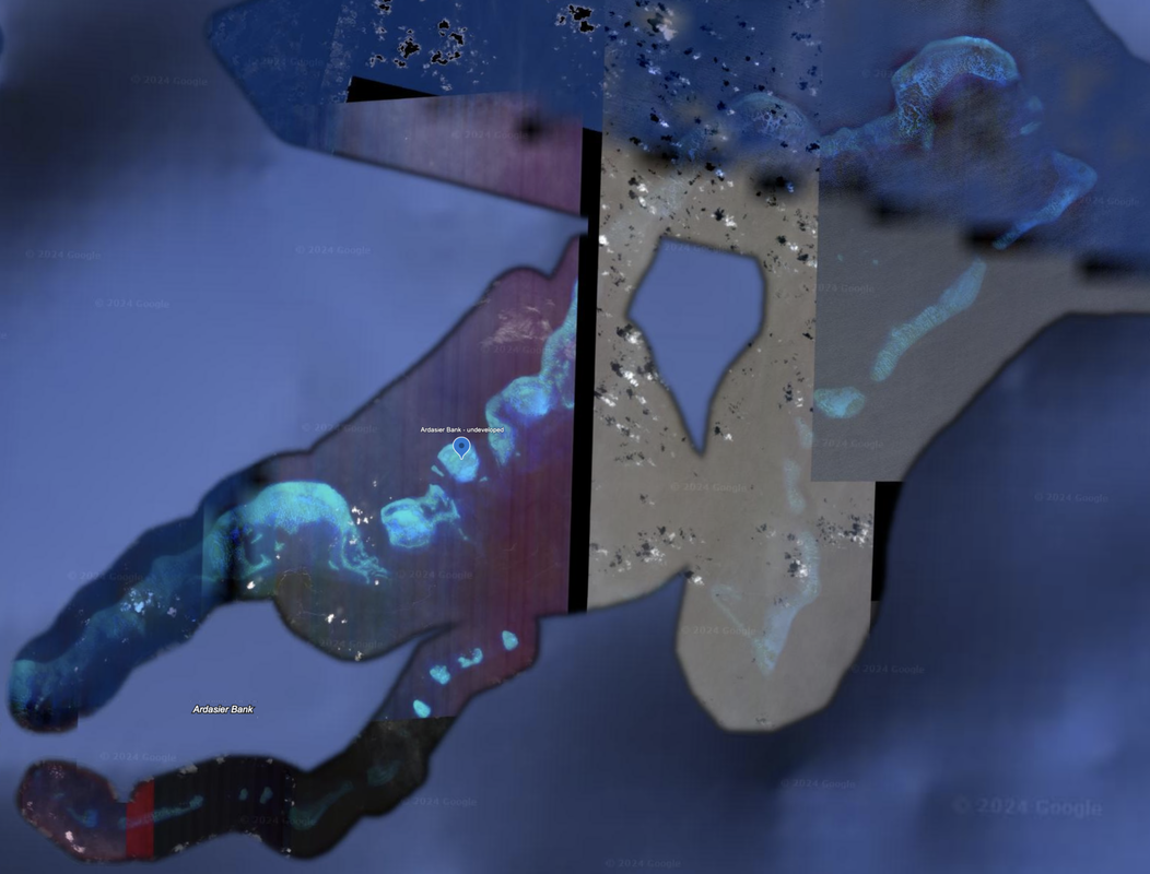
In a line from West to East, we see a line of three formations that are all near Malaysia's exclusive economic zone (EEZ) and we will review them together. They are Dallas Reef, what we name as Spratly Malaysia 2, and Ardasier Bank.
​
Picture
Dallas Reef, a 5.8 mile in diameter oval coral atoll, is submerged and has no man-made features, and likely shallow as we see waves in the satellite imagery. It lies 7.54 miles west of Malaysia Island 2 (the smaller one between Dallas Reef and Ardaiser Bank). The Dallas Reef satellite imagery is pieced together from three separate images, each dated (11/12/2018, 9/10/2018, and 3/18/2018).  Dallas Reef location: 7°38'58"N 113°42'57"E.
Picture
Dallas Reef, Google Earth, 2018
Ardasier Bank is a large formation of coral reefs that seems to be made up of two lines of coral facing each other, with a significantly open bit of water between them. Would not call them lagoons, but the coral reefs are almost like two sides of a very long, rectangular, coral atoll. The northern stretch of reefs measures 37.5 miles long, and the southern stretch is 38.7 miles long.

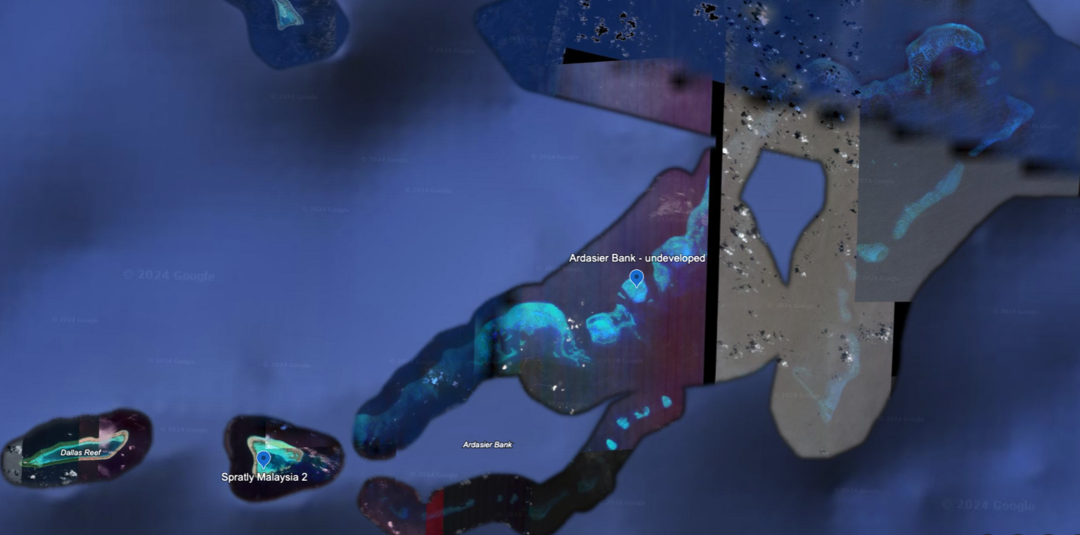
We did not see any evidence of development or land reclamation in the Ardasier Bank. Satellite imagery is from 2015, and the location is 7°53'11"N 113°55'51"E.

Picture
Ardasier Bank, 2015, 2019 Google Earth - No signs of development.
Royal Charlotte Reef

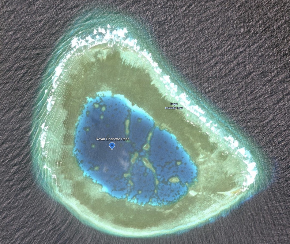
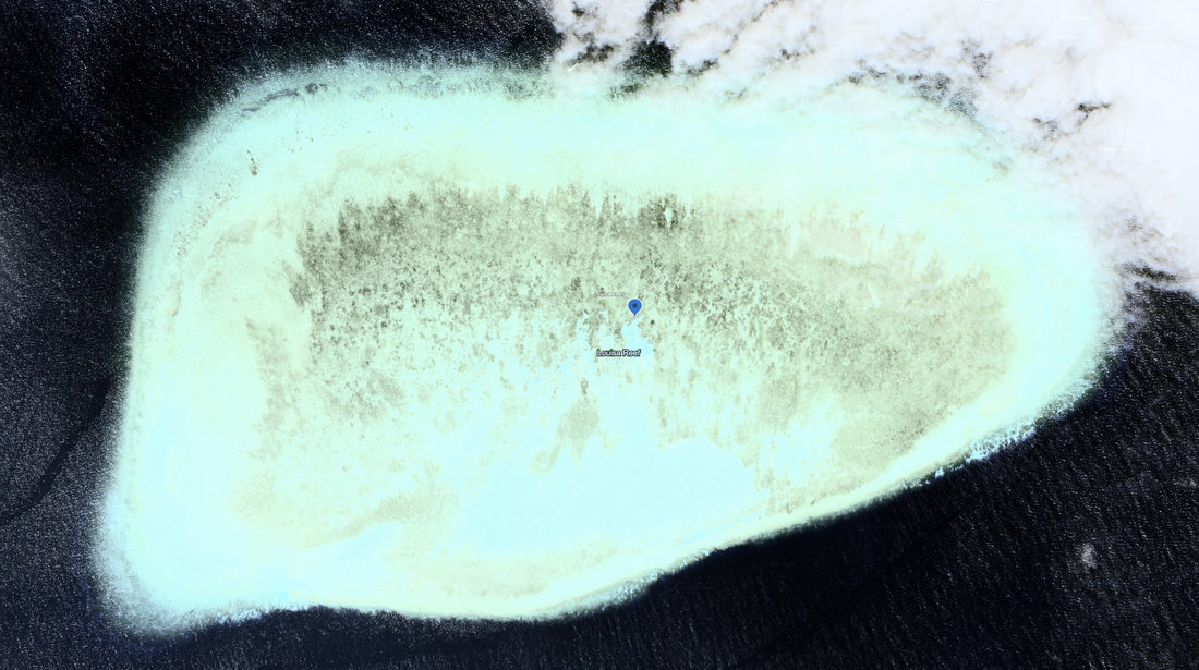
Southwest of Swallow Reef in a line parallel to the Malaysian coast we see the Royal Charlotte Reef and Louisa Reef. 
​
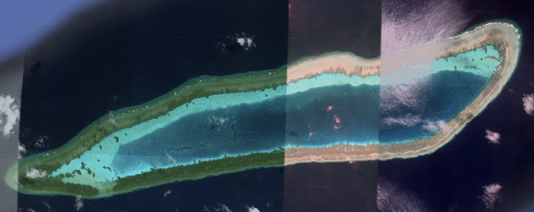
Royal Charlotte Reef looks like it may have two-thirds of its edges close to the surface, and no man-made elements. Location: 6°56'42"N 113°34’42"E
​
Picture
Louisa Reef, Brunei
​Southwest of royal Charlotte Reef we see Louisa Reef, which appears fully submerged in this 6/7/2019 satellite image.  Location: 6°19'54"N 113°14'28"E. Louisa Reef is claimed and managed by Brunei, and is covered in a separate webpage.
​
Picture
We find it interesting that to the west and north of Malaysia and Brunei's operating areas in the South China Sea, we see holdings operated and maintained by Vietnam, along with the significant development on Pigeon Reef. There are a pair of atolls to the west (Amboyna and Barque Canada), three atolls to the northwest (Pearson Reef, Alison Reef and Cornwallis South Reef), and one to the north (Pigeon Reef). This neighborhood is getting crowded.

Marang, Malaysia

Marang is an island off the town of Marang which lies on the coast of the Malaysia facing the South China Sea. 3.4 miles to sea (east) we see an inhabited island, accessible by ferry. That is Kapas Island, and we can see that picture below.

​We happened to get lucky and find an amateur photographer of an island just off Marang, in Marang district, in the state of Terengganu, Malaysia. This is the western side of the South China Sea, and is likely very close to Malaysia, maybe even within 100 miles of the coast.

What makes this photograph interesting is it shows three cranes moving around deep, brown sand. It was taken March 30, 2021 by Pok Rie. It is a dramatic photo, and one that helps us see basic island shaping in action. The artist has a few other photos of islands with brown sand. 


Picture
Google Earth 10/15/2001 - Kapas island off the coast of Malaysia in the South China Sea, 3.41 miles off shore.
Picture
Photo by Pok Rie: https://www.pexels.com/photo/aerial-of-brown-sand-on-the-ocean-8274174/, Pok Rie, March 30, 2021. Location is listed as Marang, Terengganu, Malaysia
Area
Name 1
Nearest Land
Distance from Land (miles)
Location (latitude & longitude)
Diameter (miles)
Date of Satellite Imagery
Airport Present?
Helipad Present?
Port / Dock Facility Present?
Buildings Present?
Defensive Infrastructure Present?
Athletic Facilities Present?
Hospital Present?
Sand Only Island?
Dredging Infrastructure Only?


Spratly Islands
Swallow Reef Atoll (plus one nearby island)
Malaysia
183
7°23'15"N 113°48'36"E
0.83
10/17/2023
Yes
Yes
Yes
Yes
Not sure
Yes (one)
Not sure
No
No

Copyright 2024 & 2025 US Advanced Computing Infrastructure, Inc., Chicago Quantum (SM)
833 Central Avenue #1292, Highland Park, Illinois 60035-7292
​+1.312.515.7333

  • Home
    • About Us & What We Do
    • Our Capabilities
    • Brochure
    • Positions
  • Projects
    • Quantum Computing >
      • Quantum Computing - What is it?
      • Investing in Quantum Computing Stocks
      • Early Use Cases for Quantum Computing (2019 & 2020)
      • Early Use Case - Detail
      • 2020 Quantum Computing Ecosystem
      • Platforms Detail
      • 2024 Quantum Computing - What we are seeing
      • PQC Post Quantum Cryptography
    • South China Sea >
      • Nearshore Islands >
        • Swallow Reef and multiple reefs near Malaysia
        • Louisa Reef, Brunei
        • Basco and Mavudis Islands, Batanes, Philippines
        • Scarborough Shoal and Second Thomas Shoal, Philippines
        • Laut Island, Indonesia
        • Natuna Island, Indonesia
        • Dao Bach Long, Vietnam, Gulf of Tonkin
        • Koh Paulo Wai, and related islands in Kien Giang Province, Vietnam, Gulf of Thailand
        • Con Dao and Vanguard Bank, Vietnam
        • Long Hai, Vietnam
        • Qizhou Liedao & Nanshi, Hainan, China
        • Dongsha, Pratas Islands, Republic of China
        • Penghu County, Republic of China
        • Kinmen County Islands, Republic of China
        • Southern South China Sea
        • Mengalum, Pulau Tiga and Kampong Mantanani , Malaysia
        • Strategic underwater reef of the coast of mainland China
      • Spratly Islands >
        • Subi Reef, China, Spratly Islands
        • Mischief Reef, Spratly Islands
        • Fiery Cross Reef, Yongshu Jiao, China, Spratly Islands
        • Thitu Island, Pag-asa, Kalayaan, Spratly Islands
        • Taiping Island, Spratly Islands
        • Spratly Island and Ladd Reef Vietnam, Spratly Islands
        • North Danger Reef & Trident Shoal, Spratly Islands
        • Irving Reef, West York and Loaita Bank, Spratly Islands
        • Sand Cay, Namyit Island, and Gaven Reef, Tizard Bank, and Great Discovery Reef, Spratly Islands
        • Union Bank, Johnson South Reef, Sin Cowe, Hughes Reef, Whitsun Reef, Spratly Islands
        • Nanshan Island, Flat Island, Iroquois Reef, Jackson Atoll, Spratly Islands
        • Sabina Shoal, Second Thomas Shoal to Half Moon Shoal, West of Palawan, Spratly Islands
        • Amboyna Cay, Rifleman Bank, Barque Canada Reef, Vietnam
        • Erica Reef, Mariveles Reef, Investigator Island and Viper North, Spratly Islands
        • Pearson, Alison, Cornwallis, and Pigeon Reef, Vietnam Occupied
        • Luconia Breakers, Brunei and Malaysia Coast, Spratly Islands
        • London Reefs, Vietnam and Cuarteron Reef a.k.a. Huayang Island, China, Spratly Islands
      • Paracel Islands, China, PRC Overview, South China Sea >
        • Woody Island and Rocky Island, China, Paracel Islands
        • Triton Island, Zhongjian Dao, China, Paracel Islands
        • North Reef, NW Paracel Islands
        • Tree Island, West Sand, North, Middle, South Islands, and the Three Sisters, Xuande Islands, Amphitrite Group, Paracel Islands
        • Lincoln Island, Bombay Reef and Vuladore Reef, Paracel Islands
        • Duncan, Drummond, Pattle, Money and Antelope islands, Crescent Group, Paracel Islands
      • Participant List
      • Active Conflict Areas
      • Energy Transportation, Resources & Production
      • ROC - Taiwan Environment
    • Yellow Sea Construction
    • Iran Overview >
      • Iranian Energy Export Capabilities
      • Iranian Energy Production Capabilities
      • Iranian Energy Refining Capabilities
      • Iranian Importation of Afghan Opium in 2024
  • Advisory
    • Separately Managed Accounts
    • Pharmacy Retail Trends 2024
    • US Residential Real Estate Economic Analysis
  • Insights