Spratly Island and Ladd Reef, Spratly Islands
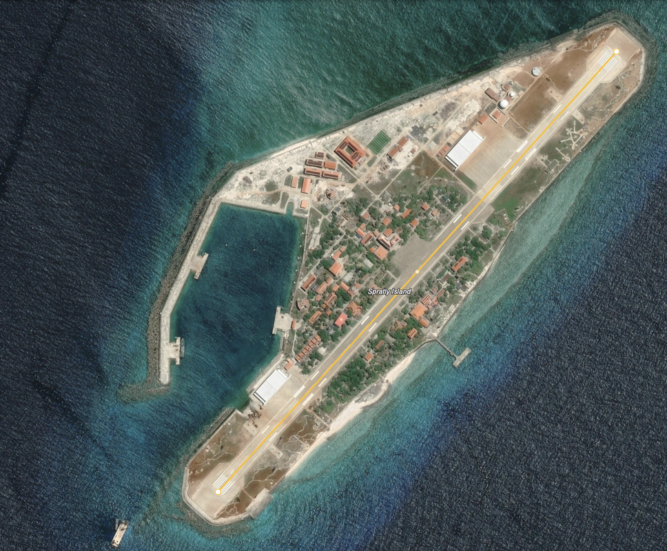
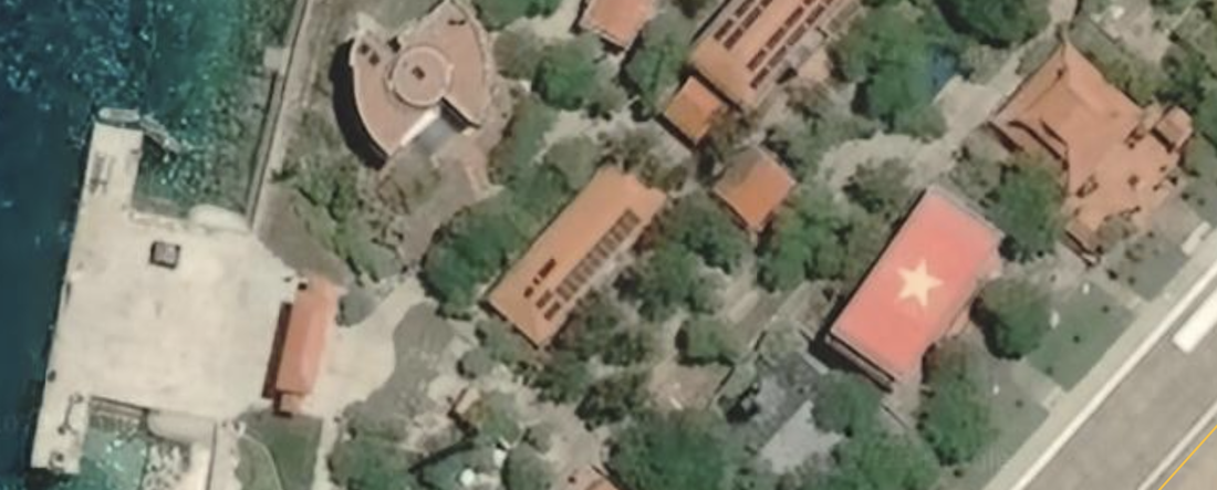
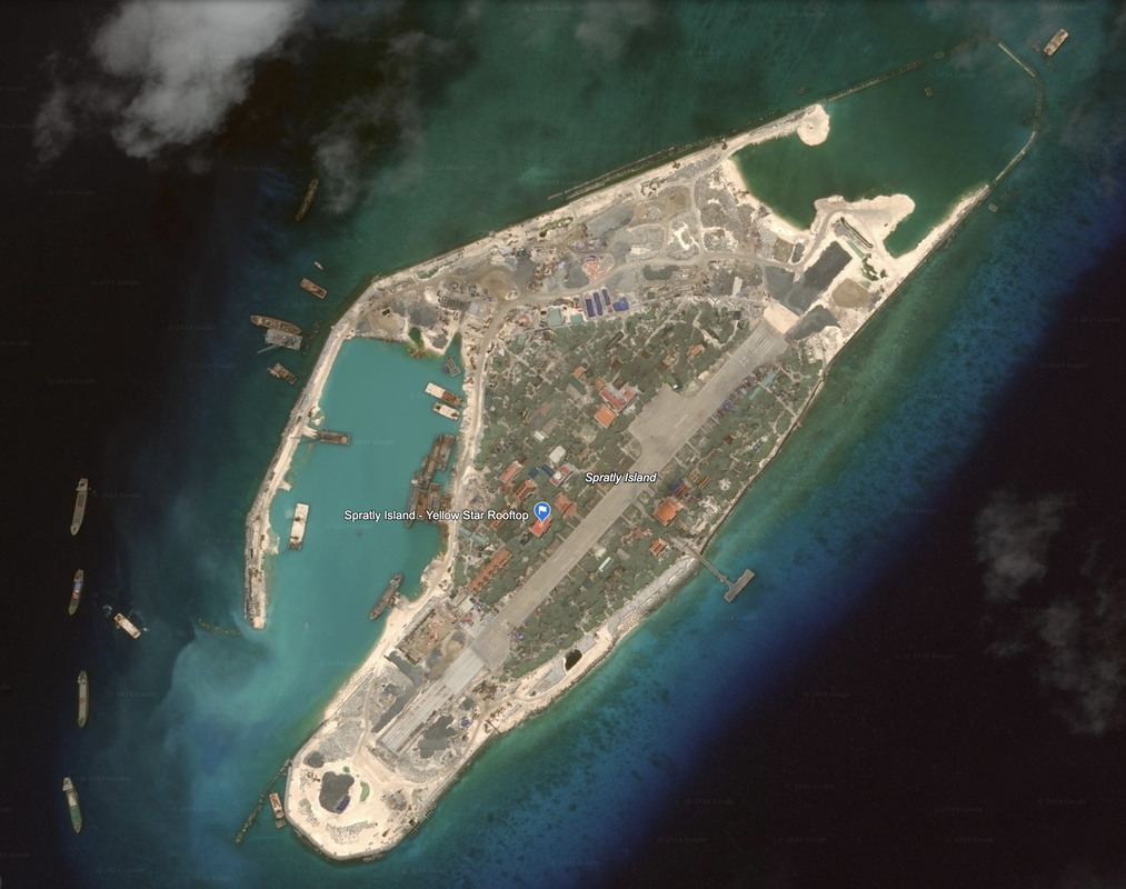
This island is 15.8 miles east of Ladd Reef. It is a developed island with a stand-out yellow star on a red roof. The reef is 1.3 miles and the island is 0.85 miles in diameter. The Satellite photography is dated 5/6/2020. The precise location is 8°38'47"N 111°55'05"E.
According to Wikipedia, this island has an area of 15 hectares (37 acres), and is Vietnamese administered. It was increased in size in 2016. There is a notation that it is still being worked on in the NGA Pub. 161 as of 2019 (land reclamation and construction of a protected harbor basin). It is known as 'The Big Spratly Island' in Vietnamese. Đảo Trường Sa or Đảo Trường Sa Lớn.
In 2007, Vietnam named the island a Commune-level town and it administers all nearby Vietnamese controlled features, including Amboyna Cay and Barque Canada Reef. The island contains the Tru'o'ng Sa District's adminstrative center, also based on Wikipedia.
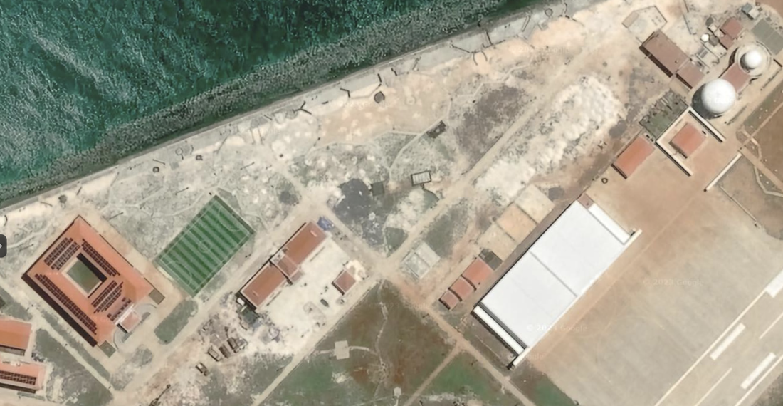
This island has a runway measuring 0.75 miles, or about 1,200 meters long. There are two large, apparently newly constructed aircraft hangers on the island. This island has two pair of radomes (four in total), and five distinct docks. It appears that there may be defensive structures on the north side of the island (possibly an anti-aircraft circular cannon).
One of my favorite features are the roofs. They are mostly a universal reddish brown, and one sports a yellow star on a red background.
Also according to Wikipedia, this island has seen extensive land reclamation since 2016, as well as a world meteorological station, cell phone coverage by Viettel, solar panels, wind turbines, a primary school, and other facilities for permanent residents.
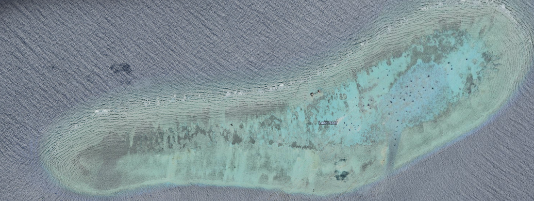
Ladd Reef is an undeveloped atoll that is 3.7 miles in diameter. It is found North of Rifleman Bank, due East of the southern tip of Vietnam, south of Ca Mau, and north of Sibu. Location: 8°39'30"N 111°41'23"E.
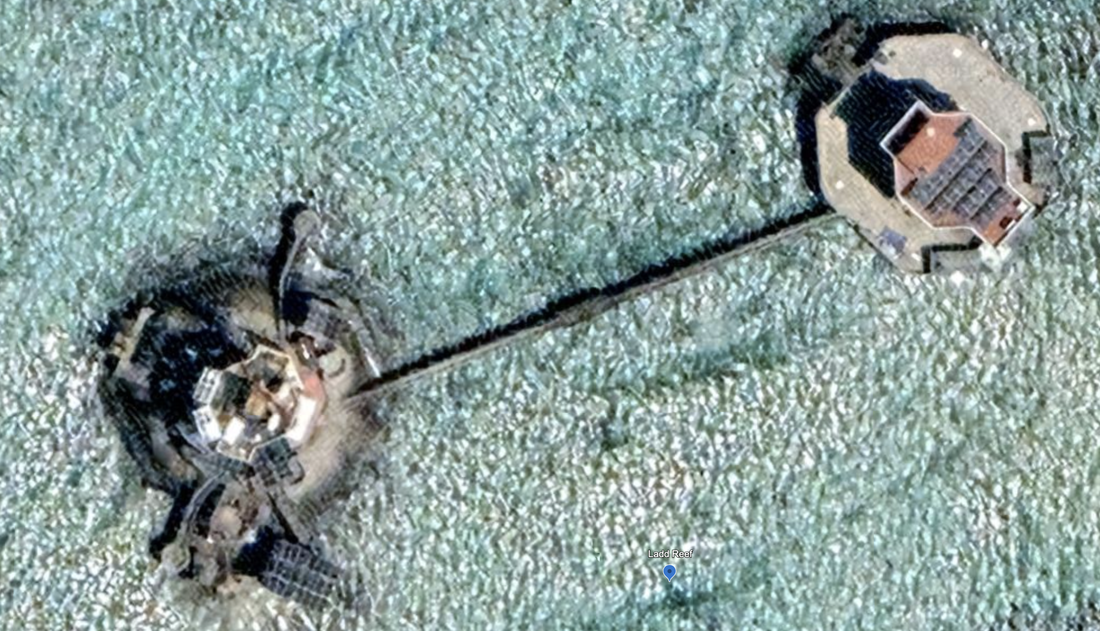
This is underwater, with what looks like a channel on the Southeast carved into the reef. There are two man-made structures connected by a long walkway or enclosed tunnel, for permanent demarcation and land reclamation activities.
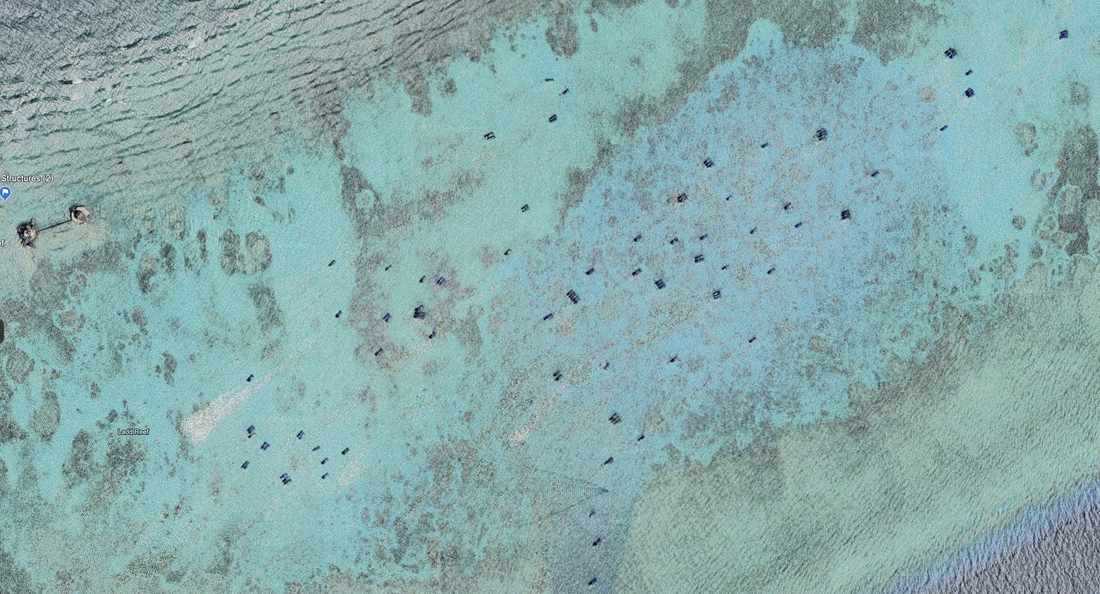
Ladd Reef has ninety-eight (98) ships in the lagoon at the time of the satellite image, 3/14/2022. That is a large number of ships given our research across the South China Sea.
Name 1
Nearest Land
Distance from Land (miles)
Location (latitude & longitude)
Diameter (miles)
Date of Satellite Imagery
Airport Present?
Helipad Present?
Port / Dock Facility Present?
Buildings Present?
Defensive Infrastructure Present?
Athletic Facilities Present?
Hospital Present?
Sand Only Island?
Dredging Infrastructure Only?
Spratly Islands
Ladd Reef and Yellow Star Spratly Island
Vietnam, Malaysia and Philippines
275, and 330 and 340
8°38'47"N 111°55'05"E.
1.3
5/6/2020
Yes
No
Yes
Yes
Yes, Likely
Yes
Not Sure
No
No
Consulting Session for one hour
This is a one-hour meeting, remote or in-person, with Jeffrey Cohen, President of U.S. Advanced Computing Infrastructure, Inc.
- You choose the topic and deliverables.
- You may buy multiple hours to fund a project.
We believe management consulting is pursuing "the art of the possible." These are areas where we believe we may be helpful:
- We will discuss our research into the South China Sea
- We offer traditional IT management consulting services.
- We offer quantum computing consulting
- We offer financial investment analysis of stock portfolios based on our Chicago Quantum Net Score (read more in our published research). Today we run a model that analyzes ~3,000 U.S. listed equities and optimizes both 'long' and 'short' stock portfolios.
- Project and program management.
- Outsourcing advisory.
- We run your business problem on our discrete mathematical models (on our own server equipment using our own solvers).
- We may configure and run your problem on quantum annealing computers from D-Wave Systems Inc.
- We ALWAYS work confidentially, diligently, free of conflict of interest, and bring our best thinking and insights.
We can operate at both the strategic and tactical level depending on client need. This includes business strategy, business problem decomposition, mathematical and data design, algorithm design, and use of quantum and classical solvers. The President has a strategic perspective from ~ 30 years of executive corporate management in IT and professional services, and also rolls up his sleeves and codes when there is a good fit with the problem and his expertise.
Absolute discretion and professionalism is assured.
In closing
If you would prefer to discuss this 1:1 and negotiate a scope of work and level of effort, please contact us at [email protected] or call (312) 515-7333. We will develop a quotation and will invoice for our services.
