Scarborough Shoal and Second Thomas Shoal, Philippines
Scarborough Shoal (water occupied and patrolled by PRC with Philippine naval and government ship activity).
Off the coast of the main island of the Philippines, West of Angeles and Northwest of Manila, Philippines, there is an unimproved location called Scarborough Shoal, known by China as Huangyan Dao and in the Philippines as Panatag Shoal (peaceful shoal).
It appears below sea-level so has no 'land' nor no habitation or man-made improvements from satellite imagery. It is 148 miles due west of the Philippines mainland. It is a profitable Philippine fishing location and takes 12-18 hours of sailing to arrive from land, so the fisherman often spend days sleeping in their boats during fishing season which is only a few months out of the year (according to 2012 Al Jazeera). This shoal is claimed as part of the municipality of Masinloc, a northern Philippine town.
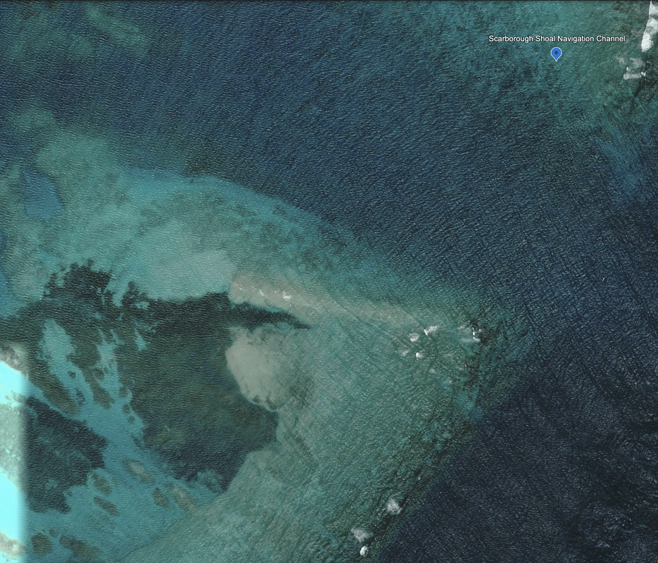
We do see what could be early-stage reclamation work at the Southeastern edge. There is a navigation channel cut into the reef, and we saw a smudge on the satellite imagery that might have been infrastructure being installed.
We read in the Global Times that from February 2 to 9, 2024, the Philippine Coast Guard Ship 9701 sailed on waters adjacent to Scarborough Shoal, also known as Huangyan Island, and were warned then repelled by Chinese Coast Guard forces. This also happened against a Philippine Bureau of Fisheries and Aquatic Resources Ship 3005, which was also repelled.
According to the South China Morning Post, Beijing has been accused of installing a "floating barrier" at the Scarborough Shoal to block fishing boats from entering the area. According to Al Jazeera on December 11, 2023, Beijing seized the Scarborough Shoal in 2012 after a months-long stand-off, and after former Philippine President Gloria Arroyo excluded Scarborough Shoal and the Spratly Islands from 2009 UNCLOS baselines. So, ownership is ambiguous.
Location: 15°08'53"N 117°46’53"E
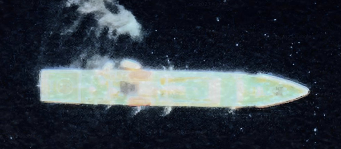
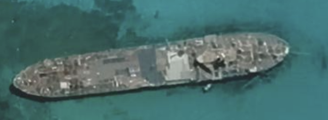
We did see a ship just to the North of the shoal that looked quite large and military grade, located here: 15°05'37"N 117°46'31"E.
I understand that Second Thomas Shoal has a ship anchored there and wonder if this could be the same situation?
In the photo below, Source Google Earth, you can see the mouth of the shoal. The satellite photos we examined showed a line, visible from space, that curved gracefully inward into the Shoal. We read that the same thing happened in mid-2023, and that the Philippines cut the barrier in September, 2023, so this is not an isolated event.
What we don't know is why the barrier has been installed, at least twice.
We do not own the right to share the Maxar / Reuters image, but you can find it here.
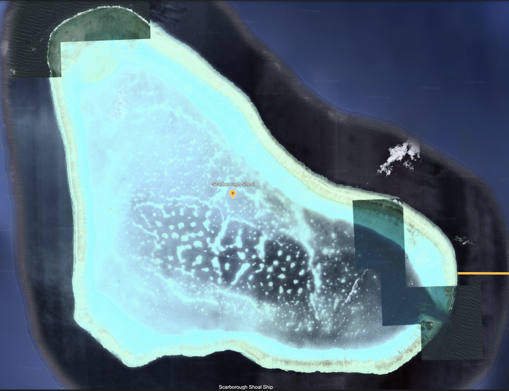
This is a reef that is claimed and patrolled by both PRC and the Philippines.
I read in the open source media that during restocking and resupply visits by Philippine boats, the Chinese are known to bump, confront, spray with water cannons and damage those vessels during logistical shipping visits. The ship seen below could just be an accident of satellite imagery, or could be a second Philippine ship being used to establish residency?
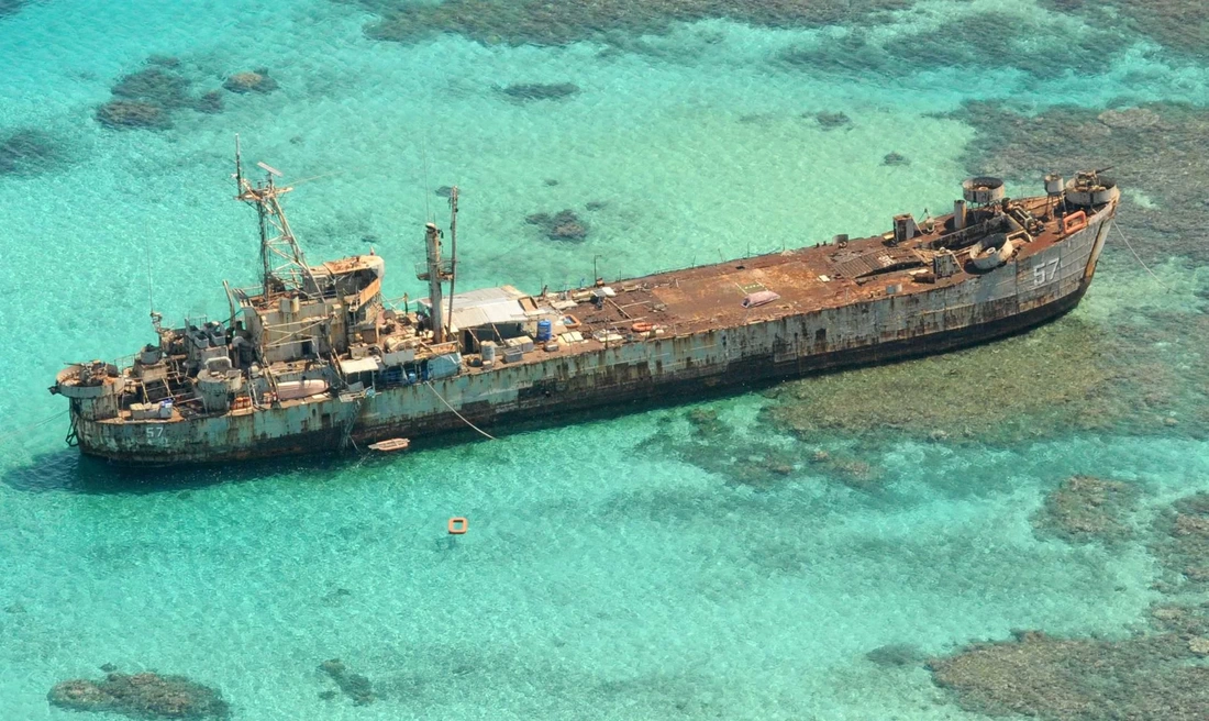
According to Radio Free Asia on 12/28/2023, the Philippine Government allotted 100 million pesos (U.S. $1.81 million) to construct permanent military and civilian (fisherfolk shelters) structures on Ayungin Shoal (Second Thomas) Shoal as confirmed by Col. Medel Aguilar, a Philippine armed forces spokesman. The current outpost is a Philippine Navy ship, the BRP Sierra Madre, which was run aground in 1999 and has been manned ever since.
The image below is a ship we spotted in the Scarborough Shoal.
This is a location that bears watching for further reclamation work near the channel.
According to Reuters, the Scarborough Shoal is claimed by three nations: China, the Philippines and Taiwan.
Name 1
Nearest Land
Distance from Land (miles)
Location (latitude & longitude)
Diameter (miles)
Date of Satellite Imagery
Airport Present?
Helipad Present?
Port / Dock Facility Present?
Buildings Present?
Defensive Infrastructure Present?
Athletic Facilities Present?
Hospital Present?
Sand Only Island?
Dredging Infrastructure Only?
Eastern South China Sea (closest to Philippines)
Scarborough Shoal
Philippines
148
15°08'53"N 117°46’53"E
11.0
10/30/2020
No
No
No
No
No
No
No
No
Maybe
Consulting Session for one hour
This is a one-hour meeting, remote or in-person, with Jeffrey Cohen, President of U.S. Advanced Computing Infrastructure, Inc.
- You choose the topic and deliverables.
- You may buy multiple hours to fund a project.
We believe management consulting is pursuing "the art of the possible." These are areas where we believe we may be helpful:
- We will discuss our research into the South China Sea
- We offer traditional IT management consulting services.
- We offer quantum computing consulting
- We offer financial investment analysis of stock portfolios based on our Chicago Quantum Net Score (read more in our published research). Today we run a model that analyzes ~3,000 U.S. listed equities and optimizes both 'long' and 'short' stock portfolios.
- Project and program management.
- Outsourcing advisory.
- We run your business problem on our discrete mathematical models (on our own server equipment using our own solvers).
- We may configure and run your problem on quantum annealing computers from D-Wave Systems Inc.
- We ALWAYS work confidentially, diligently, free of conflict of interest, and bring our best thinking and insights.
We can operate at both the strategic and tactical level depending on client need. This includes business strategy, business problem decomposition, mathematical and data design, algorithm design, and use of quantum and classical solvers. The President has a strategic perspective from ~ 30 years of executive corporate management in IT and professional services, and also rolls up his sleeves and codes when there is a good fit with the problem and his expertise.
Absolute discretion and professionalism is assured.
In closing
If you would prefer to discuss this 1:1 and negotiate a scope of work and level of effort, please contact us at [email protected] or call (312) 515-7333. We will develop a quotation and will invoice for our services.