Irving Reef, West York and Laoita Bank, Spratly Islands
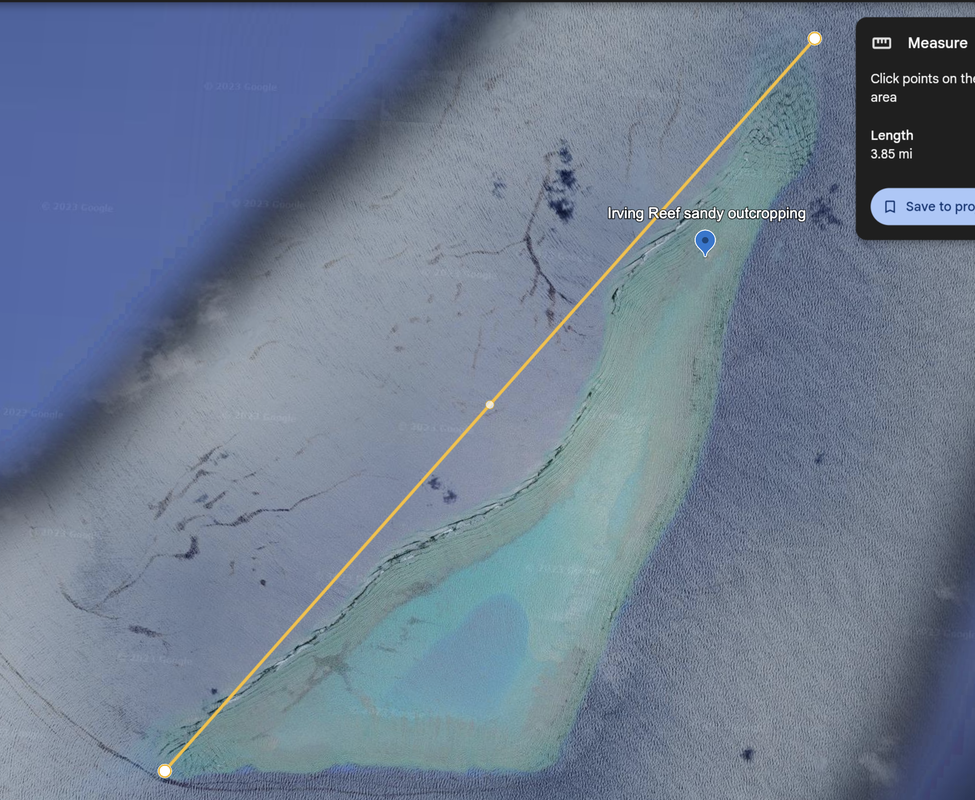
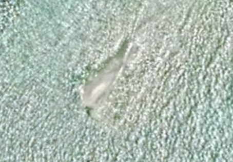
Irving Reef, a.k.a. Balagtas Reef (Philippines), Huo ai Jiao (Chinese), and da Ca Nham (Vietnamese) is a submerged and undeveloped coral atoll that is occupied by the Philippines according to Wikipedia. We see a tiny sand cay outcropping at the north end. Location 10°53'33"N 114°55’46”E. This is a fairly large reef, with the hypotenuse at 3.85 miles. Satellite image dated 4/17/2019.
|
|
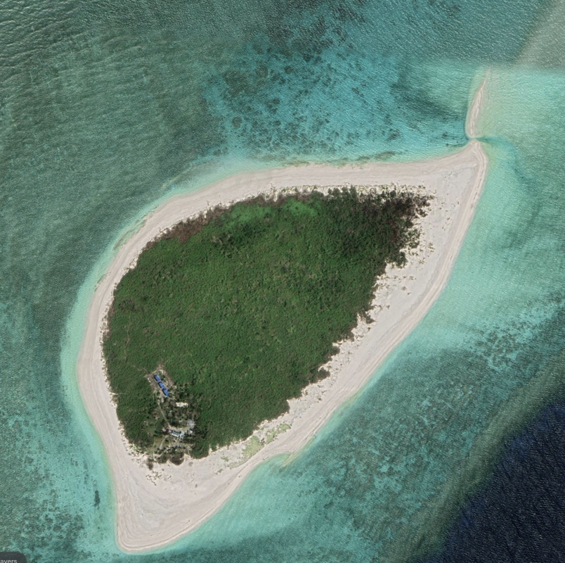
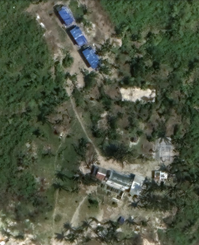
North of Irving we see West York Island. This island is 0.54 miles, with no visible infrastructure, and some buildings on the southern tip of the island. We see solar panels, what could be a single home, amidst the sandy beaches. Could this be a wealthy individual's hideaway? Location: 11°05'35"N 115°00'27"E. Imagery: 3/7/2022. If so, the secret is out.
|
|
This combined reef or pair of adjacent atolls stretch 45.2 miles in length. Location of the Laoita Bank (southern point): 10°43'12"N 114°20'57"E. Date of satellite imagery 5/14/2023. We see very small sandy cay formations, and one island with a substantial building (what we call Laoita Bank #2).
This atoll could result in a very large island if fully reclaimed, although the middle would be thin since Menzies and Laoita are not the same atoll.
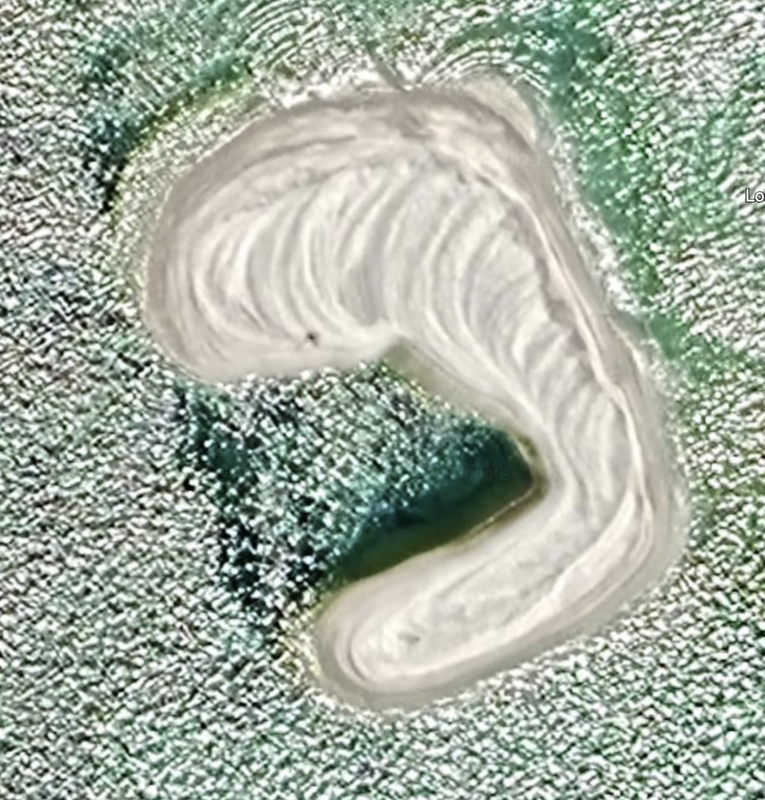
What we see currently is early-stage reclamation of sandy cays (tiny outcroppings). We see a full reclamation set of hardware on Loaita Nam 1 (a small, sandy cay). These are early days, at least in these satellite photos.
The most developed islands currently support a place to park infrastructure, and a helipad and some buildings.
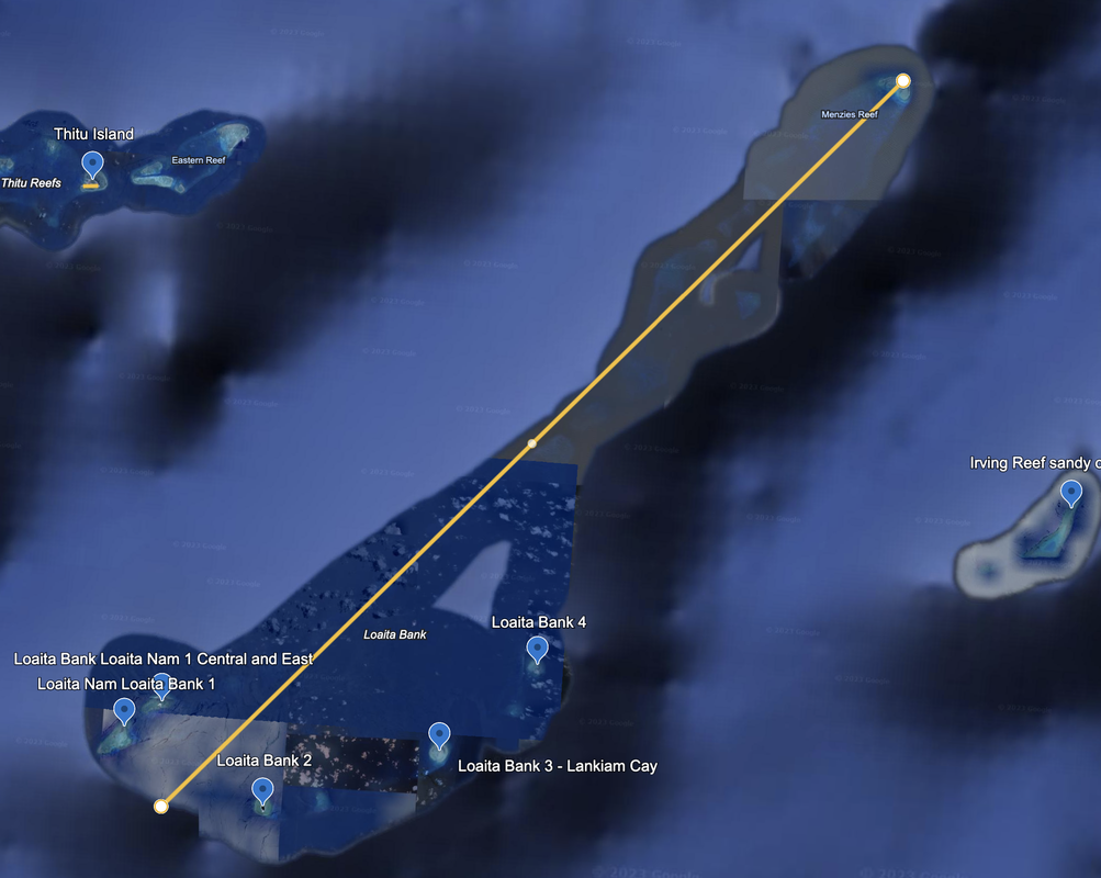
These are sandy outcroppings, and the two together look like they are both being developed with sand apparent in the water.
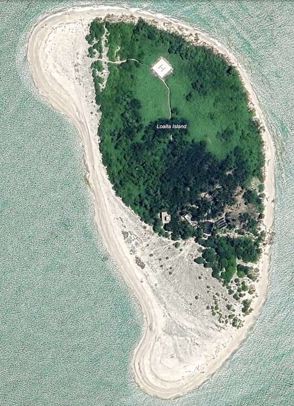
Loaita Bank 2, moving to the Southeast. An island with the southern third under development (sandy and new) and a helicopter pad to the north along with significant tree cover, buildings, and solar panels. No visible port facilities, but there is a small boat along the West coast. This is near an undeveloped Loaita Cay just to the East. Satellite image: 5/14/2023.
|
|
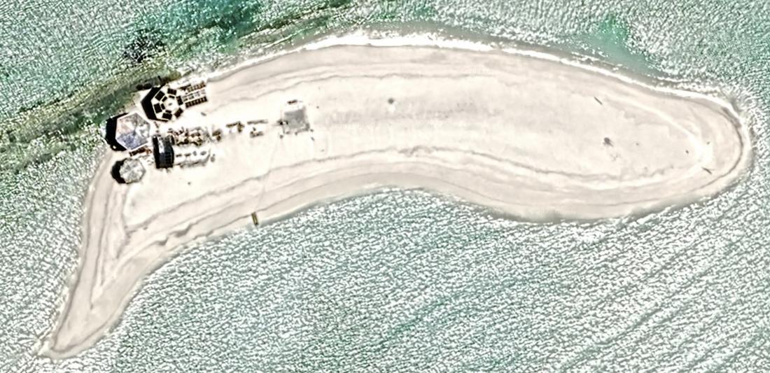
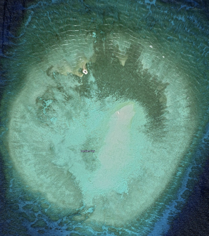
Loaita Bank 3 is labeled Lankiam Cay, and this satellite photo is dated 03/29/2019. Location: 10°42'42"N 114°32’08”E. This is a very early stage reclamation effort at this point, with two landforms being created that will likely be joined together.
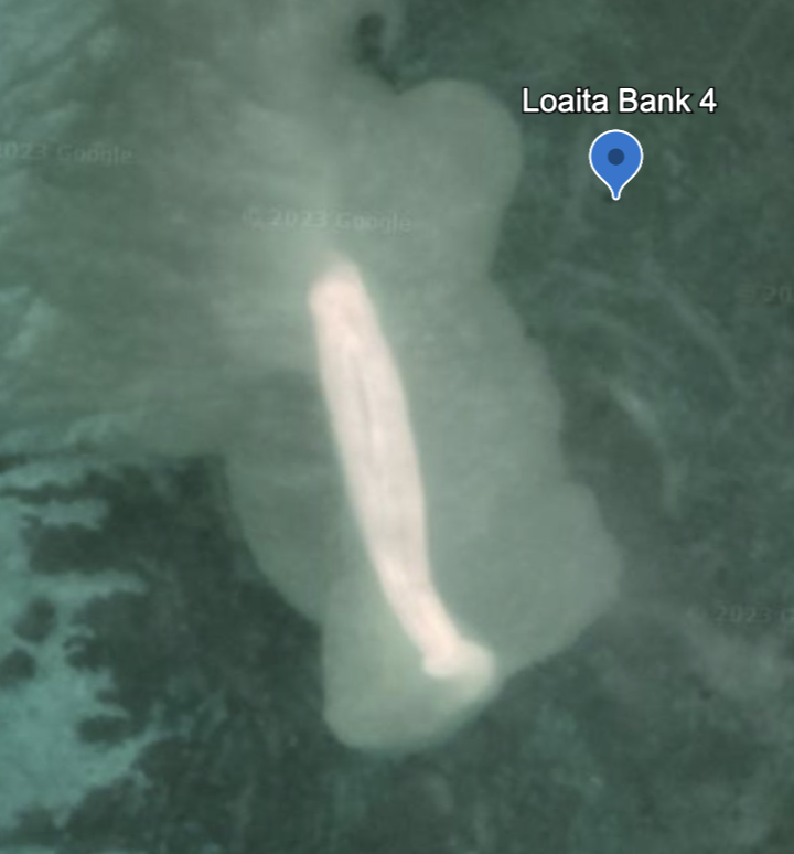
Loaita Bank 4 is far to the East, but still in the same neighborhood. Location: 0°46'00"N 114°35’52”E. This is the beginnings of an island, and the satellite photo is from 04/25/2018. There is nothing else we see in Loaita Bank, and the Northeastern tip has a reef named Menzies Reef that is close to the surface, but we see no man-made fortifications or reclamations.

|
|
Name 1
Nearest Land
Distance from Land (miles)
Location (latitude & longitude)
Diameter (miles)
Date of Satellite Imagery
Airport Present?
Helipad Present?
Port / Dock Facility Present?
Buildings Present?
Defensive Infrastructure Present?
Athletic Facilities Present?
Hospital Present?
Sand Only Island?
Dredging Infrastructure Only?
Spratly Islands
West York Island (and Irving Reef)
Philippines and Vietnam
238 and 359
11°05'35"N 115°00'27"E
0.54
3/7/2022
No
No
No
Yes
Yes
No
No
Yes (on some)
Yes (on some)
Spratly Islands
Laoita Bank (and Menzies Reef)
Philippines and Vietnam
238 and 359
10°43'12"N 114°20'57"E
45.2
5/14/2023
No
Yes
No
Yes
Yes
No
No
Yes (on some)
Yes (on some)
Consulting Session for one hour
This is a one-hour meeting, remote or in-person, with Jeffrey Cohen, President of U.S. Advanced Computing Infrastructure, Inc.
- You choose the topic and deliverables.
- You may buy multiple hours to fund a project.
We believe management consulting is pursuing "the art of the possible." These are areas where we believe we may be helpful:
- We will discuss our research into the South China Sea
- We offer traditional IT management consulting services.
- We offer quantum computing consulting
- We offer financial investment analysis of stock portfolios based on our Chicago Quantum Net Score (read more in our published research). Today we run a model that analyzes ~3,000 U.S. listed equities and optimizes both 'long' and 'short' stock portfolios.
- Project and program management.
- Outsourcing advisory.
- We run your business problem on our discrete mathematical models (on our own server equipment using our own solvers).
- We may configure and run your problem on quantum annealing computers from D-Wave Systems Inc.
- We ALWAYS work confidentially, diligently, free of conflict of interest, and bring our best thinking and insights.
We can operate at both the strategic and tactical level depending on client need. This includes business strategy, business problem decomposition, mathematical and data design, algorithm design, and use of quantum and classical solvers. The President has a strategic perspective from ~ 30 years of executive corporate management in IT and professional services, and also rolls up his sleeves and codes when there is a good fit with the problem and his expertise.
Absolute discretion and professionalism is assured.
In closing
If you would prefer to discuss this 1:1 and negotiate a scope of work and level of effort, please contact us at [email protected] or call (312) 515-7333. We will develop a quotation and will invoice for our services.