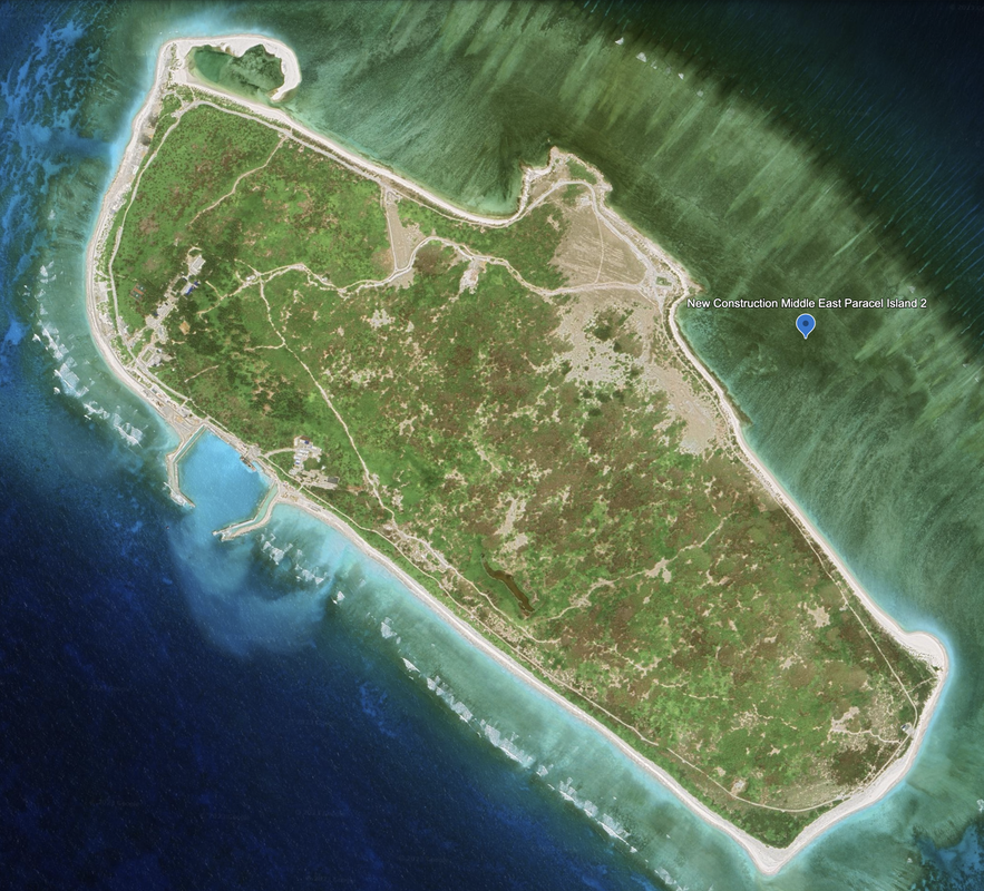
Lincoln Island and Bombay Reef, Eastern Paracel Islands
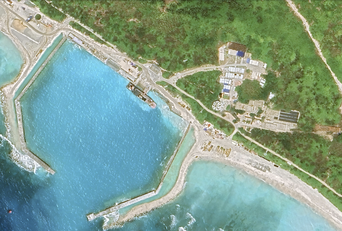
At the eastern edge of the Paracel Islands, we see a brush covered island that according to the NGA Pub. 161, lies 40 miles W of the main Hong Kong-Singapore route. It is reported there is fresh water on the island.The island has a small settlement and several towers. We see a protected quay with port facilities on the western side of the island. At a distance, this looks like an idyllic fishing island.
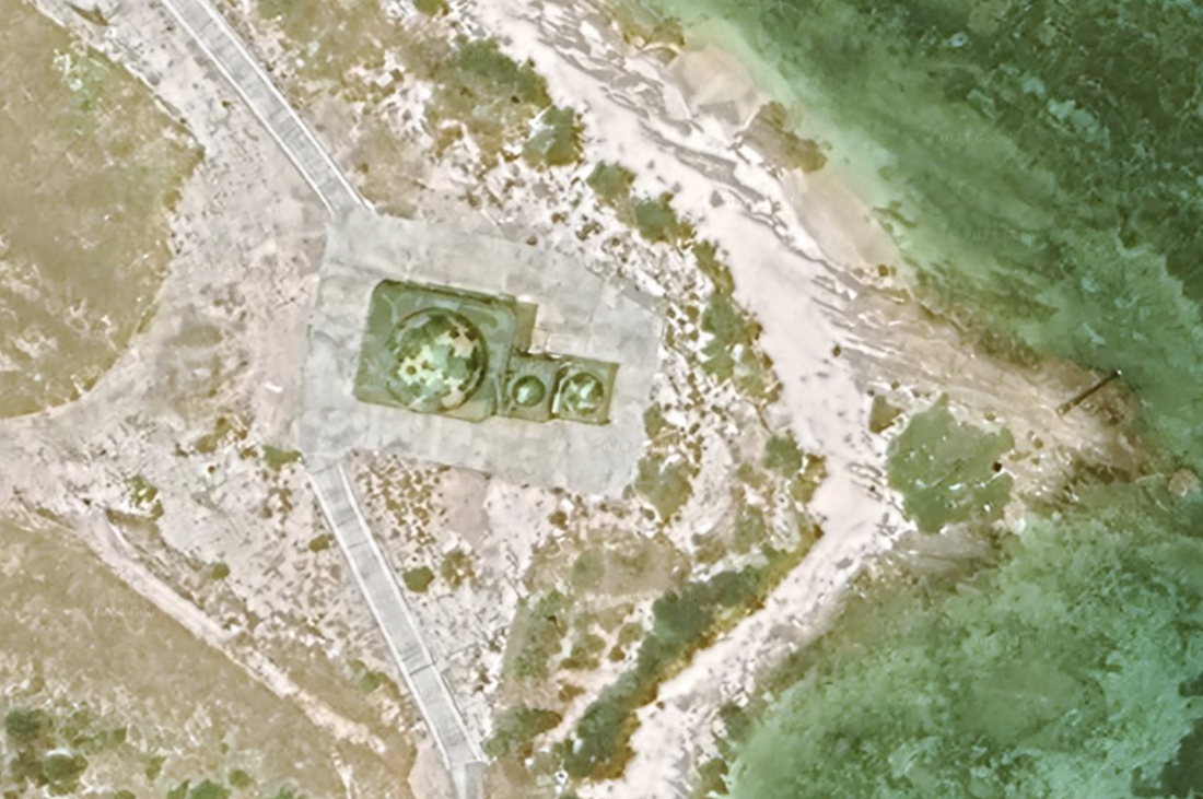
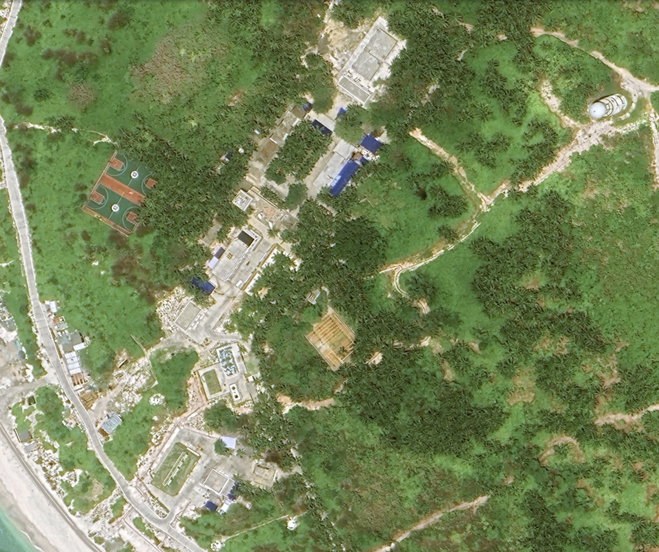
With a closer look, we see camouflaged guard towers and some defensive infrastructure around the outside of the island. We also see a few buildings, radomes, recreational facilities, roads, and a protected harbor and port on the Western side of the island. Most of the development is on the Southern side of the island. We notice the protected bay with port, and what looks like a great jogging or hiking path around the outside of the island. Finally, some of the buildings are camouflaged and it is hard to see much with the extensive tree coverage.
Location: 16°40'02"N 112°43’54"E
Satellite photo was taken 05/19/2023.
Langhua jiao, Chinese and da Bong Bay, in Vietnamese, is an atoll. It is also called Pengbojiao and Qilianyu in Chinese, according to Wikipedia.
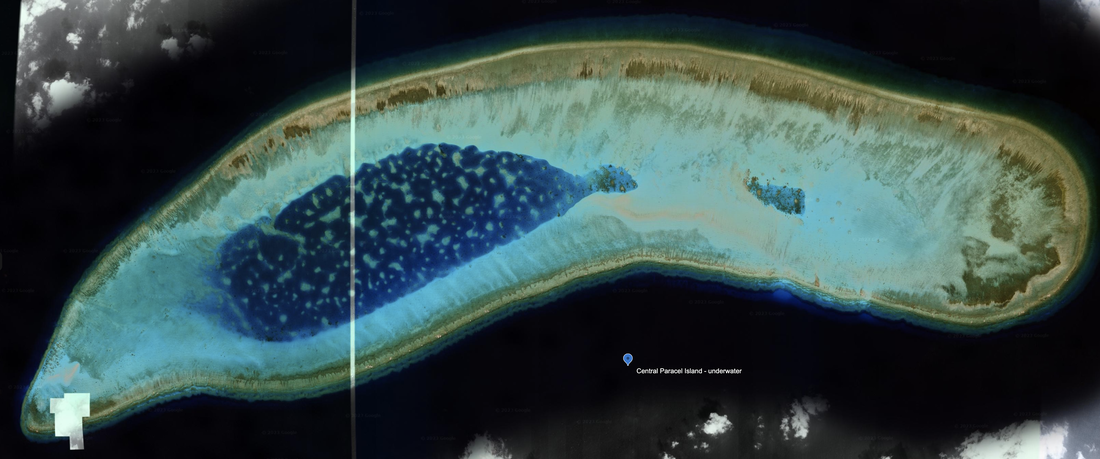
At the far Southeast corner of the Paracel islands, we see a stand-alone reef that appears to be fully submerged without any signs of land reclamation. This is still on the eastern edge of the Paracel Islands. Location: 16°02'49"N 112°30’15"E. Satellite imagery dated 3/7/2021.
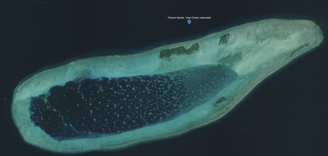
West of the island and underwater reef, we see another underwater reef with no signs of man-made development.
Location: 16°22'12"N 111°57'06"E. Satellite Imagery 7/10/2023 and it looks like two satellite images placed side by side.
Name 1
Nearest Land
Distance from Land (miles)
Location (latitude & longitude)
Diameter (miles)
Date of Satellite Imagery
Airport Present?
Helipad Present?
Port / Dock Facility Present?
Buildings Present?
Defensive Infrastructure Present?
Athletic Facilities Present?
Hospital Present?
Sand Only Island?
Dredging Infrastructure Only?
Paracel Islands
Eastern Island
China
227
16°40'02"N 112°43’54"E
1.5
5/19/2023
No
No
Yes
Yes
Yes
Yes
Not Sure
No
No
Consulting Session for one hour
This is a one-hour meeting, remote or in-person, with Jeffrey Cohen, President of U.S. Advanced Computing Infrastructure, Inc.
- You choose the topic and deliverables.
- You may buy multiple hours to fund a project.
We believe management consulting is pursuing "the art of the possible." These are areas where we believe we may be helpful:
- We will discuss our research into the South China Sea
- We offer traditional IT management consulting services.
- We offer quantum computing consulting
- We offer financial investment analysis of stock portfolios based on our Chicago Quantum Net Score (read more in our published research). Today we run a model that analyzes ~3,000 U.S. listed equities and optimizes both 'long' and 'short' stock portfolios.
- Project and program management.
- Outsourcing advisory.
- We run your business problem on our discrete mathematical models (on our own server equipment using our own solvers).
- We may configure and run your problem on quantum annealing computers from D-Wave Systems Inc.
- We ALWAYS work confidentially, diligently, free of conflict of interest, and bring our best thinking and insights.
We can operate at both the strategic and tactical level depending on client need. This includes business strategy, business problem decomposition, mathematical and data design, algorithm design, and use of quantum and classical solvers. The President has a strategic perspective from ~ 30 years of executive corporate management in IT and professional services, and also rolls up his sleeves and codes when there is a good fit with the problem and his expertise.
Absolute discretion and professionalism is assured.
In closing
If you would prefer to discuss this 1:1 and negotiate a scope of work and level of effort, please contact us at [email protected] or call (312) 515-7333. We will develop a quotation and will invoice for our services.