Fiery Cross Reef, Spratly Islands
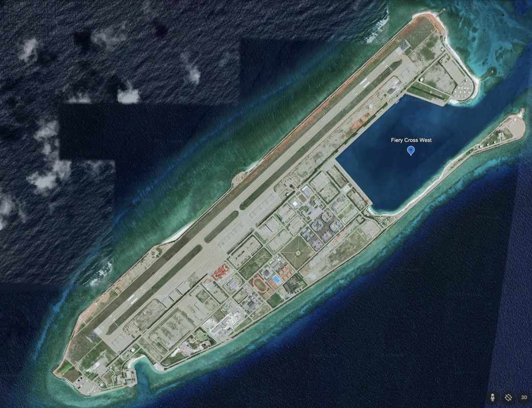
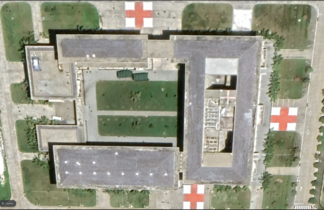
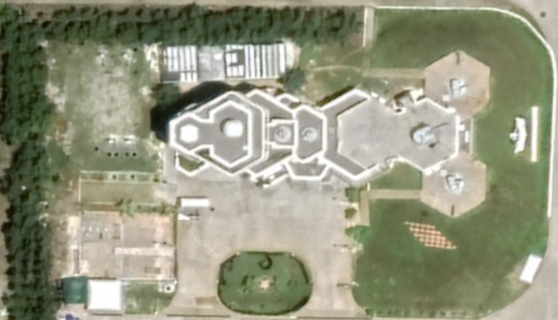
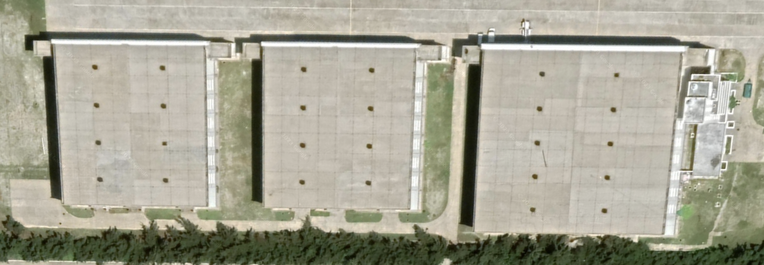
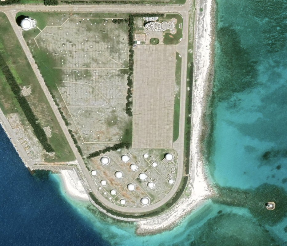
We notice the island has an impressive runway, and numerous aircraft hangers. We see a running track, and what looks like fuel storage. Let’s look deeper. Elegant buildings that are multi-story (based on the shadows they cast), and significant infrastructure to defend their island, and to store aircraft in dozens of hangers. We see either a significant number of radomes or fuel storage tanks. We see at least five defensive AA cannon pointed away from the island, and some with a three-gun battery, a multi-building hospital, track and field facilities, an olympic sized swimming pool with lap lanes, and twelve missile launch sites.
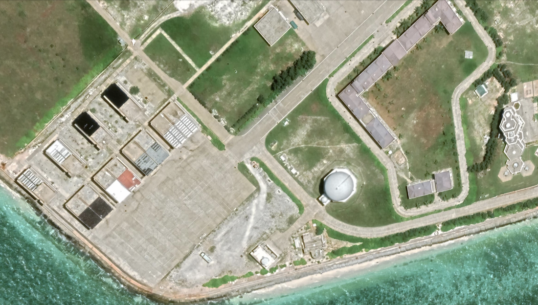
We focus on the fitness facilities, because that usually reflects the housing and caring for troops. On this island we see numerous housing units around a significant athletic facility. We see a five-lane swimming pool, two tennis courts, a full running track, and four basketball courts. We see a parade ground with new trees, and what look like administrative buildings. We see many undeveloped tracts of land and some significant buildings on the island. There is more room to grow the garrison.
Around the runway we see many aircraft hangers and other large buildings, such as the one below.
|
|
|
|
These will pack quite an offensive punch at a distance. Also note the anti-aircraft cannon to the east, for that 'close shave' protection.
3/17/2019 Fiery Cross Land Reclamation, Google Earth.
|

5/16/2022, Fiery Cross Reef Land Reclamation, Google Earth.
|

Name 1
Nearest Land
Distance from Land (miles)
Location (latitude & longitude)
Diameter (miles)
Date of Satellite Imagery
Airport Present?
Helipad Present?
Port / Dock Facility Present?
Buildings Present?
Defensive Infrastructure Present?
Athletic Facilities Present?
Hospital Present?
Sand Only Island?
Dredging Infrastructure Only?
Spratly Islands
Fiery Cross (3 islands)
Philippines and Vietnam
294 and 295
9°33'03"N 112°53'07"E
2.4
Undated
Yes
No
Yes
Yes
Yes
Yes
Yes
Yes (2)
No
Consulting Session for one hour
This is a one-hour meeting, remote or in-person, with Jeffrey Cohen, President of U.S. Advanced Computing Infrastructure, Inc.
- You choose the topic and deliverables.
- You may buy multiple hours to fund a project.
We believe management consulting is pursuing "the art of the possible." These are areas where we believe we may be helpful:
- We will discuss our research into the South China Sea
- We offer traditional IT management consulting services.
- We offer quantum computing consulting
- We offer financial investment analysis of stock portfolios based on our Chicago Quantum Net Score (read more in our published research). Today we run a model that analyzes ~3,000 U.S. listed equities and optimizes both 'long' and 'short' stock portfolios.
- Project and program management.
- Outsourcing advisory.
- We run your business problem on our discrete mathematical models (on our own server equipment using our own solvers).
- We may configure and run your problem on quantum annealing computers from D-Wave Systems Inc.
- We ALWAYS work confidentially, diligently, free of conflict of interest, and bring our best thinking and insights.
We can operate at both the strategic and tactical level depending on client need. This includes business strategy, business problem decomposition, mathematical and data design, algorithm design, and use of quantum and classical solvers. The President has a strategic perspective from ~ 30 years of executive corporate management in IT and professional services, and also rolls up his sleeves and codes when there is a good fit with the problem and his expertise.
Absolute discretion and professionalism is assured.
In closing
If you would prefer to discuss this 1:1 and negotiate a scope of work and level of effort, please contact us at [email protected] or call (312) 515-7333. We will develop a quotation and will invoice for our services.