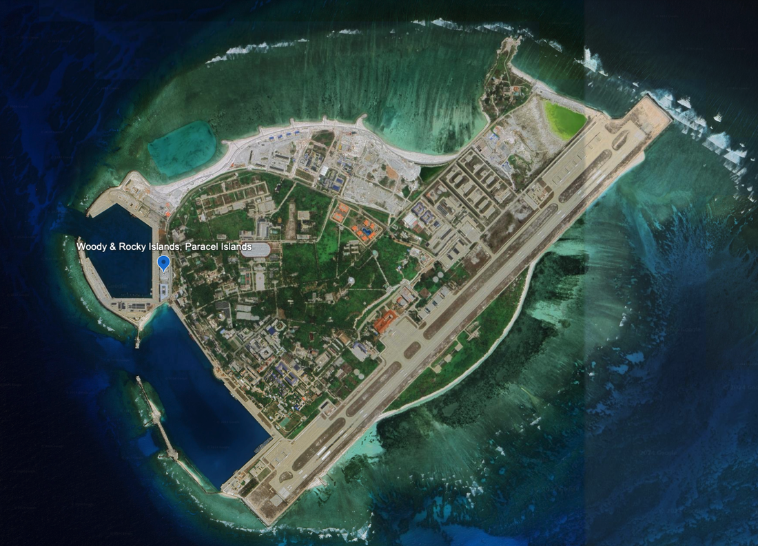
Woody Island and Rocky Island, Paracel Islands
With the reclaimed land, this now a combined island. It lies 5.6 miles south of the southernmost of the Three Sisters, or South Sand. It is an important island, and according to the NGA Pub 161, it is a military garrison with works in progress continuing to expand the island and harbors. Satellite Imagery is from 4/5/2023, and we see significant patches on the island that are newly reclaimed and are under construction with cranes and equipment, and new buildings.
A few bulleted observations:
- It has two dredged harbors to the west of the island with significant space for ships to dock.
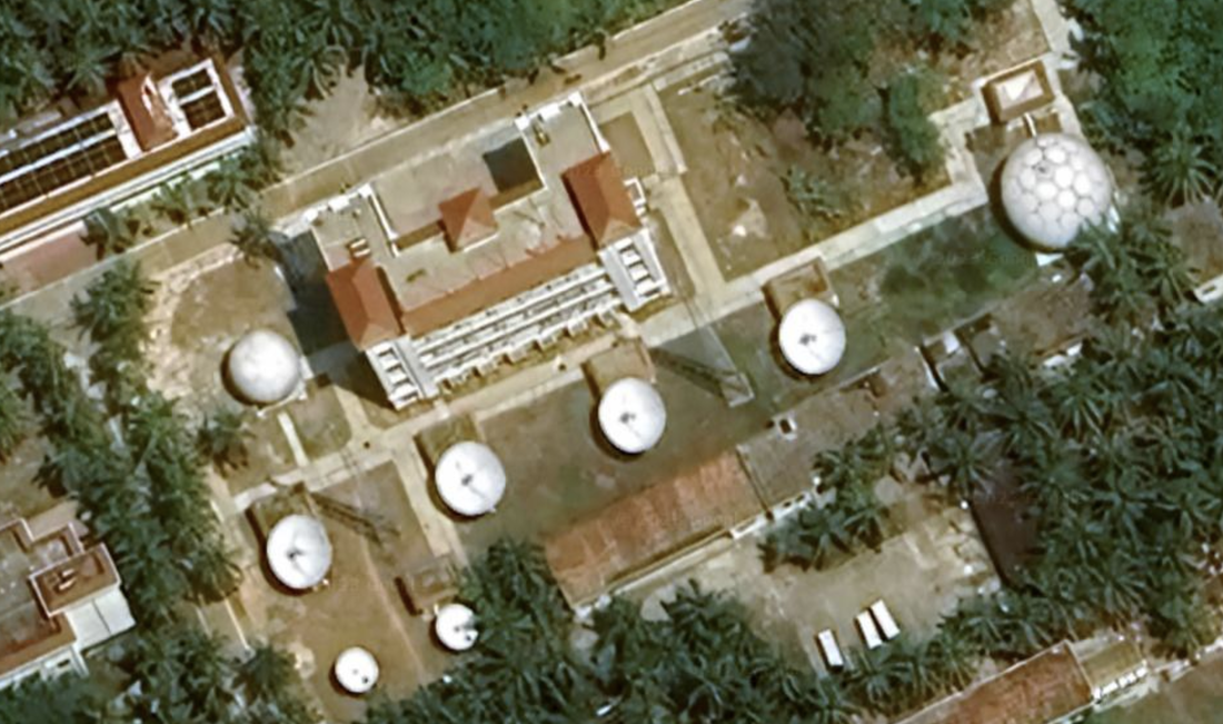
- It has many buildings of multiple story, including a government building with a metal dome.
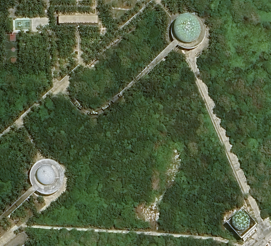
- There are many radomes, spread throughout the island. Some painted green, and some in white. Some are in the triangle configuration.
- We see a field of satellite dishes. There is a hospital
- Many athletic fields and a pool with four swim lanes.
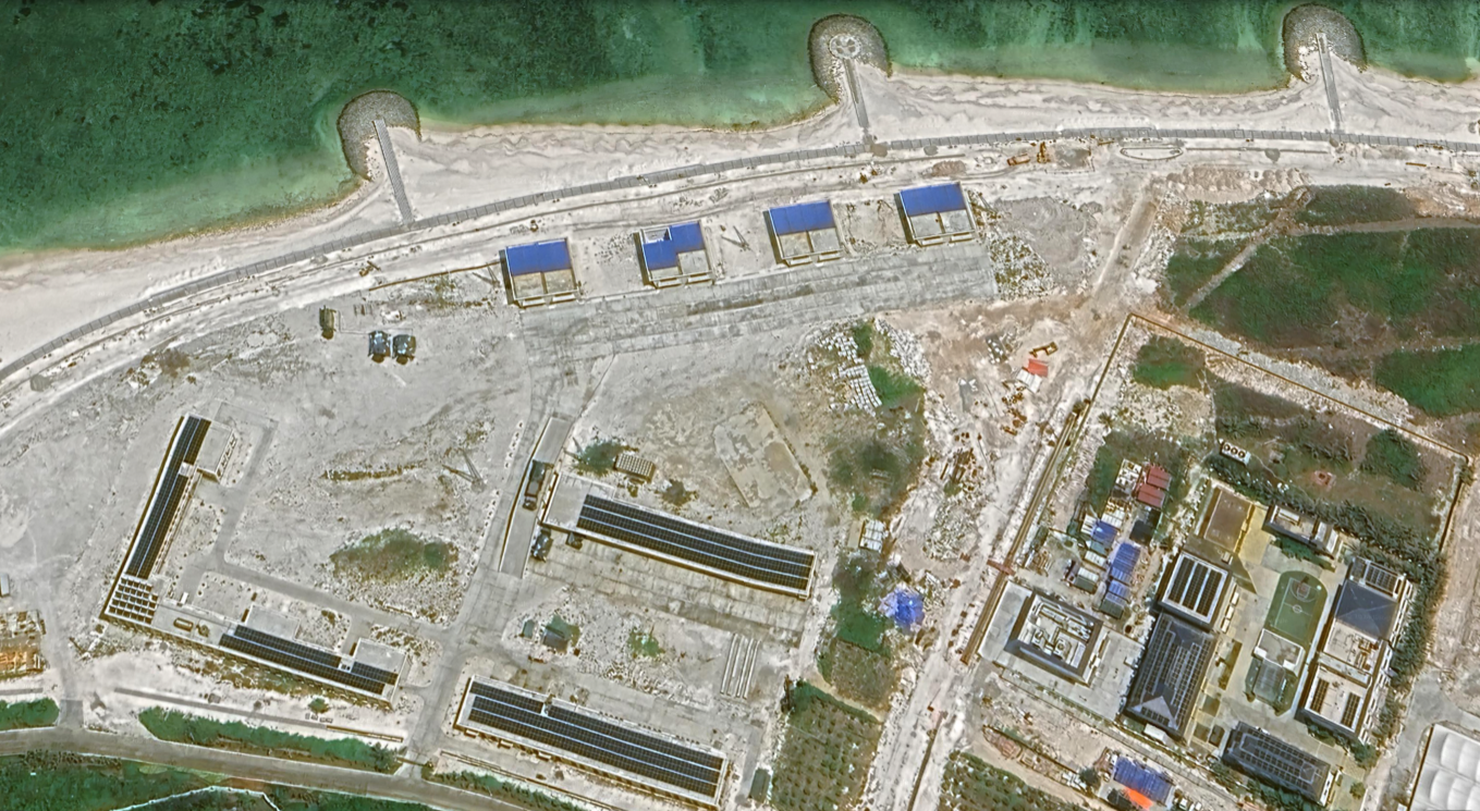
- Many of the buildings are topped with solar panels.
- Many large buildings.
- This is the island with the eight missile batteries with the blue roofs.
- There is an airport with concrete aircraft hangars.
- Near the airport there are rows of what might be barracks or office buildings, some with solar panels on the roofs.
This is the southern tip of the Amphitrite group of the Paracel Islands has a permanently inhabited island that was previously two islands connected by a causeway, but was combined through continued land reclamation. Woody Island was the larger land formation with a runway, and Rocky Island was a smaller island to the Northeast.
Location: 16°50'39"N 112°18'57"E, and the satellite imagery is from 4/5/2023. This is a well developed island with a runway, two protected ports, and room for continued expansion.
We see significant new construction underway.
This island is 184.5 miles Southeast of Lingshui Bay in Hainan, China, at location: 16°50'53"N 112°18’18”E. The island is 2.0 miles in diameter from the tip of the runway to the edge of the protected bay with docking facilities.
The runway measures 1.67 miles long, with what looks like room for at least 25 aircraft to park. The satellite photograph is as of 04/27/2022, 3/8/2023 and 4/5/2023, so it is fairly new.
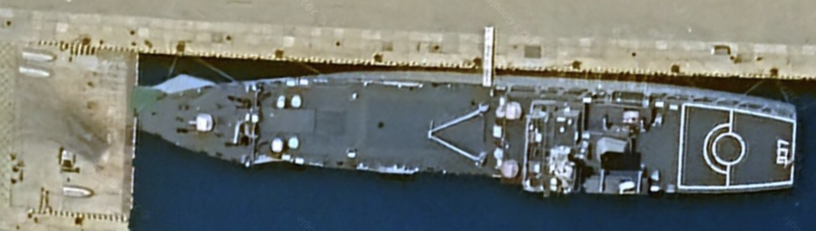
They are always elevated. There are many on this island. For example, we see a second set of ‘three radomes’ and what looks like an airport control tower at the southwest corner of the island by the naval vessel.
We also see a naval vessel in a recent satellite image.
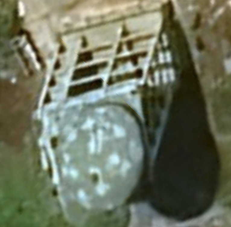
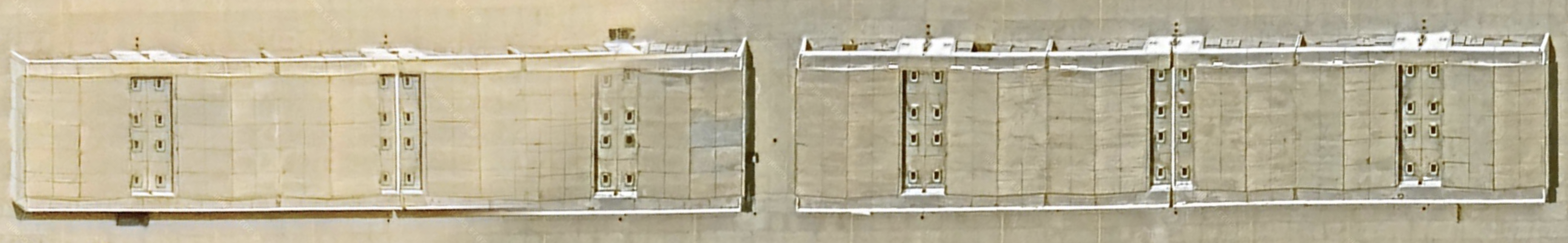
We also see at least four hangars for aircraft storage and maintenance, then another twelve, then a bunch more. We also see large, cylindrical liquid storage tankers. Lots of warm weather structures as well. Significant number of buildings and parade grounds on this island. We also see significant telecommunications and radar gear, including six satellite uplink stations and two radar 'balls' in one building's lot.
We see so many radomes and communications gear on the island that we joke they might be trying to build a quantum computer.
We see extensive fitness and athletic facilities, a running track, and lots of housing. We also see many areas where construction continues.
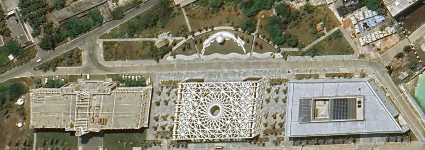
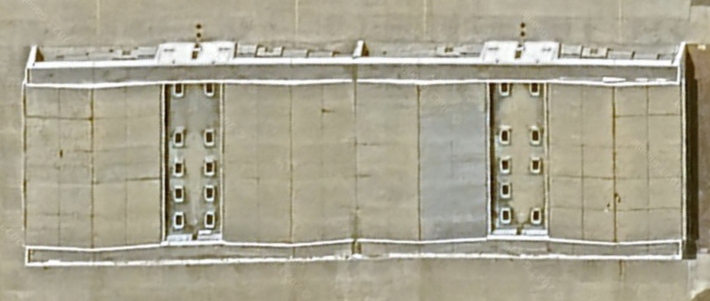
One building is covered with a white, metallic mesh. We remember seeing a building like the one in the center in Beijing at the Olympic center. Beautiful architecture. Location of the cool building: 16°50'17"N 112°19’47"E.
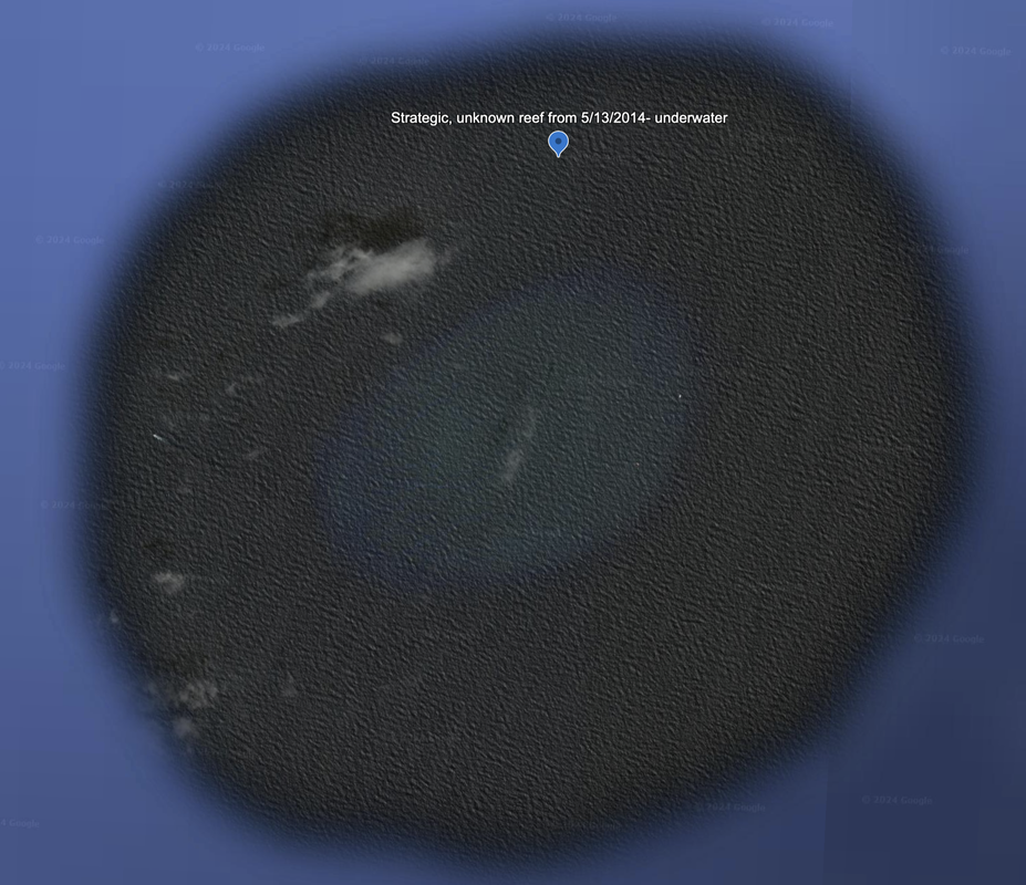
The PRC militarized islands in the South China Sea are mutually supporting, along with Hainan Island, to stop most traffic from transiting the SCS from north to south without having to approach or even enter the Philippine's EEZ. However, we believe there is one small underwater island missing from that geometry and our satellite imagery suggests it is still underwater and undeveloped.
PRC has mutually supporting islands in the South China Sea, both in the Spratly Islands, and between Hainan and the Paracels.
Spratly Islands
Subi to Fiery Cross: 123 miles
Subi to Mischief: 118.8 miles
Fiery Cross to Mischief: 178.9 miles
Subi to Woody: 405.1 miles (it's a stretch)
Paracel Islands
Woody to Hainan: 206.4 miles
Woody to Mystery: 190 miles
Hainan to Mystery: 192 miles
Woody to Dongsha: 400 miles (too far)
Mystery is a tiny, underwater reef that we will keep our eyes on. Location: 19°09'35"N 113°54'27"E, satellite imagery is dated 5/13/2014, which is almost 10 years old! 1.6 miles in diameter.
We checked back March 25, 2024, and Google Earth still has this as an underwater feature. We do think this is a strategic spot in the South China Sea which would enable a mutually supporting triangle of PRC military bases. It requires further investigation and analysis.
Name 1
Nearest Land
Distance from Land (miles)
Location (latitude & longitude)
Diameter (miles)
Date of Satellite Imagery
Airport Present?
Helipad Present?
Port / Dock Facility Present?
Buildings Present?
Defensive Infrastructure Present?
Athletic Facilities Present?
Hospital Present?
Sand Only Island?
Dredging Infrastructure Only?
Paracel Islands
The Ice Skate (Island 10 in N.E. Corner)
China
Lingshui Bay in Hainan, China.
184.5
16°50'53"N 112°18'18"E
2.0
4/5/2023
Yes
Yes
Yes
Yes
Yes
Yes
Not Sure
No
No
Consulting Session for one hour
This is a one-hour meeting, remote or in-person, with Jeffrey Cohen, President of U.S. Advanced Computing Infrastructure, Inc.
- You choose the topic and deliverables.
- You may buy multiple hours to fund a project.
We believe management consulting is pursuing "the art of the possible." These are areas where we believe we may be helpful:
- We will discuss our research into the South China Sea
- We offer traditional IT management consulting services.
- We offer quantum computing consulting
- We offer financial investment analysis of stock portfolios based on our Chicago Quantum Net Score (read more in our published research). Today we run a model that analyzes ~3,000 U.S. listed equities and optimizes both 'long' and 'short' stock portfolios.
- Project and program management.
- Outsourcing advisory.
- We run your business problem on our discrete mathematical models (on our own server equipment using our own solvers).
- We may configure and run your problem on quantum annealing computers from D-Wave Systems Inc.
- We ALWAYS work confidentially, diligently, free of conflict of interest, and bring our best thinking and insights.
We can operate at both the strategic and tactical level depending on client need. This includes business strategy, business problem decomposition, mathematical and data design, algorithm design, and use of quantum and classical solvers. The President has a strategic perspective from ~ 30 years of executive corporate management in IT and professional services, and also rolls up his sleeves and codes when there is a good fit with the problem and his expertise.
Absolute discretion and professionalism is assured.
In closing
If you would prefer to discuss this 1:1 and negotiate a scope of work and level of effort, please contact us at [email protected] or call (312) 515-7333. We will develop a quotation and will invoice for our services.