Tree Island, West Sand, North, Middle, South Islands, and the Three Sisters, Xuande Islands, Amphitrite Group, Paracel Islands
The Chinese have a few names for this group of islands in an arc, because they are the eastern islands in the Paracel Islands, and the first that traditional Chinese fisherman would visit. They are called the upper seven islands, or Shang Zhi / The Upper Stand-Off, or Xuande Islands. Source Liu, L. The Fishermen...2021 DOI Link.
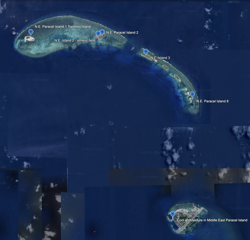
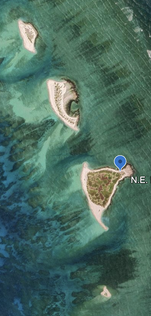
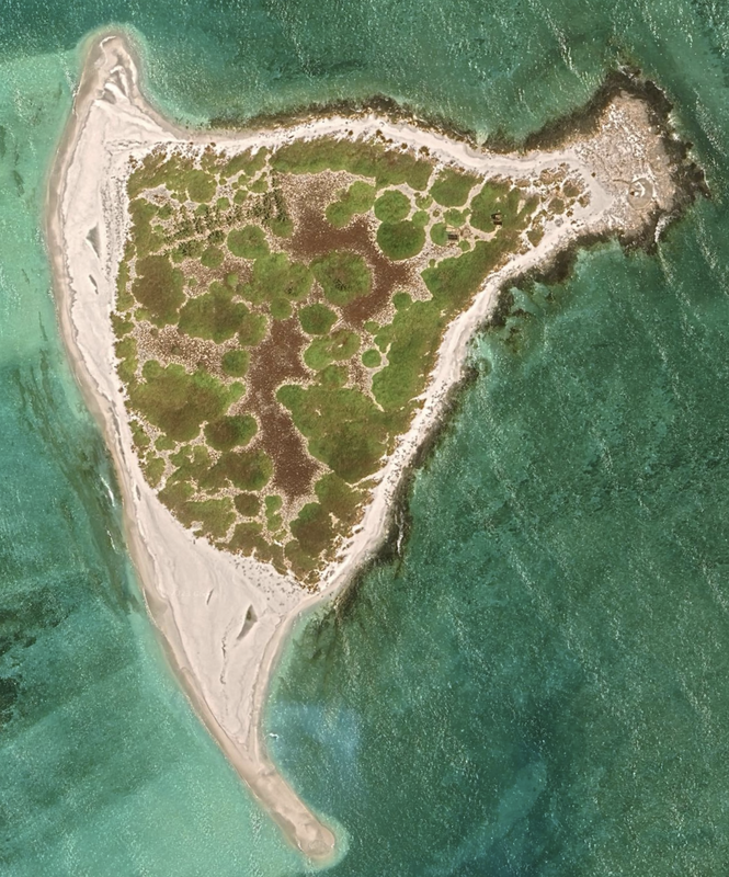
We mark the first island at this location. Location: 16°57'23"N 112°16’10”E The first or most Northeast island is 165.4 miles Southeast of Nanyanh, Hainan, China. Location of the first island is: 17°02'18"N 112°05’08"E. Two of these islands appear on NGA Nautical Chart 508, West Sand and Tree Island. We believe those are the first two islands we analyze.
We analyze each of these islands going from Northwest to Southeast below. Woody / Rocky Island is discussed on another webpage.
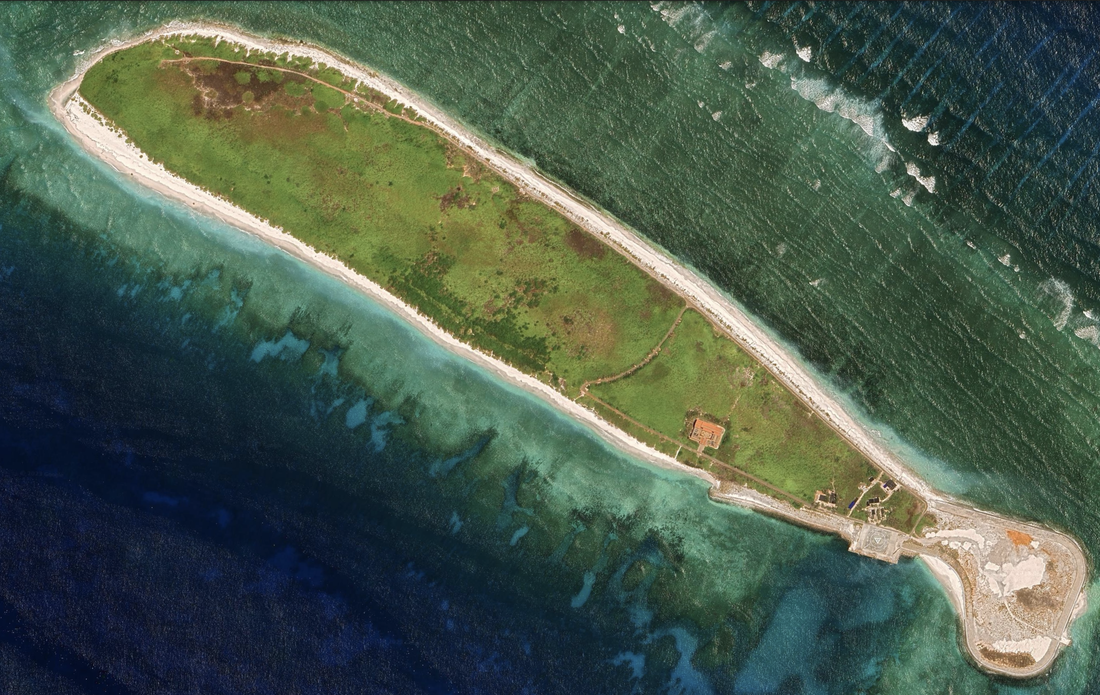
West Sand, Xisha Zhou in Chinese, Con Cat Tay in Vietnamese, is administered by PRC and receiving investment to grow trees on the island. This island is also claimed by ROC and Vietnam.Satellite imagery 5/9/2023 and location: 16°58'46"N 112°12'25"E.
Island 1 has has buildings, a square foundation, and what looks to be a road system etched into the sand.
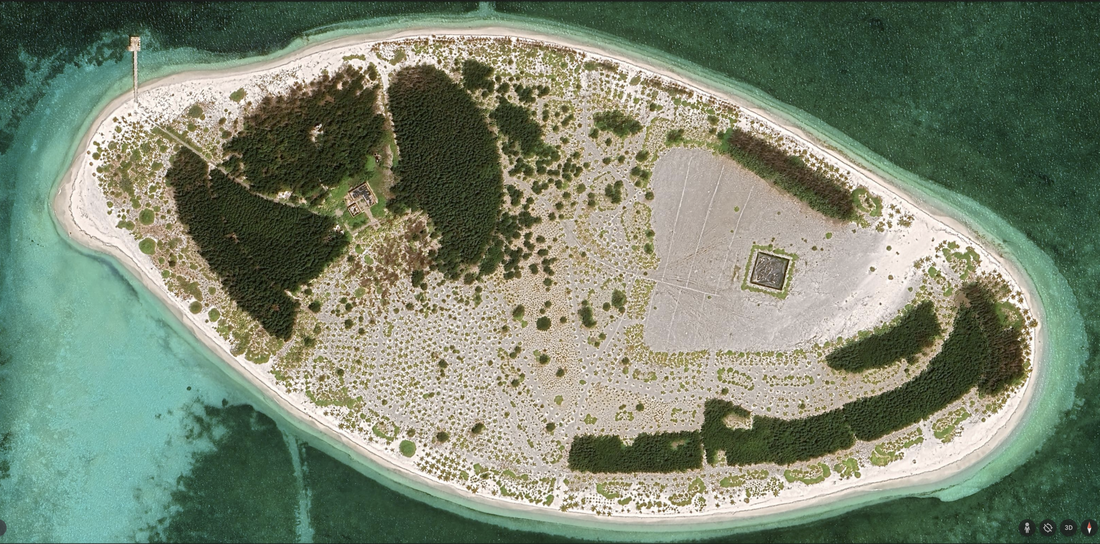
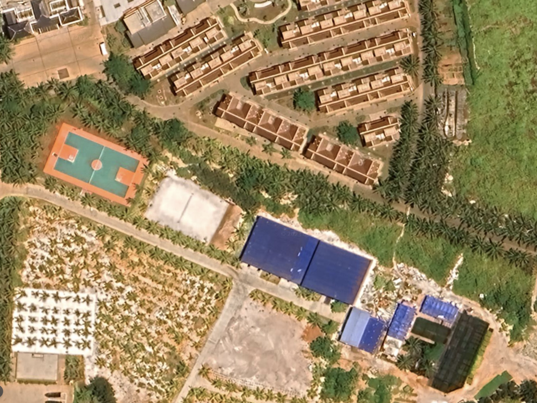
Island two is about 3.3 miles wast of West Sand, and is more developed with a visible athletic field, helicopter pad, and large sets of buildings around a central square. There is a group of 48 houses (more like townhomes) and larger buildings around a park and circle. We see a large building that reminds me of a Chinese religious Buddist temple (don't ask how I know that), but it looks to be unfinished inside (courtyards look messy, construction crane). We see two solar farms and a two windmills to the north of the island. Somehow, this looks to be an eco-friendly vacation island.
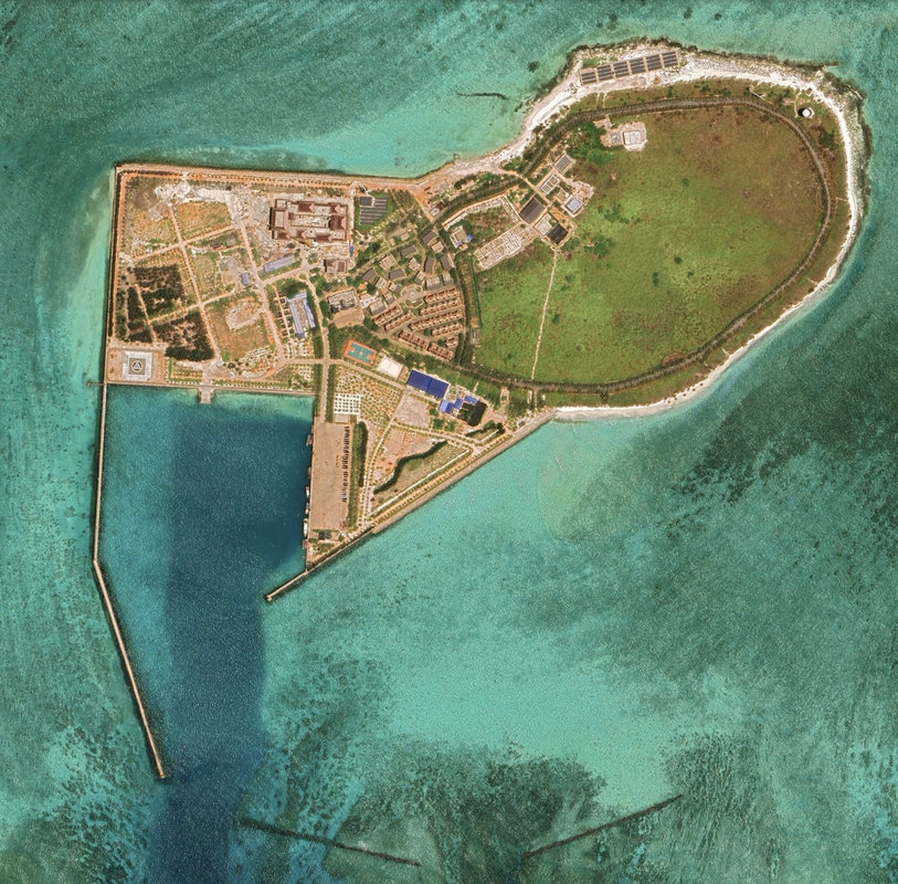
There is a large protected harbor that looks deep and dredged. Location. 16°58'40"N 112°16’12”E. Satellite imagery from 5/9/2023.
According to Wikipedia, the island is open to tourists and is accessible by hiring a fishing boat from Hainan, Chiuna.
We see many ships currently docked, and smaller ships on shore, likely for fishing. There are many trees planted on the island. There is a road around the island that looks great for jogging.
Island three, four, five, six and seven look the same as each other, without any visible man-made structures.
According to Wikipedia, these are known as the Qilian Yu sub-group, or the Seven Sisters. There are second islands or small reclamations south and east of Tree island that make up the rest of Amphitrite.
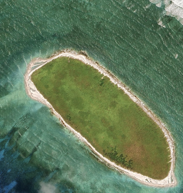
Island Three, below, is named North Island. In Chinese, it is called Changzhi, chang because it is long and zhi because it stays above water during high tide. We read in Liu, L, 2021 cited above, of similar naming: Yuanzhi is an oval island, Weizhi for an island at the outer end. The numbering system for islands, say Big Island 1, 2 and 3 are numbered in order from north to south.
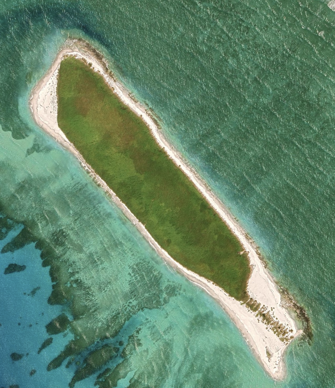
These three sisters, that make up Islands six, seven and eight are named North Sand, Middle Sand and South Sand.
Island nine is just south of island eight, and is small and sandy. There are two of these sandy spits below Island Eight, and we did not include a satellite image.
Name 1
Nearest Land
Distance from Land (miles)
Location (latitude & longitude)
Diameter (miles)
Date of Satellite Imagery
Airport Present?
Helipad Present?
Port / Dock Facility Present?
Buildings Present?
Defensive Infrastructure Present?
Athletic Facilities Present?
Hospital Present?
Sand Only Island?
Dredging Infrastructure Only?
Paracel Islands
Northeast Corner (reef with 9 islands)
China
165.4
17°02'18"N 112°05'08"E
11
5/9/2023
No
Yes
Yes
Yes
Maybe
Yes
Not Sure
No
No
Consulting Session for one hour
This is a one-hour meeting, remote or in-person, with Jeffrey Cohen, President of U.S. Advanced Computing Infrastructure, Inc.
- You choose the topic and deliverables.
- You may buy multiple hours to fund a project.
We believe management consulting is pursuing "the art of the possible." These are areas where we believe we may be helpful:
- We will discuss our research into the South China Sea
- We offer traditional IT management consulting services.
- We offer quantum computing consulting
- We offer financial investment analysis of stock portfolios based on our Chicago Quantum Net Score (read more in our published research). Today we run a model that analyzes ~3,000 U.S. listed equities and optimizes both 'long' and 'short' stock portfolios.
- Project and program management.
- Outsourcing advisory.
- We run your business problem on our discrete mathematical models (on our own server equipment using our own solvers).
- We may configure and run your problem on quantum annealing computers from D-Wave Systems Inc.
- We ALWAYS work confidentially, diligently, free of conflict of interest, and bring our best thinking and insights.
We can operate at both the strategic and tactical level depending on client need. This includes business strategy, business problem decomposition, mathematical and data design, algorithm design, and use of quantum and classical solvers. The President has a strategic perspective from ~ 30 years of executive corporate management in IT and professional services, and also rolls up his sleeves and codes when there is a good fit with the problem and his expertise.
Absolute discretion and professionalism is assured.
In closing
If you would prefer to discuss this 1:1 and negotiate a scope of work and level of effort, please contact us at [email protected] or call (312) 515-7333. We will develop a quotation and will invoice for our services.