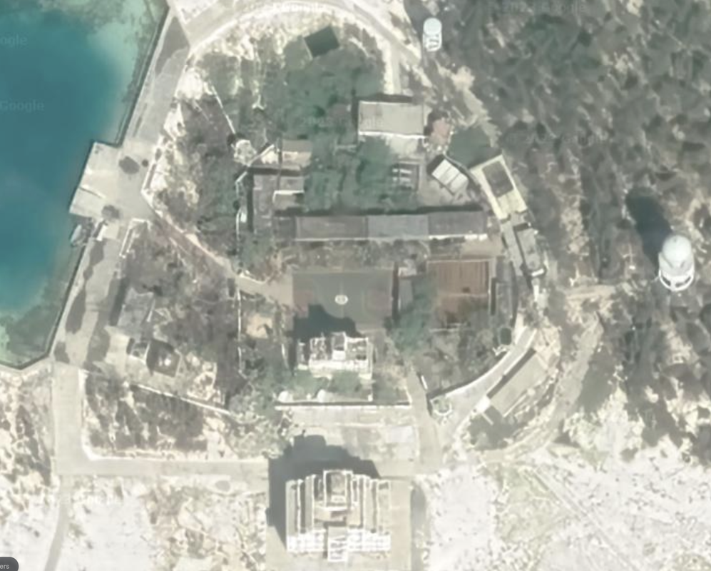
Triton Island, SW Paracel Islands
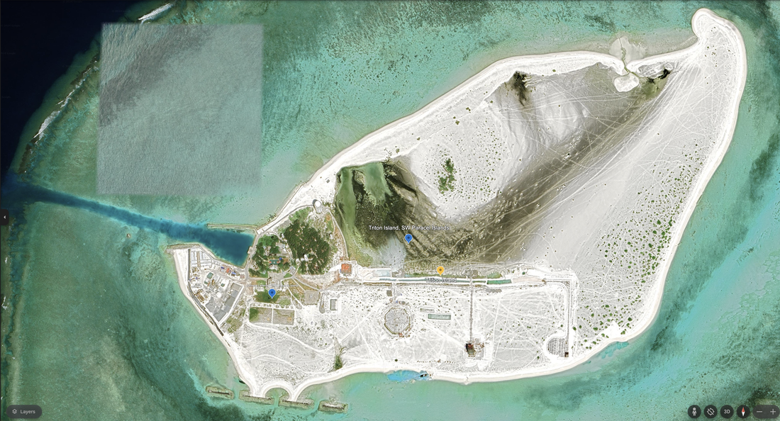
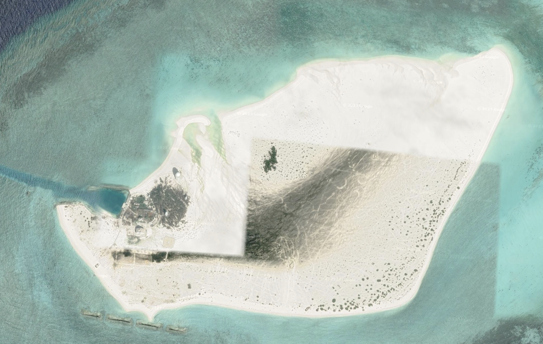
Triton island is at the southwest corner of the Paracel islands, south of the Crescent Group. It is 160 miles east of Quang Ngai, Vietnam, and 156.3 miles from Binh Chau, Vietnam. Location: 15°47'19"N 111°11'35"E. It is being reclaimed and has grown at least 5x in size, maybe larger. Triton Island is 1.14 miles in diameter, atop an atoll / reef structure that stretches 2.43 miles along the same heading. This island can more than double in diameter.
Google Earth has new satellite imagery dated 11/7/2023 which shows continued island development.
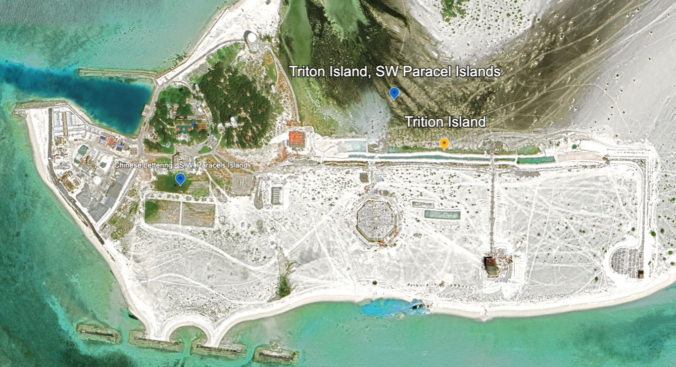
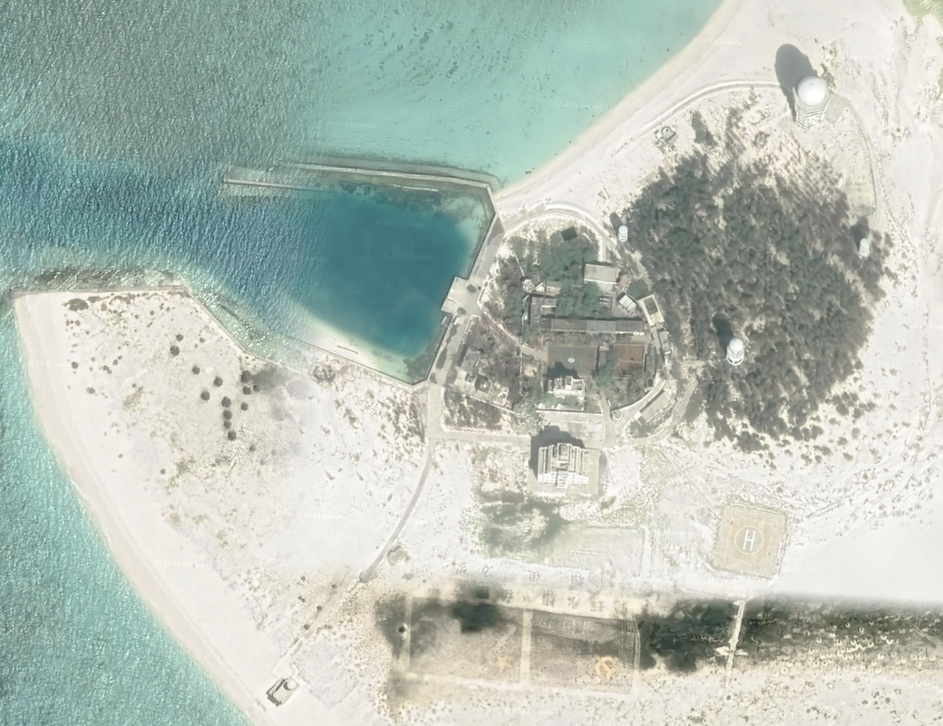
There is a small core settlement on the island with tall, important looking buildings, the small pier and quay, and mature trees and grass. It is a densely populated space. The rest of the island is new sand with significant construction underway. We see the very tall structures (four of them) with radomes / round equipment on top, a very tall building, structures that look like base housing, and an athletic field. There is a helipad. Location: 15°46'57"N 111°11’52"E.
- We notice a white wall around the central compound of the island, and the tall building is outside the walls.
- There are possibly guard stations and openings for roads. Walls are not commonly found in the South China Sea.
- It has a small quay for ships and a thin channel cut through the coral for island boat access.
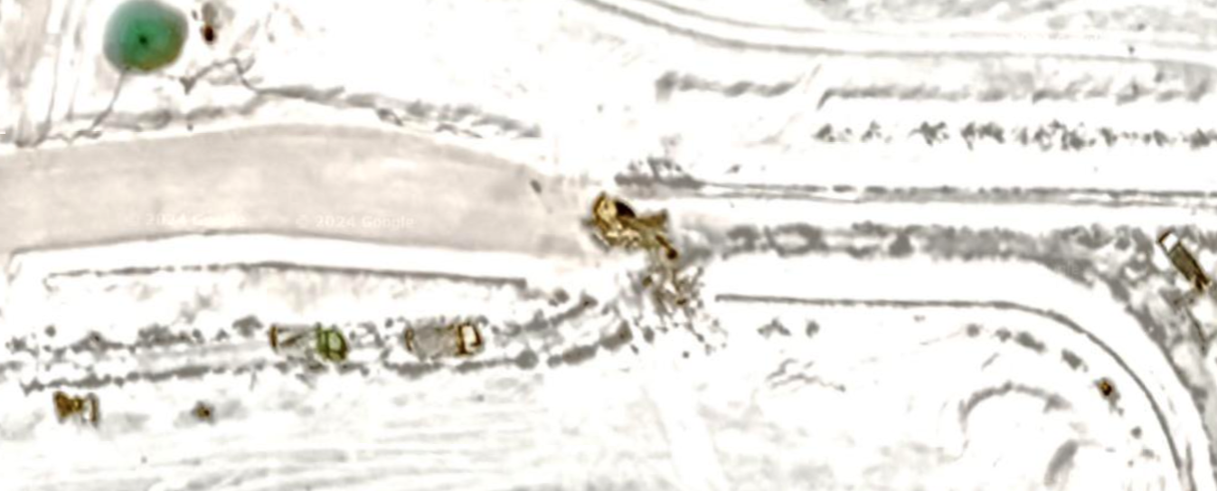
- We see significant building, and can make out trucks at work. We see the rectangles of lands in the sand, with two significant elevated square buildings under development, possibly radomes, to join the three radomes and one tower already present.
- We see a significant octagonal building foundation.
- We see the outline of rectangles of development (land being outlined / fenced).
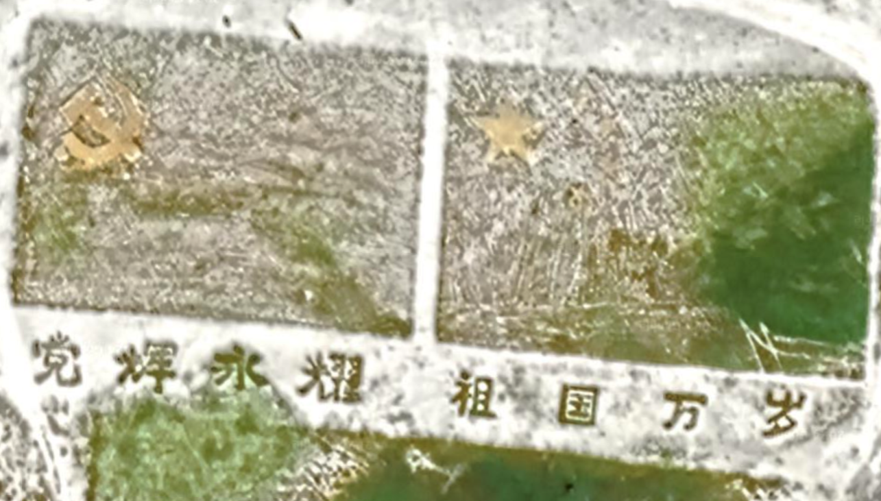
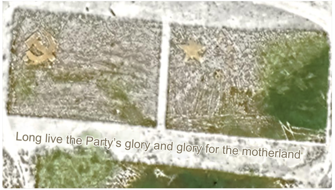
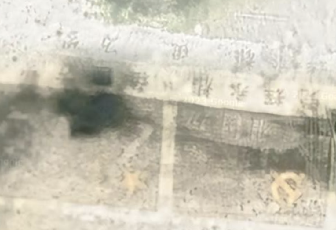
- We can still see the two flags from space and the message. One is the flag of the Chinese Communist Party. One is the flag of the People's Republic of China. Their insignia are in gold, with a phrase atop the flags, still visible from satellite imagery. The phrase reads: "Long live the Party's glory and glory for the motherland." I wish I had not seen that.
These appear to be early days for this island's development. We see four land reclamation points at the southern end.
Location: 15°46'58"N 111°12'21"
Name 1
Nearest Land
Distance from Land (miles)
Location (latitude & longitude)
Diameter (miles)
Date of Satellite Imagery
Airport Present?
Helipad Present?
Port / Dock Facility Present?
Buildings Present?
Defensive Infrastructure Present?
Athletic Facilities Present?
Hospital Present?
Sand Only Island?
Dredging Infrastructure Only?
Paracel Islands
South West Reef
Vietnam
160
15°47'19"N 111°11'35"E
1.2
12/12/2020
No
Yes
Yes
Yes
Not Sure
Yes
Not Sure
No
No
Consulting Session for one hour
This is a one-hour meeting, remote or in-person, with Jeffrey Cohen, President of U.S. Advanced Computing Infrastructure, Inc.
- You choose the topic and deliverables.
- You may buy multiple hours to fund a project.
We believe management consulting is pursuing "the art of the possible." These are areas where we believe we may be helpful:
- We will discuss our research into the South China Sea
- We offer traditional IT management consulting services.
- We offer quantum computing consulting
- We offer financial investment analysis of stock portfolios based on our Chicago Quantum Net Score (read more in our published research). Today we run a model that analyzes ~3,000 U.S. listed equities and optimizes both 'long' and 'short' stock portfolios.
- Project and program management.
- Outsourcing advisory.
- We run your business problem on our discrete mathematical models (on our own server equipment using our own solvers).
- We may configure and run your problem on quantum annealing computers from D-Wave Systems Inc.
- We ALWAYS work confidentially, diligently, free of conflict of interest, and bring our best thinking and insights.
We can operate at both the strategic and tactical level depending on client need. This includes business strategy, business problem decomposition, mathematical and data design, algorithm design, and use of quantum and classical solvers. The President has a strategic perspective from ~ 30 years of executive corporate management in IT and professional services, and also rolls up his sleeves and codes when there is a good fit with the problem and his expertise.
Absolute discretion and professionalism is assured.
In closing
If you would prefer to discuss this 1:1 and negotiate a scope of work and level of effort, please contact us at [email protected] or call (312) 515-7333. We will develop a quotation and will invoice for our services.
