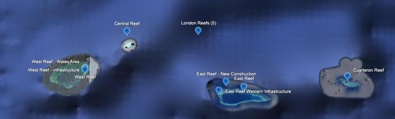
London Reefs including Cuarteron Reef, Spratly Islands
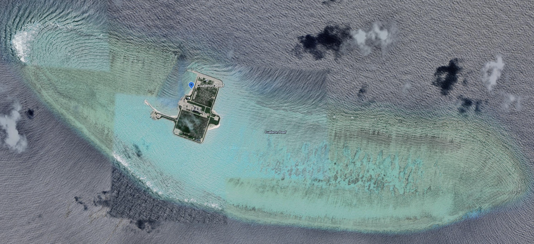
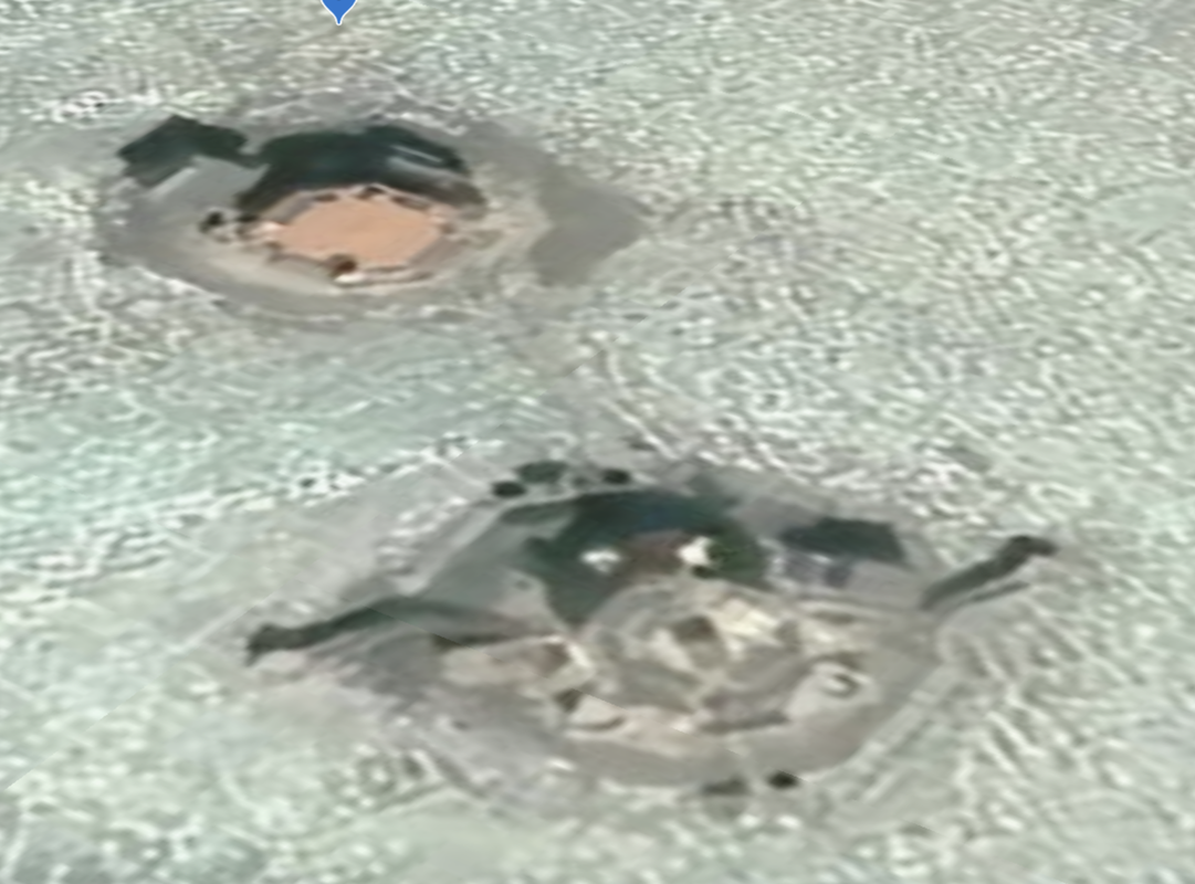
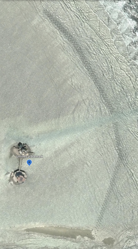
Cuateron Reef is the Eastern reef in the chain of London reefs. The full reef is 3.0 miles in diameter with a small island in the lagoon near a navigational channel cut into the Northern side of the atoll. Location: 8°51'57"N 112°49'33"E.
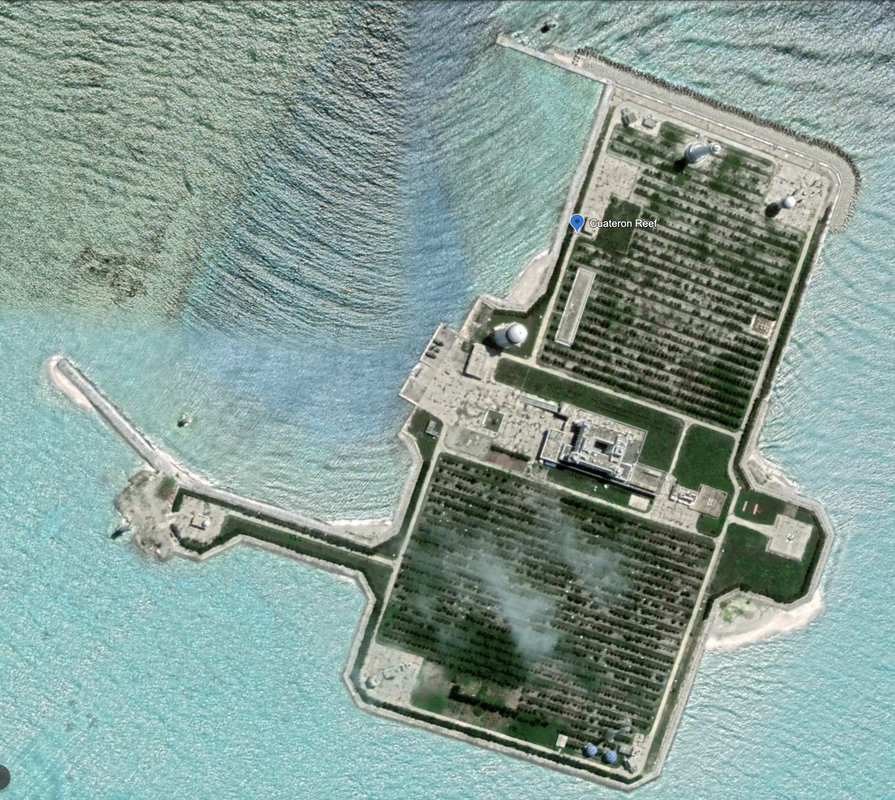
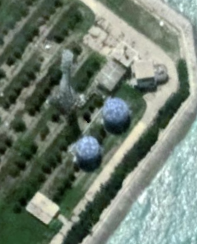
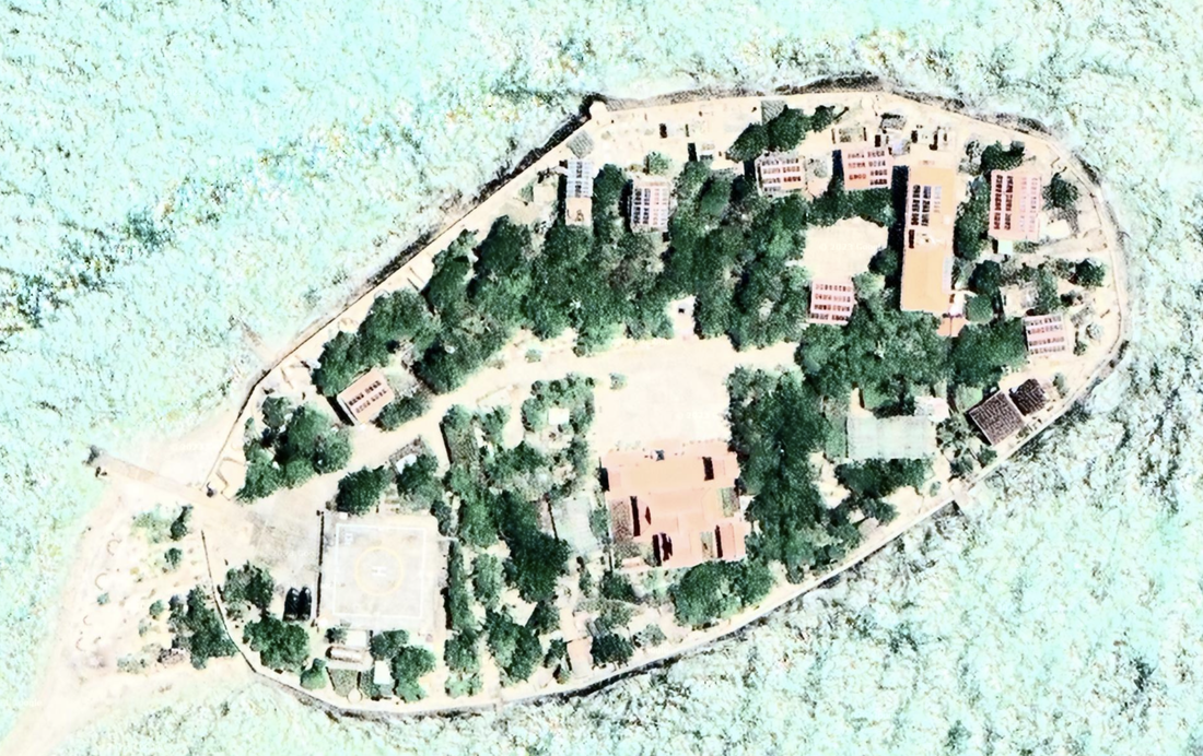
It has a developed island with a mix of structures on the offsetting Northwest and Southeast corners, a parade ground, and ample port facilities. Location: 8°52'00"N 112°49'38"E. Satellite imagery 6/18/2019.
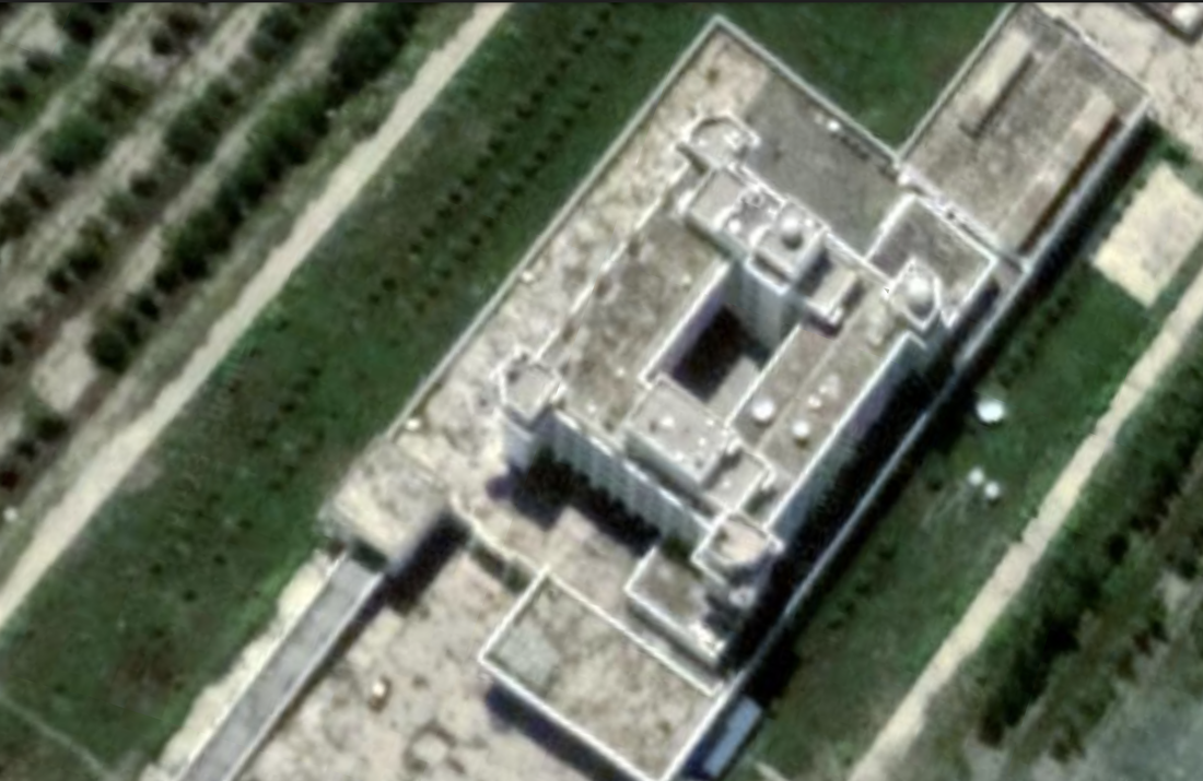
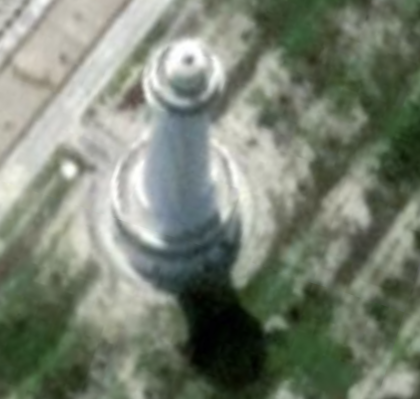
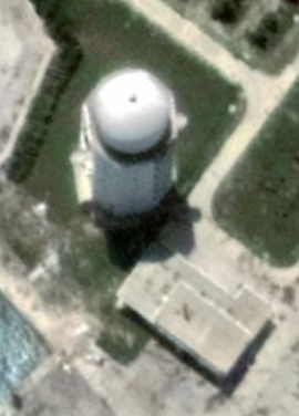
We notice a very well developed building and courtyard in the center of the island. We see a large white ball on a tall tower (radome or water tower), and other obviously manmade structures. It has a helicopter pad on the east of the island.
On the southern corner, we see the famous blue radomes along with a tall structure between them. We do see a lighthouse and various navigational aids around the island. On two other corners, we see what may be anti-aircraft cannons on the 'typical' white building structure we see on many other South China Sea Islands.
The main building is consistent with other buildings we have seen. It has a deep courtyard (multi-story building) a ramp leading up into the building (above the bottom floor) and four turrets connected to the corners. The building has a ramp up into the building which implies that vehicles or heavy wheeled equipment is in use on the island (not visible in the satellite imagery).
Cuateron also has two navigational lights in the water, what might be a tall lighthouse, and a number of other tall structures that look like airport control towers with the round tops and windows all around, set up very high.
We see evenly spaced rows of plantings and lush green grassy spaces.
|
|
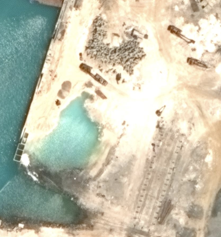
West Reef (or West London Reef), is a full island and enclosed bay that is under significant renovation and land reclamation. Island satellite imagery is dated 3/25/2016 from Google Earth, and shows a diameter of 0.41 miles. Location: 8°52'03"N 112°15'05"E. The island has land reclamation structures for thickening the walls of the bay. We also see about 15 ships and other sea-faring structures including what might be a barge. The island has more than a dozen buildings. We also see significant work done to smooth out the island, and some water still showing to the Northeast of the enclosed bay area. Looks like the construction equipment is onsite to close up the opening and both build up and smooth out the sand.
This reef is 6.4 miles in diameter, shaped as an atoll, with multiple infrastructure elements for reclamation around the atoll, in addition to the island. Satellite footage when zoomed out is 5/19/2020, and it looks like this atoll will be seeing significant incremental reclamation effort.
The last time we analyzed the SCS, this island was less developed. This looks like new reclamation work.
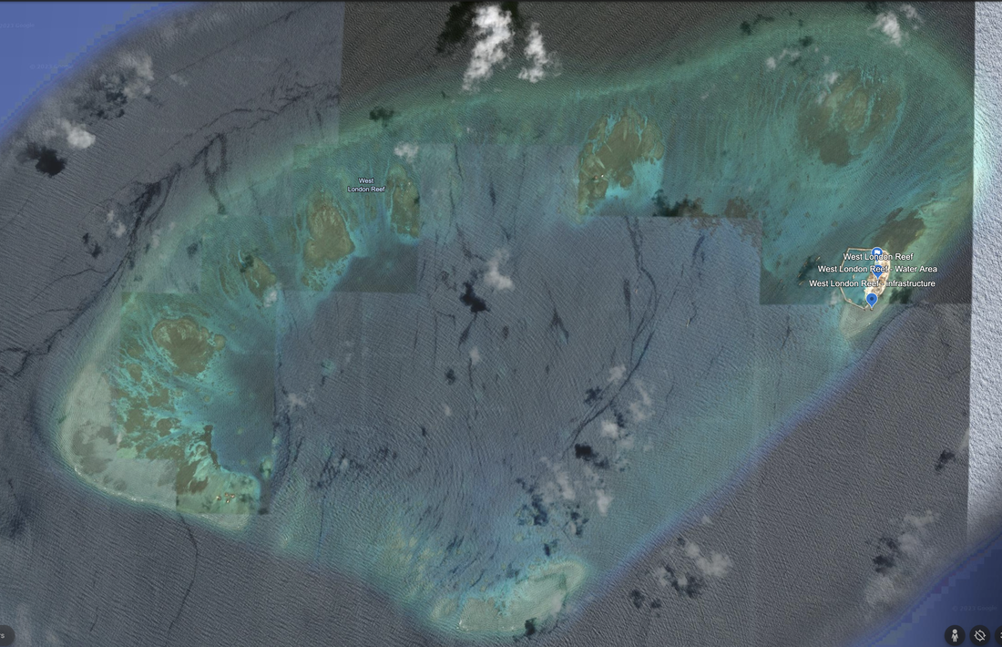
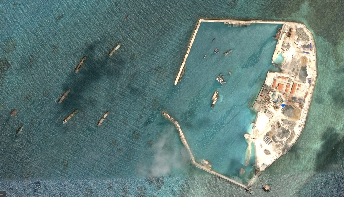
West London Reef Construction Site
|
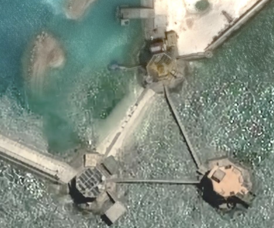
West London Reef, Reclamation Infrastructure at work
|
East of West Reef, we find Central Reef.
Surprisingly oval with a solid sea-wall, and what looks like more recent growth on the Western shore. Lots of greenery planted around the island, and a dense population of buildings, that look fairly uniform. We see what might be solar panels on the roofs.
We do see a helicopter pad on the western edge of the island, for safe and convenient transport, and there is little in the way of port facilities. The date of these photos is 04/21/2022, and the location is 8°55'52"N 112°21’11”E. The picture is a bit rough to focus on, with very bright lighting and glare. The most precise location is 8°55'49"N 112°21'15"E. Diameter is 0.17 miles, including the thin sandy spit of land on the west side of the island.
Central London Reef Island
|
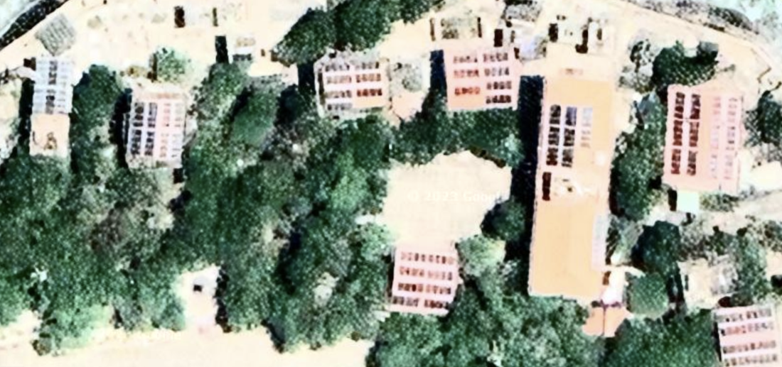
Central London Reef rooftops
|
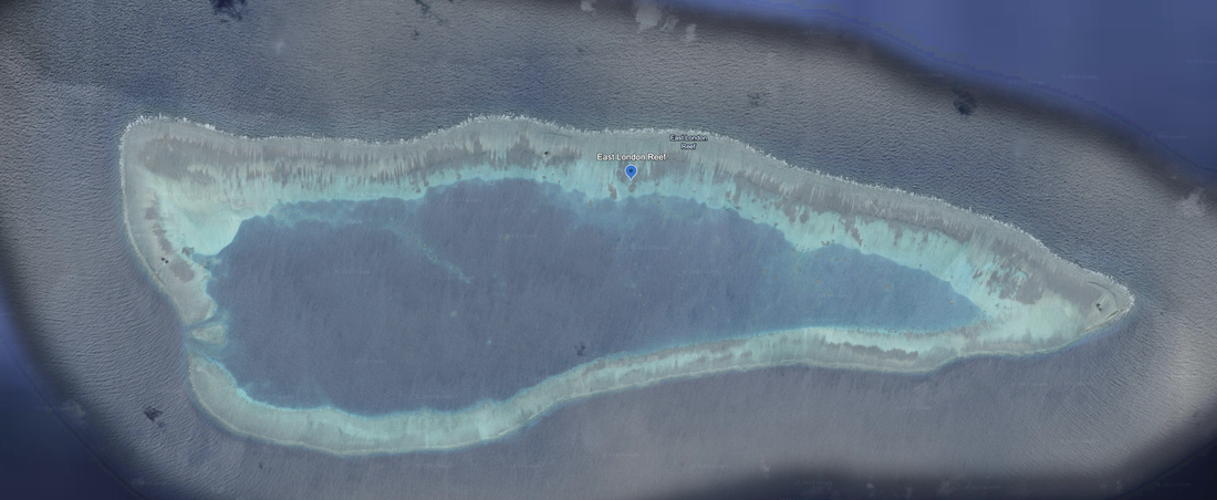
East Reef, located °48'51"N 112°37’50”E, seems to be a submerged reef atoll. We do see a permanent markers and island reclamation structures, to the east, west and north of the coral atoll. This is an 8.2 mile diameter reef atoll with two navigation channels cut into the reef on the western side, and a large natural lagoon. Satellite Imagery: 2/15/2021.
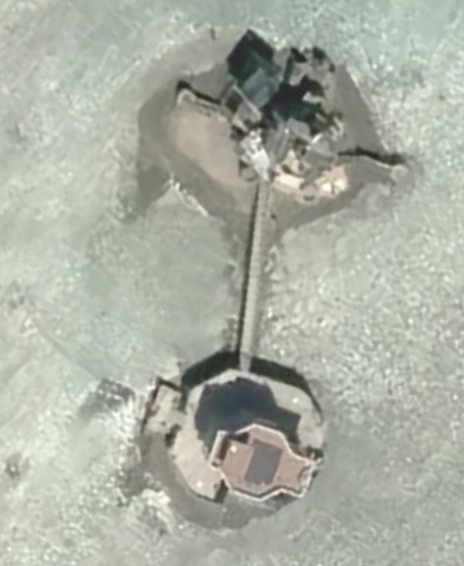
East London Reef Infrastructure
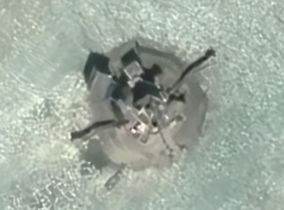
East London Reef Infrastructure 3
|
East London Reef Infrastructure 2
East London Reef Infrastructure 4
|
Name 1
Nearest Land
Distance from Land (miles)
Location (latitude & longitude)
Diameter (miles)
Date of Satellite Imagery
Airport Present?
Helipad Present?
Port / Dock Facility Present?
Buildings Present?
Defensive Infrastructure Present?
Athletic Facilities Present?
Hospital Present?
Sand Only Island?
Dredging Infrastructure Only?
Spratly Islands
Cuateron Island
Philippines, Malaysia and Vietnam
282 and 291 and 323
8°51'57"N 112°49'33"E
3.0
6/18/2019
No
No
Yes
Yes
No
No
No
No
No
Spratly Islands
West London Reef
Vietnam, Philippines, and Malaysia
288 and 300 and 315
8.8666334, 112.2569091
6.4
5/19/2020
No
No
Yes
Yes
No
No
No
No
No
Consulting Session for one hour
This is a one-hour meeting, remote or in-person, with Jeffrey Cohen, President of U.S. Advanced Computing Infrastructure, Inc.
- You choose the topic and deliverables.
- You may buy multiple hours to fund a project.
We believe management consulting is pursuing "the art of the possible." These are areas where we believe we may be helpful:
- We will discuss our research into the South China Sea
- We offer traditional IT management consulting services.
- We offer quantum computing consulting
- We offer financial investment analysis of stock portfolios based on our Chicago Quantum Net Score (read more in our published research). Today we run a model that analyzes ~3,000 U.S. listed equities and optimizes both 'long' and 'short' stock portfolios.
- Project and program management.
- Outsourcing advisory.
- We run your business problem on our discrete mathematical models (on our own server equipment using our own solvers).
- We may configure and run your problem on quantum annealing computers from D-Wave Systems Inc.
- We ALWAYS work confidentially, diligently, free of conflict of interest, and bring our best thinking and insights.
We can operate at both the strategic and tactical level depending on client need. This includes business strategy, business problem decomposition, mathematical and data design, algorithm design, and use of quantum and classical solvers. The President has a strategic perspective from ~ 30 years of executive corporate management in IT and professional services, and also rolls up his sleeves and codes when there is a good fit with the problem and his expertise.
Absolute discretion and professionalism is assured.
In closing
If you would prefer to discuss this 1:1 and negotiate a scope of work and level of effort, please contact us at [email protected] or call (312) 515-7333. We will develop a quotation and will invoice for our services.